 |
|
|
Location &
QuickFacts
|
FAA
Information Effective: |
2008-06-05 |
|
Airport
Identifier: |
97KS |
|
Airport
Status: |
Operational |
|
Longitude/Latitude: |
094-45-20.3500W/38-48-36.5200N
-94.755653/38.810144 (Estimated) |
|
Elevation: |
1060 ft / 323.09 m (Estimated) |
|
Land: |
80 acres |
|
From
nearest city: |
5 nautical miles NW of Olathe, KS |
|
Location: |
Johnson County, KS |
|
Magnetic Variation: |
04E (2000) |
Owner & Manager
|
Ownership: |
Privately owned |
|
Owner: |
Richard D. Combs |
|
Address: |
15575 Barton
Overland, KS 66221 |
|
Phone number: |
913-897-9402 |
|
Manager: |
Richard D. Combs |
|
Address: |
15575 Barton
Overland, KS 66221 |
|
Phone number: |
913-897-9402 |
Airport
Operations and Facilities
|
Airport
Use: |
Private |
|
Wind
indicator: |
Yes |
|
Segmented Circle: |
No |
|
Control
Tower: |
No |
|
Region: |
ACE - Central |
|
Boundary
ARTCC: |
ZKC - Kansas City |
|
Tie-in
FSS: |
COU - Columbia |
|
FSS Toll
Free: |
1-800-WX-BRIEF |
|
Runway Information
Runway 08/26
|
Dimension: |
2000 x 60 ft / 609.6 x 18.3 m |
|
Surface: |
TURF, |
|
|
Runway 08
|
Runway 26
|
|
Traffic
Pattern: |
Right |
Left |
|
Obstruction: |
30 ft pline, 250.0 ft from runway |
|
|
Radio Navigation Aids
|
ID |
Type |
Name |
Ch |
Freq |
Var |
Dist |
|
GQ |
NDB |
Norge |
|
517.00 |
05E |
15.8 nm |
|
GKB |
NDB |
Norge |
|
517.00 |
05E |
15.8 nm |
|
LXT |
NDB |
Lesumit |
|
263.00 |
04E |
20.1 nm |
|
DO |
NDB |
Dotte |
|
359.00 |
05E |
24.7 nm |
|
GPH |
NDB |
Mosby |
|
284.00 |
03E |
38.4 nm |
|
TO |
NDB |
Biloy |
|
521.00 |
05E |
47.4 nm |
|
FOE |
TACAN |
Forbes |
053X |
|
05E |
43.2 nm |
|
OJC |
VOR/DME |
Johnson County |
077X |
113.00 |
06E |
2.0 nm |
|
RIS |
VOR/DME |
Riverside |
051X |
111.40 |
05E |
20.1 nm |
|
MCI |
VORTAC |
Kansas City |
079Y |
113.25 |
05E |
28.6 nm |
|
ANX |
VORTAC |
Napoleon |
087X |
114.00 |
07E |
33.9 nm |
|
BUM |
VORTAC |
Butler |
106X |
115.90 |
07E |
34.7 nm |
|
TOP |
VORTAC |
Topeka |
125X |
117.80 |
05E |
42.0 nm |
|
MKC |
VOT |
Kansas City Downtown |
|
108.60 |
|
20.2 nm |
|
FOE |
VOT |
Forbes |
|
111.00 |
|
43.5 nm |
Remarks
-
PRVDD CLEAR 20:1
APCH, CLEAR 7:1 TRANSITIONAL SFC; CLEAR RY SAFETY AREA; RIGHT TRAFFIC RY 08;
PILOTS COMPLY WITH CLASS D AIRSPACE VIA 2-WAY RADIO COMMUNICATIONS WITH
JOHNSON COUNTY EXECUTIVE AIRPORT ATCT.
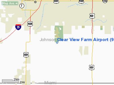
Clear View Farm Airport
Address:
Johnson County, KS
Tel:
913-897-9402
Images
and information placed above are from
http://www.airport-data.com/airport/97KS/
We
thank them for the data!
|
General Info |
| Country |
United
States |
| State |
KANSAS
|
| FAA ID |
97KS
|
| Latitude |
38-48-36.520N |
|
Longitude |
094-45-20.350W |
|
Elevation |
1060
feet |
| Near
City |
OLATHE
|
We don't guarantee the information is fresh and accurate. The data may
be wrong or outdated.
For more up-to-date information please refer to other sources.
|
|


