 |
|
|
Location &
QuickFacts
|
FAA
Information Effective: |
2008-06-05 |
|
Airport
Identifier: |
18KS |
|
Airport
Status: |
Operational |
|
Longitude/Latitude: |
097-06-26.1410W/37-22-15.0810N
-97.107261/37.370856 (Estimated) |
|
Elevation: |
1270 ft / 387.10 m (Estimated) |
|
Land: |
0 acres |
|
From
nearest city: |
1 nautical miles SE of Udall, KS |
|
Location: |
Cowley County, KS |
|
Magnetic Variation: |
07E (1985) |
Owner & Manager
|
Ownership: |
Privately owned |
|
Owner: |
Cherokee Strip Home Owners |
|
Address: |
|
|
Manager: |
Richard F. Geide, Jr. |
|
Address: |
2323 S. Crestway
Wichita, KS 67218 |
|
Phone number: |
316-684-0884 |
Airport
Operations and Facilities
|
Airport
Use: |
Private |
|
Wind
indicator: |
Yes |
|
Segmented Circle: |
No |
|
Control
Tower: |
No |
|
Landing
fee charge: |
No |
|
Sectional chart: |
Wichita |
|
Region: |
ACE - Central |
|
Boundary
ARTCC: |
ZKC - Kansas City |
|
Tie-in
FSS: |
ICT - Wichita |
|
FSS on
Airport: |
No |
|
FSS Toll
Free: |
1-800-WX-BRIEF |
|
Runway Information
Runway 17/35
|
Dimension: |
2500 x 200 ft / 762.0 x 61.0 m |
|
Surface: |
TURF-GRVL, |
|
|
Runway 17
|
Runway 35
|
|
Traffic
Pattern: |
Left |
Right |
|
Radio Navigation Aids
|
ID |
Type |
Name |
Ch |
Freq |
Var |
Dist |
|
EGT |
NDB |
Wellington |
|
414.00 |
07E |
13.8 nm |
|
IC |
NDB |
Piche |
|
332.00 |
07E |
20.8 nm |
|
EQA |
NDB |
El Dorado |
|
383.00 |
05E |
28.2 nm |
|
PN |
NDB |
Ponca |
|
515.00 |
05E |
32.8 nm |
|
EWK |
NDB |
Newton |
|
281.00 |
06E |
42.4 nm |
|
IAB |
TACAN |
Mc Connell |
112X |
|
07E |
16.9 nm |
|
ICT |
VORTAC |
Wichita |
085X |
113.80 |
07E |
32.0 nm |
|
PER |
VORTAC |
Pioneer |
079X |
113.20 |
06E |
37.6 nm |
|
ICT |
VOT |
Wichita |
|
114.00 |
|
22.3 nm |
Remarks
-
CONDITIONAL -
PROVIDED THE APCH TO EACH RWY IS MAINTAINED FOR A MINIMUM 20:1 GLIDE SLOPE AND
THE TRANSITIONAL SURFACE BE MAINTAINED FOR A 7:1 SLOPE.
Based Aircraft
|
Aircraft based
on field: |
10 |
|
Single Engine
Airplanes: |
10 |
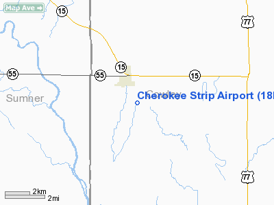
Cherokee Strip Airport
Address:
Cowley County, KS
Tel:
316-684-0884
Images
and information placed above are from
http://www.airport-data.com/airport/18KS/
We
thank them for the data!
|
General Info |
| Country |
United
States |
| State |
KANSAS
|
| FAA ID |
18KS
|
| Latitude |
37-22-15.081N |
|
Longitude |
097-06-26.141W |
|
Elevation |
1270
feet |
| Near
City |
UDALL
|
We don't guarantee the information is fresh and accurate. The data may
be wrong or outdated.
For more up-to-date information please refer to other sources.
|
|


