 |
|
|
|
|
|
|
Location &
QuickFacts
|
FAA
Information Effective: |
2008-06-05 |
|
Airport
Identifier: |
9K0 |
|
Airport
Status: |
Operational |
|
Longitude/Latitude: |
096-33-16.0260W/38-21-31.0520N
-96.554452/38.358626 (Estimated) |
|
Elevation: |
1273 ft / 388.01 m (Surveyed) |
|
Land: |
33 acres |
|
From
nearest city: |
1 nautical miles S of Cottonwood Falls, KS |
|
Location: |
Chase County, KS |
|
Magnetic Variation: |
06E (1985) |
Owner & Manager
|
Ownership: |
Publicly owned |
|
Owner: |
City Of Cottonwood Falls |
|
Address: |
220 Broadway
Cottonwood Falls, KS 66845 |
|
Phone number: |
620-273-6666 |
|
Manager: |
Charley Klamm |
|
Address: |
220 Broadway
Cottonwood Falls, KS 66845 |
|
Phone number: |
620-273-8686 |
Airport
Operations and Facilities
|
Airport
Use: |
Open to public |
|
Wind
indicator: |
Yes |
|
Segmented Circle: |
No |
|
Control
Tower: |
No |
|
Lighting
Schedule: |
DUSK-DAWN |
|
Landing
fee charge: |
No |
|
Sectional chart: |
Kansas City |
|
Region: |
ACE - Central |
|
Boundary
ARTCC: |
ZKC - Kansas City |
|
Tie-in
FSS: |
ICT - Wichita |
|
FSS on
Airport: |
No |
|
FSS Toll
Free: |
1-800-WX-BRIEF |
|
NOTAMs
Facility: |
ICT (NOTAM-d service avaliable) |
|
Federal Agreements: |
1 |
Airport Communications
Airport Services
|
Airframe
Repair: |
NONE |
|
Power
Plant Repair: |
NONE |
|
Bottled
Oxygen: |
NONE |
|
Bulk
Oxygen: |
NONE |
|
Runway Information
Runway 17/35
|
Dimension: |
2300 x 155 ft / 701.0 x 47.2 m |
|
Surface: |
TURF, Good Condition
SOFT & SLICK IN SPOTS WHEN WET. |
|
Edge Lights: |
Low |
|
|
Runway 17
|
Runway 35
|
|
Traffic
Pattern: |
Left |
Left |
|
Obstruction: |
86 ft tower, 1375.0 ft from runway, 54 ft left of
centerline, 15:1 slope to clear |
3 ft fence, 25.0 ft from runway, 8:1 slope to clear |
|
Radio Navigation Aids
|
ID |
Type |
Name |
Ch |
Freq |
Var |
Dist |
|
HRU |
NDB |
Herington |
|
407.00 |
06E |
23.4 nm |
|
EQA |
NDB |
El Dorado |
|
383.00 |
05E |
37.0 nm |
|
EWK |
NDB |
Newton |
|
281.00 |
06E |
38.3 nm |
|
UKL |
NDB |
Boyd |
|
245.00 |
05E |
39.4 nm |
|
CVY |
NDB |
Cavalry |
|
314.00 |
06E |
41.7 nm |
|
MQD |
NDB |
Mc Dowell Creek |
|
391.00 |
06E |
45.7 nm |
|
FRI |
VOR |
Fort Riley |
|
109.40 |
06E |
39.5 nm |
|
MHK |
VOR/DME |
Manhattan |
039X |
110.20 |
06E |
47.6 nm |
|
EMP |
VORTAC |
Emporia |
075X |
112.80 |
08E |
20.0 nm |
Remarks
-
TOWER 1375 FT FROM AER 17.
-
EXISTED PRIOR TO 1959.
Based Aircraft
|
Aircraft based
on field: |
3 |
|
Single Engine
Airplanes: |
2 |
|
Ultralights: |
1 |
Operational Statistics
Time Period: 2006-09-14 - 2007-09-13
|
Aircraft
Operations: |
23/Week |
|
General
Aviation Local: |
52.2% |
|
General
Aviation Itinerant: |
43.5% |
|
Military: |
4.3% |
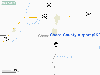
Chase County Airport
Address:
Chase County, KS
Tel:
620-273-6666, 620-273-8686
Images
and information placed above are from
http://www.airport-data.com/airport/9K0/
We
thank them for the data!
|
General Info |
| Country |
United
States |
| State |
KANSAS
|
| FAA ID |
9K0
|
| Latitude |
38-21-31.052N |
|
Longitude |
096-33-16.026W |
|
Elevation |
1273
feet |
| Near
City |
COTTONWOOD FALLS |
We don't guarantee the information is fresh and accurate. The data may
be wrong or outdated.
For more up-to-date information please refer to other sources.
|
|


