|
|
Captain Jack Thomas/el Dorado Airport |
| Captain Jack Thomas/El Dorado Airport |
| IATA: EDK â ICAO: KEQA â FAA LID: EQA |
| Summary |
| Airport type |
Public |
| Owner |
City of El Dorado |
| Operator |
Deric Karst |
| Location |
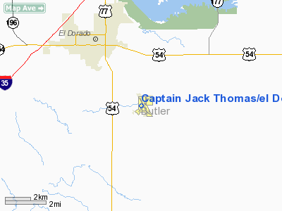
El Dorado, Kansas |
| Elevation AMSL |
1,378 ft / 420 m |
| Coordinates |
37°46â²27â³N 096°49â²03â³W / 37.77417°N 96.8175°W / 37.77417; -96.8175 |
| Runways |
| Direction |
Length |
Surface |
| ft |
m |
| 4/22 |
4,204 |
1,281 |
Asphalt |
| 15/33 |
4,200 |
1,280 |
Concrete |
| Statistics (2006) |
| Aircraft operations |
13,225 |
| Based aircraft |
29 |
| Source: Federal Aviation Administration |
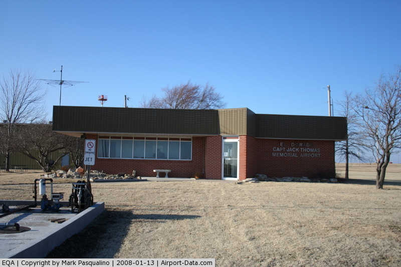
Captain Jack Thomas/El Dorado Airport (IATA: EDK, ICAO: KEQA, FAA LID: EQA) is a public airport located three miles (5 km) southeast of the central business district of El Dorado, in Butler County, Kansas, United States. This airport is publicly owned by City of El Dorado.
Although most U.S. airports use the same three-letter location identifier for the FAA and IATA, this airport is assigned EQA by the FAA and EDK by the IATA. The airport's ICAO identifier is KEQA.
Facilities and aircraft
Captain Jack Thomas/El Dorado Airport covers an area of 220 acres (89 ha) which contains two runways:
- Runway 4/22: 4,204 x 75 ft (1,281 x 23 m), Surface: Asphalt
- Runway 15/33: 4,200 x 75 ft (1,280 x 23 m), Surface: Concrete
For 12-month period ending April 14, 2006, the airport had 13,225 aircraft operations, an average of 36 per day: 99% general aviation (13,200) and <1% military (25). There are 29 aircraft based at this airport: 97% single engine (28) and 3% ultralights (1).
The above content comes from Wikipedia and is published under free licenses – click here to read more.
|
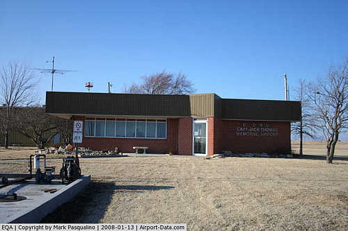 |
(Click on the photo to enlarge) |
|
Location &
QuickFacts
|
FAA
Information Effective: |
2008-06-05 |
|
Airport
Identifier: |
EQA |
|
Airport
Status: |
Operational |
|
Longitude/Latitude: |
096-49-03.4600W/37-46-26.7900N
-96.817628/37.774108 (Estimated) |
|
Elevation: |
1378 ft / 420.01 m (Surveyed) |
|
Land: |
220 acres |
|
From
nearest city: |
3 nautical miles SE of El Dorado, KS |
|
Location: |
Butler County, KS |
|
Magnetic Variation: |
05E (2000) |
Owner & Manager
|
Ownership: |
Publicly owned |
|
Owner: |
City Of El Dorado |
|
Address: |
220 East First, Po. Box 792
El Dorado, KS 67042 |
|
Phone
number: |
316-321-1327 |
|
Manager: |
Herb Llewellyn |
|
Address: |
1485 Se 30th St., 1485 Se 30th St
El Dorado, KS 67042 |
|
Phone number: |
316-321-9100 |
Airport Operations and Facilities
|
Airport
Use: |
Open to public |
|
Wind
indicator: |
Yes |
|
Segmented Circle: |
Yes |
|
Control
Tower: |
No |
|
Lighting
Schedule: |
DUSK-DAWN
ACTVT MIRL RY 15/33 & HIRL RY 04/22 - 122.9. |
|
Beacon
Color: |
Clear-Green (lighted land airport) |
|
Landing
fee charge: |
No |
|
Sectional chart: |
Kansas City |
|
Region: |
ACE - Central |
|
Boundary
ARTCC: |
ZKC - Kansas City |
|
Tie-in
FSS: |
ICT - Wichita |
|
FSS on
Airport: |
No |
|
FSS Toll
Free: |
1-800-WX-BRIEF |
|
NOTAMs
Facility: |
ICT (NOTAM-d service avaliable) |
|
Federal Agreements: |
NGY |
Airport Communications
|
CTAF: |
122.800 |
|
Unicom: |
122.800 |
Airport Services
|
Fuel
available: |
100LLA MOGAS |
|
Airframe
Repair: |
MAJOR |
|
Power
Plant Repair: |
MAJOR |
|
Bottled
Oxygen: |
NONE |
|
Bulk
Oxygen: |
NONE |
|
Runway Information
Runway 04/22
|
Dimension: |
4204 x 75 ft / 1281.4 x 22.9 m |
|
Surface: |
ASPH, Good Condition |
|
Weight Limit: |
Single wheel: 18000 lbs.
Dual wheel: 23000 lbs. |
|
Edge Lights: |
High |
|
|
Runway 04
|
Runway 22
|
|
Longitude: |
096-49-23.1930W |
096-48-47.2210W |
|
Latitude: |
37-46-12.8330N |
37-46-43.0390N |
|
Elevation: |
1376.00 ft |
1378.00 ft |
|
Alignment: |
43 |
127 |
|
Traffic
Pattern: |
Left |
Left |
|
Markings: |
Non-precision instrument, Good Condition |
Non-precision instrument, Good Condition |
|
Runway 15/33
|
Dimension: |
4200 x 75 ft / 1280.2 x 22.9 m |
|
Surface: |
CONC, Good Condition |
|
Weight Limit: |
Single wheel: 12500 lbs.
Dual wheel: 12500 lbs. |
|
Edge Lights: |
Medium |
|
|
Runway 15
|
Runway 33
|
|
Longitude: |
096-49-11.1600W |
096-48-52.2620W |
|
Latitude: |
37-46-45.0000N |
37-46-06.2820N |
|
Elevation: |
1375.00 ft |
1373.00 ft |
|
Alignment: |
127 |
127 |
|
Traffic
Pattern: |
Left |
Left |
|
Markings: |
Non-precision instrument, Fair Condition |
Non-precision instrument, Good Condition |
|
Crossing
Height: |
25.00 ft |
25.00 ft |
|
VASI: |
4-light PAPI on left side |
4-light PAPI on left side |
|
Visual
Glide Angle: |
3.00° |
3.00° |
|
Obstruction: |
34 ft trees, 1110.0 ft from runway, 26:1 slope to clear |
, 50:1 slope to clear |
|
Radio Navigation Aids
|
ID |
Type |
Name |
Ch |
Freq |
Var |
Dist |
|
EQA |
NDB |
El Dorado |
|
383.00 |
05E |
0.3 nm |
|
EWK |
NDB |
Newton |
|
281.00 |
06E |
27.8 nm |
|
IC |
NDB |
Piche |
|
332.00 |
07E |
32.6 nm |
|
EGT |
NDB |
Wellington |
|
414.00 |
07E |
38.4 nm |
|
IAB |
TACAN |
Mc Connell |
112X |
|
07E |
23.3 nm |
|
ICT |
VORTAC |
Wichita |
085X |
113.80 |
07E |
36.5 nm |
|
EMP |
VORTAC |
Emporia |
075X |
112.80 |
08E |
44.7 nm |
|
ICT |
VOT |
Wichita |
|
114.00 |
|
30.4 nm |
Remarks
-
PRVDD THE APCH TO
EACH RWY IS MAINTD FOR A MIN 20:1 GLIDE SLOPE AND THE TRSNL SFC BE MAINTD FOR
A 7:1 SLOPE.
Based Aircraft
|
Aircraft based
on field: |
29 |
|
Single Engine
Airplanes: |
28 |
|
Ultralights: |
1 |
Operational Statistics
Time Period: 2006-07-25 - 2007-07-24
|
Aircraft
Operations: |
255/Week |
|
General
Aviation Local: |
73.3% |
|
General
Aviation Itinerant: |
26.5% |
|
Military: |
0.2% |
Captain Jack Thomas/el Dorado Airport
Address:
Butler County, KS
Tel:
316-321-1327,
316-321-9100
Images
and information placed above are from
http://www.airport-data.com/airport/EQA/
We
thank them for the data!
|
General Info |
| Country |
United
States |
| State |
KANSAS
|
| FAA ID |
EQA
|
| Latitude |
37-46-26.790N |
|
Longitude |
096-49-03.460W |
|
Elevation |
1378
feet |
| Near
City |
EL
DORADO |
We don't guarantee the information is fresh and accurate. The data may
be wrong or outdated.
For more up-to-date information please refer to other sources.
|
|