 |
|
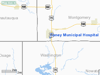
Caney Municipal Hospital Helicopter Pad Heliport |
|
Location &
QuickFacts
|
FAA
Information Effective: |
2008-06-05 |
|
Airport
Identifier: |
SN11 |
|
Airport
Status: |
Operational |
|
Longitude/Latitude: |
095-55-53.9290W/37-00-23.2600N
-95.931647/37.006461 (Estimated) |
|
Elevation: |
755 ft / 230.12 m (Estimated) |
|
Land: |
0 acres |
|
From
nearest city: |
0 nautical miles N of Caney, KS |
|
Location: |
Montgomery County, KS |
|
Magnetic Variation: |
06E (1985) |
Owner & Manager
|
Ownership: |
Privately owned |
|
Owner: |
Caney Municipal Hospital |
|
Address: |
P.o. Box 325
Caney, KS 67333 |
|
Phone
number: |
316-879-2182 |
|
Manager: |
Linda Mellen |
|
Address: |
P.o. Box 325
Caney, KS 67333 |
|
Phone number: |
316-879-2182 |
Airport Operations and Facilities
|
Airport
Use: |
Private
MEDICAL. |
|
Segmented Circle: |
No |
|
Control
Tower: |
No |
|
Lighting
Schedule: |
PHONE REQ
FOR PERIMETER LGTS CALL 316-879-2182. |
|
Sectional chart: |
Kansas City |
|
Region: |
ACE - Central |
|
Boundary
ARTCC: |
ZKC - Kansas City |
|
Tie-in
FSS: |
ICT - Wichita |
|
FSS Toll
Free: |
1-800-WX-BRIEF |
|
Runway Information
Helipad H1
|
Dimension: |
30 x 30 ft / 9.1 x 9.1 m |
|
Surface: |
CONC, |
|
|
Runway H1
|
Runway
|
|
Traffic
Pattern: |
Left |
Left |
|
Radio Navigation Aids
|
ID |
Type |
Name |
Ch |
Freq |
Var |
Dist |
|
CFV |
NDB |
Coffeyville |
|
212.00 |
05E |
18.1 nm |
|
PPF |
NDB |
Parsons |
|
258.00 |
06E |
28.4 nm |
|
DW |
NDB |
Owaso |
|
375.00 |
06E |
42.1 nm |
|
BVO |
VOR/DME |
Bartlesville |
126X |
117.90 |
08E |
11.2 nm |
|
CNU |
VOR/DME |
Chanute |
029X |
109.20 |
05E |
40.6 nm |
|
OSW |
VORTAC |
Oswego |
123X |
117.60 |
08E |
36.1 nm |
|
TUL |
VORTAC |
Tulsa |
091X |
114.40 |
08E |
49.2 nm |
|
TUL |
VOT |
Tulsa Intl |
|
109.00 |
|
49.2 nm |
Remarks
-
PRVDD CLEAR APCH/DEP
PATHS TO LANDING AREA FOR A MINIMUM 8:1 GLIDE SLOPE AND A CLEAR TRANSITIONAL
SURFACE FOR A MINIMUM 2:1 SLOPE.
Caney Municipal Hospital Helicopter Pad
Heliport
Address:
Montgomery County, KS
Tel:
316-879-2182
Images
and information placed above are from
http://www.airport-data.com/airport/SN11/
We
thank them for the data!
|
General Info |
| Country |
United
States |
| State |
KANSAS
|
| FAA ID |
SN11
|
| Latitude |
37-00-23.260N |
|
Longitude |
095-55-53.929W |
|
Elevation |
755 feet
|
| Near
City |
CANEY
|
We don't guarantee the information is fresh and accurate. The data may
be wrong or outdated.
For more up-to-date information please refer to other sources.
|
|


