 |
|
|
Location &
QuickFacts
|
FAA
Information Effective: |
2008-06-05 |
|
Airport
Identifier: |
SN97 |
|
Airport
Status: |
Operational |
|
Longitude/Latitude: |
101-11-51.5790W/37-19-35.0850N
-101.197661/37.326412 (Estimated) |
|
Elevation: |
3056 ft / 931.47 m (Surveyed) |
|
Land: |
0 acres |
|
From
nearest city: |
1 nautical miles E of Moscow, KS |
|
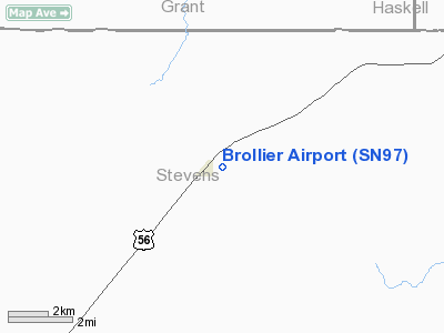
Location: |
Stevens County, KS |
|
Magnetic Variation: |
09E (1985) |
Owner & Manager
|
Ownership: |
Privately owned |
|
Owner: |
Carl & Darlene Brollier |
|
Address: |
Moscow, KS 67952 |
|
Manager: |
Greg Kuban |
|
Address: |
Moscow, KS 67952 |
|
Phone number: |
316-598-2356 |
Airport
Operations and Facilities
|
Airport
Use: |
Private |
|
Wind
indicator: |
Yes |
|
Segmented Circle: |
No |
|
Control
Tower: |
No |
|
Lighting
Schedule: |
PHONE REQ |
|
Landing
fee charge: |
No |
|
Sectional chart: |
Wichita |
|
Region: |
ACE - Central |
|
Boundary
ARTCC: |
ZKC - Kansas City |
|
Tie-in
FSS: |
ICT - Wichita |
|
FSS on
Airport: |
No |
|
FSS Toll
Free: |
1-800-WX-BRIEF |
|
Runway Information
Runway 18/36
|
Dimension: |
2400 x 75 ft / 731.5 x 22.9 m |
|
Surface: |
ASPH, |
|
Edge Lights: |
Low |
|
|
Runway 18
|
Runway 36
|
|
Traffic
Pattern: |
Left |
Left |
|
Radio Navigation Aids
|
ID |
Type |
Name |
Ch |
Freq |
Var |
Dist |
|
HQG |
NDB |
Hugoton |
|
365.00 |
09E |
12.9 nm |
|
ULS |
NDB |
Ulysses |
|
395.00 |
09E |
18.2 nm |
|
JHN |
NDB |
Bear Creek |
|
341.00 |
10E |
31.6 nm |
|
GC |
NDB |
Pieve |
|
347.00 |
09E |
37.7 nm |
|
EHA |
NDB |
Elkhart |
|
377.00 |
10E |
38.3 nm |
|
GUY |
NDB |
Guymon |
|
275.00 |
09E |
40.1 nm |
|
MEJ |
NDB |
Meade |
|
389.00 |
09E |
40.2 nm |
|
LBL |
VORTAC |
Liberal |
070X |
112.30 |
11E |
20.1 nm |
|
GCK |
VORTAC |
Garden City |
080X |
113.30 |
11E |
42.1 nm |
Remarks
-
PROVIDED RWY THRS
ARE DSPLCD A SUFFICIENT DISTANCE SO THAT THE ROADS WOULD NO LONGER PRESENT A
PSBL UNSAFE COND FOR ACFT USING THE RWY.
Based Aircraft
|
Aircraft based
on field: |
5 |
|
Single Engine
Airplanes: |
4 |
|
Multi Engine
Airplanes: |
1 |
Brollier Airport
Address:
Stevens County, KS
Tel:
316-598-2356
Images
and information placed above are from
http://www.airport-data.com/airport/SN97/
We
thank them for the data!
|
General Info |
| Country |
United
States |
| State |
KANSAS
|
| FAA ID |
SN97
|
| Latitude |
37-19-35.085N |
|
Longitude |
101-11-51.579W |
|
Elevation |
3056
feet |
| Near
City |
MOSCOW
|
We don't guarantee the information is fresh and accurate. The data may
be wrong or outdated.
For more up-to-date information please refer to other sources.
|
|


