 |
|
|
|
|
|
|
Location &
QuickFacts
|
FAA
Information Effective: |
2008-06-05 |
|
Airport
Identifier: |
5K0 |
|
Airport
Status: |
Operational |
|
Longitude/Latitude: |
101-33-20.6000W/39-44-32.9820N
-101.555722/39.742495 (Estimated) |
|
Elevation: |
3489 ft / 1063.45 m (Estimated) |
|
Land: |
12 acres |
|
From
nearest city: |
1 nautical miles SW of Bird City, KS |
|
Location: |
Cheyenne County, KS |
|
Magnetic Variation: |
09E (1980) |
Owner & Manager
|
Ownership: |
Privately owned |
|
Owner: |
Rod Young |
|
Address: |
122 West 6th
Bird City, KS 67731 |
|
Phone
number: |
785-734-2631 |
|
Manager: |
Rod Young |
|
Address: |
122 West 6th
Bird City, KS 67731 |
|
Phone number: |
785-734-2631 |
Airport Operations and Facilities
|
Airport
Use: |
Open to public |
|
Wind
indicator: |
Yes |
|
Segmented Circle: |
No |
|
Control
Tower: |
No |
|
Lighting
Schedule: |
DUSK-DAWN |
|
Beacon
Color: |
Clear (unlighted land airport)
ROTG BCN OTS INDEFLY. |
|
Sectional chart: |
Wichita |
|
Region: |
ACE - Central |
|
Boundary
ARTCC: |
ZDV - Denver |
|
Tie-in
FSS: |
ICT - Wichita |
|
FSS Toll
Free: |
1-800-WX-BRIEF |
|
NOTAMs
Facility: |
ICT (NOTAM-d service avaliable) |
Airport Communications
|
Runway Information
Runway 08/26
|
Dimension: |
3460 x 70 ft / 1054.6 x 21.3 m |
|
Surface: |
TURF, Good Condition |
|
|
Runway 08
|
Runway 26
|
|
Traffic
Pattern: |
Right |
Left |
|
Obstruction: |
17 ft road, 65 ft right of centerline |
18 ft road, 0.0 ft from runway, 65 ft left of centerline |
|
Runway 17/35
|
Dimension: |
2270 x 75 ft / 691.9 x 22.9 m |
|
Surface: |
TURF, Good Condition |
|
|
Runway 17
|
Runway 35
|
|
Traffic
Pattern: |
Left |
Left |
|
Obstruction: |
17 ft road, 77 ft left of centerline |
17 ft road, 0.0 ft from runway, 77 ft right of centerline |
|
Radio Navigation Aids
|
ID |
Type |
Name |
Ch |
Freq |
Var |
Dist |
|
SYF |
NDB |
St Francis |
|
386.00 |
10E |
9.7 nm |
|
ADT |
NDB |
Atwood |
|
365.00 |
09E |
24.3 nm |
|
GL |
NDB |
Shugr |
|
414.00 |
09E |
27.0 nm |
|
JDM |
NDB |
Wheatfield |
|
408.00 |
08E |
27.3 nm |
|
ITR |
NDB |
Kit Carson |
|
209.00 |
10E |
45.1 nm |
|
IML |
NDB |
Imperial |
|
283.00 |
09E |
46.3 nm |
|
OIN |
NDB |
Oberlin |
|
341.00 |
09E |
47.3 nm |
|
GLD |
VORTAC |
Goodland |
098X |
115.10 |
12E |
22.2 nm |
Remarks
-
PUBLIC PHONE IN
OFFICE AT ARPT.
-
PRVDD APCHS ARE
MAINTAINED FOR A 20:1 GLIDE SLOPE & TRANSITIONAL SURFACE A 7:1 SLOPE; RGT HAND
TFC PTN TO RWY 8 IS USED.
Based Aircraft
|
Aircraft based
on field: |
2 |
|
Single Engine
Airplanes: |
2 |
Operational Statistics
Time Period: 2006-07-10 - 2007-07-09
|
Aircraft
Operations: |
31/Week |
|
General
Aviation Local: |
93.8% |
|
General
Aviation Itinerant: |
6.3% |
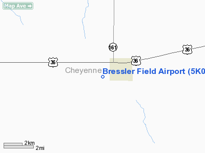
Bressler Field Airport
Address:
Cheyenne County, KS
Tel:
785-734-2631
Images
and information placed above are from
http://www.airport-data.com/airport/5K0/
We
thank them for the data!
|
General Info |
| Country |
United
States |
| State |
KANSAS
|
| FAA ID |
5K0
|
| Latitude |
39-44-32.982N |
|
Longitude |
101-33-20.600W |
|
Elevation |
3489
feet |
| Near
City |
BIRD
CITY |
We don't guarantee the information is fresh and accurate. The data may
be wrong or outdated.
For more up-to-date information please refer to other sources.
|
|


