 |
|
|
Location &
QuickFacts
|
FAA
Information Effective: |
2008-06-05 |
|
Airport
Identifier: |
SN20 |
|
Airport
Status: |
Operational |
|
Longitude/Latitude: |
097-02-56.1360W/37-43-10.0580N
-97.048927/37.719461 (Estimated) |
|
Elevation: |
1300 ft / 396.24 m (Estimated) |
|
Land: |
0 acres |
|
From
nearest city: |
4 nautical miles NW of Augusta, KS |
|
Location: |
Butler County, KS |
|
Magnetic Variation: |
07E (1985) |
Owner & Manager
|
Ownership: |
Privately owned |
|
Owner: |
Jerry & Jan Brady |
|
Address: |
Rt 1, Box 116b
Augusta, KS 67010 |
|
Phone number: |
316-775-3163 |
|
Address: |
|
Airport Operations and Facilities
|
Airport
Use: |
Private |
|
Wind
indicator: |
Yes |
|
Segmented Circle: |
No |
|
Control
Tower: |
No |
|
Landing
fee charge: |
No |
|
Sectional chart: |
Wichita |
|
Region: |
ACE - Central |
|
Boundary
ARTCC: |
ZKC - Kansas City |
|
Tie-in
FSS: |
ICT - Wichita |
|
FSS on
Airport: |
No |
|
FSS Toll
Free: |
1-800-WX-BRIEF |
|
Runway
Information
Runway N/S
|
Dimension: |
2000 x 80 ft / 609.6 x 24.4 m |
|
Surface: |
TURF, |
|
|
Runway N
|
Runway S
|
|
Traffic
Pattern: |
Left |
Left |
|
Obstruction: |
25 ft pole, 250.0 ft from runway |
, 250.0 ft from runway |
|
Radio Navigation Aids
|
ID |
Type |
Name |
Ch |
Freq |
Var |
Dist |
|
EQA |
NDB |
El Dorado |
|
383.00 |
05E |
11.6 nm |
|
IC |
NDB |
Piche |
|
332.00 |
07E |
21.1 nm |
|
EWK |
NDB |
Newton |
|
281.00 |
06E |
23.3 nm |
|
EGT |
NDB |
Wellington |
|
414.00 |
07E |
28.8 nm |
|
MPR |
NDB |
Mc Pherson |
|
227.00 |
06E |
48.4 nm |
|
IAB |
TACAN |
Mc Connell |
112X |
|
07E |
12.0 nm |
|
HUT |
VOR/DME |
Hutchinson |
115X |
116.80 |
09E |
45.2 nm |
|
ICT |
VORTAC |
Wichita |
085X |
113.80 |
07E |
25.5 nm |
|
ICT |
VOT |
Wichita |
|
114.00 |
|
19.0 nm |
Remarks
-
PRVDD THE APCH TO
EACH RWY IS MAINT FOR A MIN 20:1 GLIDE SLOPE AND THE TRANSITIONAL SFC MAINT
FOR A 7:1 SLOPE.
Based Aircraft
|
Aircraft based
on field: |
1 |
|
Single Engine
Airplanes: |
1 |
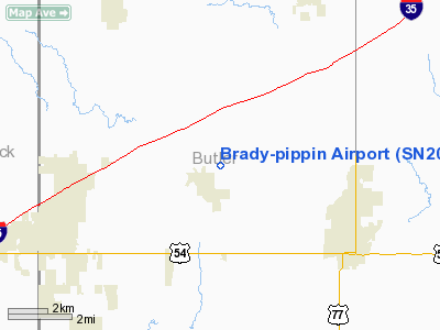
Brady-pippin Airport
Address:
Butler County, KS
Tel:
316-775-3163
Images
and information placed above are from
http://www.airport-data.com/airport/SN20/
We
thank them for the data!
|
General Info |
| Country |
United
States |
| State |
KANSAS
|
| FAA ID |
SN20
|
| Latitude |
37-43-10.058N |
|
Longitude |
097-02-56.136W |
|
Elevation |
1300
feet |
| Near
City |
AUGUSTA
|
We don't guarantee the information is fresh and accurate. The data may
be wrong or outdated.
For more up-to-date information please refer to other sources.
|
|


