 |
|
|
Location &
QuickFacts
|
FAA
Information Effective: |
2008-06-05 |
|
Airport
Identifier: |
SN27 |
|
Airport
Status: |
Operational |
|
Longitude/Latitude: |
094-56-40.8770W/39-03-45.0120N
-94.944688/39.062503 (Estimated) |
|
Elevation: |
920 ft / 280.42 m (Estimated) |
|
Land: |
0 acres |
|
From
nearest city: |
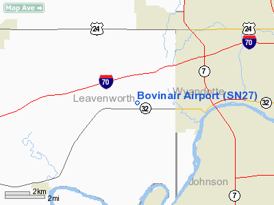
3 nautical miles W of Bonner Springs, KS |
|
Location: |
Leavenworth County, KS |
|
Magnetic Variation: |
05E (1985) |
Owner & Manager
|
Ownership: |
Privately owned |
|
Owner: |
William F Millsap |
|
Address: |
15980 158th
Bonner Springs, KS 66012 |
|
Phone number: |
913-422-2038 |
|
Manager: |
William F Millsap |
|
Address: |
15980 158th
Bonner Springs, KS 66012 |
|
Phone number: |
913-422-2038 |
Airport
Operations and Facilities
|
Airport
Use: |
Private |
|
Wind
indicator: |
Yes |
|
Segmented Circle: |
No |
|
Control
Tower: |
No |
|
Landing
fee charge: |
No |
|
Sectional chart: |
Kansas City |
|
Region: |
ACE - Central |
|
Boundary
ARTCC: |
ZKC - Kansas City |
|
Tie-in
FSS: |
ICT - Wichita |
|
FSS on
Airport: |
No |
|
FSS Toll
Free: |
1-800-WX-BRIEF |
|
Runway Information
Runway 17/35
|
Dimension: |
2000 x 30 ft / 609.6 x 9.1 m |
|
Surface: |
TURF, |
|
|
Runway 17
|
Runway 35
|
|
Traffic
Pattern: |
Left |
Left |
|
Radio Navigation Aids
|
ID |
Type |
Name |
Ch |
Freq |
Var |
Dist |
|
DO |
NDB |
Dotte |
|
359.00 |
05E |
13.2 nm |
|
GQ |
NDB |
Norge |
|
517.00 |
05E |
13.5 nm |
|
GKB |
NDB |
Norge |
|
517.00 |
05E |
13.5 nm |
|
LXT |
NDB |
Lesumit |
|
263.00 |
04E |
27.5 nm |
|
GPH |
NDB |
Mosby |
|
284.00 |
03E |
34.2 nm |
|
TO |
NDB |
Biloy |
|
521.00 |
05E |
34.8 nm |
|
AZN |
NDB |
Amazon |
|
233.00 |
06E |
49.4 nm |
|
FOE |
TACAN |
Forbes |
053X |
|
05E |
34.2 nm |
|
OJC |
VOR/DME |
Johnson County |
077X |
113.00 |
06E |
16.5 nm |
|
RIS |
VOR/DME |
Riverside |
051X |
111.40 |
05E |
16.6 nm |
|
MCI |
VORTAC |
Kansas City |
079Y |
113.25 |
05E |
16.5 nm |
|
TOP |
VORTAC |
Topeka |
125X |
117.80 |
05E |
28.5 nm |
|
ANX |
VORTAC |
Napoleon |
087X |
114.00 |
07E |
38.1 nm |
|
MKC |
VOT |
Kansas City Downtown |
|
108.60 |
|
16.6 nm |
|
FOE |
VOT |
Forbes |
|
111.00 |
|
34.4 nm |
Remarks
-
PRVDD THE APCH TO
EACH RWY IS MAINT FOR A MIN 20:1 UNOBSTRUCTED GLIDE SLOPE, AND THE
TRANSITIONAL SFC MAINT FOR A 7:1 SLOPE.
Based Aircraft
|
Aircraft based
on field: |
1 |
|
Single Engine
Airplanes: |
1 |
Bovinair Airport
Address:
Leavenworth County, KS
Tel:
913-422-2038
Images
and information placed above are from
http://www.airport-data.com/airport/SN27/
We
thank them for the data!
|
General Info |
| Country |
United
States |
| State |
KANSAS
|
| FAA ID |
SN27
|
| Latitude |
39-03-45.012N |
|
Longitude |
094-56-40.877W |
|
Elevation |
920 feet
|
| Near
City |
BONNER
SPRINGS |
We don't guarantee the information is fresh and accurate. The data may
be wrong or outdated.
For more up-to-date information please refer to other sources.
|
|


