 |
|
|
Location &
QuickFacts
|
FAA
Information Effective: |
2008-06-05 |
|
Airport
Identifier: |
8KS5 |
|
Airport
Status: |
Operational |
|
Longitude/Latitude: |
095-16-48.9000W/37-19-00.2200N
-95.280250/37.316728 (Estimated) |
|
Elevation: |
890 ft / 271.27 m (Estimated) |
|
Land: |
6 acres |
|
From
nearest city: |
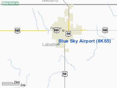
1 nautical miles S of Parsons, KS |
|
Location: |
Labette County, KS |
|
Magnetic Variation: |
05E (1995) |
Owner & Manager
|
Ownership: |
Privately owned |
|
Owner: |
Gale Dringenberg |
|
Address: |
2601 Clark
Parsons, KS 67357 |
|
Phone number: |
316-421-0289 |
|
Manager: |
Gale Dringenberg |
|
Address: |
2601 Clark
Parsons, KS 67357 |
|
Phone number: |
316-421-0289 |
Airport
Operations and Facilities
|
Airport
Use: |
Private |
|
Wind
indicator: |
Yes |
|
Segmented Circle: |
No |
|
Control
Tower: |
No |
|
Sectional chart: |
Kansas City |
|
Region: |
ACE - Central |
|
Boundary
ARTCC: |
ZKC - Kansas City |
|
Tie-in
FSS: |
ICT - Wichita |
|
FSS on
Airport: |
No |
|
FSS Toll
Free: |
1-800-WX-BRIEF |
|
Runway Information
Runway 06/24
|
Dimension: |
2000 x 50 ft / 609.6 x 15.2 m |
|
Surface: |
TURF, |
|
|
Runway 06
|
Runway 24
|
|
Traffic
Pattern: |
Left |
Left |
|
Obstruction: |
16 ft bldg, 285.0 ft from runway |
4 ft fence, 50.0 ft from runway |
|
Radio Navigation Aids
|
ID |
Type |
Name |
Ch |
Freq |
Var |
Dist |
|
PPF |
NDB |
Parsons |
|
258.00 |
06E |
11.0 nm |
|
CFV |
NDB |
Coffeyville |
|
212.00 |
05E |
19.4 nm |
|
PTS |
NDB |
Pittsburg |
|
365.00 |
05E |
27.5 nm |
|
MSB |
NDB |
Monarch |
|
410.00 |
04E |
29.2 nm |
|
FSK |
NDB |
Fort Scott |
|
379.00 |
05E |
37.9 nm |
|
LLU |
NDB |
Spring River |
|
356.00 |
05E |
47.4 nm |
|
CNU |
VOR/DME |
Chanute |
029X |
109.20 |
05E |
23.9 nm |
|
BVO |
VOR/DME |
Bartlesville |
126X |
117.90 |
08E |
45.8 nm |
|
EOS |
VOR/DME |
Neosho |
120X |
117.30 |
07E |
49.5 nm |
|
OSW |
VORTAC |
Oswego |
123X |
117.60 |
08E |
10.2 nm |
Remarks
-
PRVDD MAINTAIN A
CLEAR 20:1 APCH SLOPE & 7:1 TRANSITIONAL SFC.
Based Aircraft
|
Aircraft based
on field: |
1 |
|
Single Engine
Airplanes: |
1 |
Blue Sky Airport
Address:
Labette County, KS
Tel:
316-421-0289
Images
and information placed above are from
http://www.airport-data.com/airport/8KS5/
We
thank them for the data!
|
General Info |
| Country |
United
States |
| State |
KANSAS
|
| FAA ID |
8KS5
|
| Latitude |
37-19-00.220N |
|
Longitude |
095-16-48.900W |
|
Elevation |
890 feet
|
| Near
City |
PARSONS
|
We don't guarantee the information is fresh and accurate. The data may
be wrong or outdated.
For more up-to-date information please refer to other sources.
|
|


