 |
|
|
Location &
QuickFacts
|
FAA
Information Effective: |
2008-06-05 |
|
Airport
Identifier: |
5KS9 |
|
Airport
Status: |
Operational |
|
Longitude/Latitude: |
101-21-45.5830W/39-49-32.9890N
-101.362662/39.825830 (Estimated) |
|
Elevation: |
3345 ft / 1019.56 m (Surveyed) |
|
Land: |
0 acres |
|
From
nearest city: |
3 nautical miles N of Mc Donald, KS |
|
Location: |
Rawlins County, KS |
|
Magnetic Variation: |
09E (1985) |
Owner & Manager
|
Ownership: |
Privately owned |
|
Owner: |
Harvey A Black |
|
Address: |
Mc Donald, KS 66745 |
|
Phone number: |
913-538-2492 |
|
Address: |
|
Airport Operations and Facilities
|
Airport Use: |
Private |
|
Wind indicator: |
Yes |
|
Segmented Circle: |
No |
|
Control Tower: |
No |
|
Landing fee charge: |
No |
|
Sectional chart: |
Wichita |
|
Region: |
ACE - Central |
|
Boundary ARTCC: |
ZDV - Denver |
|
Tie-in FSS: |
ICT - Wichita |
|
FSS on Airport: |
No |
|
FSS Toll Free: |
1-800-WX-BRIEF |
Airport Services
|
Airframe
Repair: |
NONE |
|
Power
Plant Repair: |
NONE |
|
Runway Information
Runway 17/35
|
Dimension: |
2625 x 40 ft / 800.1 x 12.2 m |
|
Surface: |
TURF, |
|
|
Runway 17
|
Runway 35
|
|
Traffic
Pattern: |
Right |
Left |
|
Radio Navigation Aids
|
ID |
Type |
Name |
Ch |
Freq |
Var |
Dist |
|
MCK |
FAN MARKER |
Mc Cook |
|
|
11E |
43.3 nm |
|
ADT |
NDB |
Atwood |
|
365.00 |
09E |
14.7 nm |
|
SYF |
NDB |
St Francis |
|
386.00 |
10E |
19.5 nm |
|
JDM |
NDB |
Wheatfield |
|
408.00 |
08E |
23.9 nm |
|
GL |
NDB |
Shugr |
|
414.00 |
09E |
33.8 nm |
|
OIN |
NDB |
Oberlin |
|
341.00 |
09E |
38.1 nm |
|
IML |
NDB |
Imperial |
|
283.00 |
09E |
43.0 nm |
|
OEL |
NDB |
Oakley |
|
380.00 |
08E |
49.8 nm |
|
MCK |
VOR/DME |
Mc Cook |
100X |
115.30 |
08E |
42.0 nm |
|
GLD |
VORTAC |
Goodland |
098X |
115.10 |
12E |
30.4 nm |
|
HCT |
VORTAC |
Hayes Center |
124X |
117.70 |
11E |
42.8 nm |
Remarks
-
E-W RWY TO BE
ABANDONED. IAW AGREEMENT W/JACK POORE TFC FOR BLACK TO WEST SIDE AND FOR JACK
POORE FLD TO THE EAST SIDE.
Based Aircraft
|
Aircraft based
on field: |
1 |
|
Single Engine
Airplanes: |
1 |
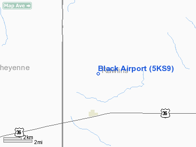
Black Airport
Address:
Rawlins County, KS
Tel:
913-538-2492
Images
and information placed above are from
http://www.airport-data.com/airport/5KS9/
We
thank them for the data!
|
General Info |
| Country |
United
States |
| State |
KANSAS
|
| FAA ID |
5KS9
|
| Latitude |
39-49-32.989N |
|
Longitude |
101-21-45.583W |
|
Elevation |
3345
feet |
| Near
City |
MC
DONALD |
We don't guarantee the information is fresh and accurate. The data may
be wrong or outdated.
For more up-to-date information please refer to other sources.
|
|


