 |
|
|
Location &
QuickFacts
|
FAA
Information Effective: |
2008-06-05 |
|
Airport
Identifier: |
7KS4 |
|
Airport
Status: |
Operational |
|
Longitude/Latitude: |
095-26-21.0000W/39-38-00.0000N
-95.439167/39.633333 (Estimated) |
|
Elevation: |
1180 ft / 359.66 m (Estimated) |
|
Land: |
0 acres |
|
From
nearest city: |
5 nautical miles W of Huron, KS |
|
Location: |
Atchison County, KS |
|
Magnetic Variation: |
05E (1995) |
Owner & Manager
|
Ownership: |
Privately owned |
|
Owner: |
Leon A Torkelson |
|
Address: |
5568 324th Rd
Huron, KS 66439 |
|
Phone number: |
913-548-7775 |
|
Manager: |
Leon A Torkelson |
|
Address: |
5568 324th Rd
Huron, KS 66439 |
|
Phone number: |
913-548-7775 |
Airport
Operations and Facilities
|
Airport
Use: |
Private |
|
Wind
indicator: |
Yes |
|
Segmented Circle: |
No |
|
Control
Tower: |
No |
|
Sectional chart: |
Kansas City |
|
Region: |
ACE - Central |
|
Boundary
ARTCC: |
ZKC - Kansas City |
|
Tie-in
FSS: |
ICT - Wichita |
|
FSS on
Airport: |
No |
|
FSS Toll
Free: |
1-800-WX-BRIEF |
|
Runway Information
Runway 02/20
|
Dimension: |
1600 x 70 ft / 487.7 x 21.3 m |
|
Surface: |
TURF, |
|
|
Runway 02
|
Runway 20
|
|
Traffic
Pattern: |
Left |
Left |
|
Obstruction: |
|
40 ft trees, 400.0 ft from runway |
|
Radio Navigation Aids
|
ID |
Type |
Name |
Ch |
Freq |
Var |
Dist |
|
FNB |
NDB |
Brenner |
|
404.00 |
05E |
27.5 nm |
|
AZN |
NDB |
Amazon |
|
233.00 |
06E |
28.8 nm |
|
TO |
NDB |
Biloy |
|
521.00 |
05E |
32.9 nm |
|
DO |
NDB |
Dotte |
|
359.00 |
05E |
40.5 nm |
|
EVU |
NDB |
Emville |
|
317.00 |
05E |
49.3 nm |
|
FOE |
TACAN |
Forbes |
053X |
|
05E |
42.5 nm |
|
RBA |
VOR/DME |
Robinson |
019X |
108.20 |
04E |
13.1 nm |
|
RIS |
VOR/DME |
Riverside |
051X |
111.40 |
05E |
49.8 nm |
|
TOP |
VORTAC |
Topeka |
125X |
117.80 |
05E |
30.3 nm |
|
STJ |
VORTAC |
St Joseph |
102X |
115.50 |
08E |
30.8 nm |
|
MCI |
VORTAC |
Kansas City |
079Y |
113.25 |
05E |
38.7 nm |
|
PWE |
VORTAC |
Pawnee City |
071X |
112.40 |
05E |
49.1 nm |
|
FOE |
VOT |
Forbes |
|
111.00 |
|
42.3 nm |
|
MKC |
VOT |
Kansas City Downtown |
|
108.60 |
|
49.7 nm |
Remarks
-
MAINTAIN CLEAR
20:1 APCH & 7:1 TRANSITIONAL SFC.
Based Aircraft
|
Aircraft based
on field: |
1 |
|
Single Engine
Airplanes: |
1 |
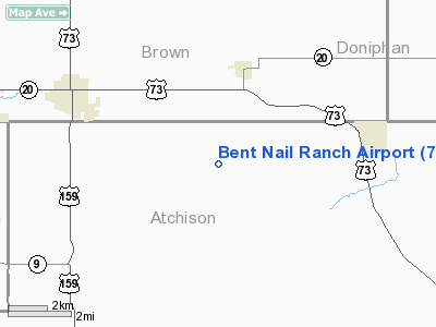
Bent Nail Ranch Airport
Address:
Atchison County, KS
Tel:
913-548-7775
Images
and information placed above are from
http://www.airport-data.com/airport/7KS4/
We
thank them for the data!
|
General Info |
| Country |
United
States |
| State |
KANSAS
|
| FAA ID |
7KS4
|
| Latitude |
39-38-00.000N |
|
Longitude |
095-26-21.000W |
|
Elevation |
1180
feet |
| Near
City |
HURON
|
We don't guarantee the information is fresh and accurate. The data may
be wrong or outdated.
For more up-to-date information please refer to other sources.
|
|


