 |
|
Belleville Municipal Airport |
Coordinates: 39°49â²04â³N 097°39â²35â³W / 39.81778°N 97.65972°W / 39.81778; -97.65972
| Belleville Municipal Airport |
| IATA: none â ICAO: KRPB â FAA LID: RPB |
| Summary |
| Airport type |
Public |
| Owner |
City of Belleville |
| Serves |
Belleville, Kansas |
| Elevation AMSL |
1,537 ft / 468 m |
| Runways |
| Direction |
Length |
Surface |
| ft |
m |
| 18/36 |
3,507 |
1,069 |
Asphalt |
| 14/32 |
1,415 |
431 |
Turf |
| Statistics (2007) |
| Aircraft operations |
7,650 |
| Based aircraft |
11 |
| Source: Federal Aviation Administration |
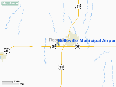
Belleville Municipal Airport (ICAO: KRPB, FAA LID: RPB) is a city-owned public-use airport located one mile (2 km) west of the central business district of Belleville, a city in Republic County, Kansas, United States.
Although most U.S. airports use the same three-letter location identifier for the FAA and IATA, Belleville Municipal Airport is assigned RPB by the FAA but has no designation from the IATA.
Facilities and aircraft
Belleville Municipal Airport covers an area of 111 acres (45 ha) which contains two runways: 18/36 with a 3,507 x 60 ft (1,069 x 18 m) asphalt pavement and 14/32 with a 1,415 x 100 ft (431 x 30 m) turf surface.
For the 12-month period ending July 24, 2007, the airport had 7,650 aircraft operations, an average of 20 per day: 99% general aviation and 1% military. At that time there were 11 aircraft based at this airport: 82% single-engine and 18% ultralight.
The above content comes from Wikipedia and is published under free licenses – click here to read more.
|
Location &
QuickFacts
|
FAA
Information Effective: |
2008-06-05 |
|
Airport
Identifier: |
RPB |
|
Airport
Status: |
Operational |
|
Longitude/Latitude: |
097-39-34.5110W/39-49-03.9350N
-97.659586/39.817760 (Estimated) |
|
Elevation: |
1537 ft / 468.48 m (Surveyed) |
|
Land: |
111 acres |
|
From
nearest city: |
1 nautical miles W of Belleville, KS |
|
Location: |
Republic County, KS |
|
Magnetic Variation: |
07E (1985) |
Owner & Manager
|
Ownership: |
Publicly owned |
|
Owner: |
City Of Belleville |
|
Address: |
1819 L St
Belleville, KS 66935 |
|
Phone
number: |
785-527-2288 |
|
Manager: |
Stuart Sutton |
|
Address: |
1560 U.s. Hwy 36
Belleville, KS 66935 |
|
Phone
number: |
1-888-324-5285
STUART SUTTON/SERVICE AGENT-FBO CHESTER FLYING SERVICE -
1-888-324-5285. |
Airport
Operations and Facilities
|
Airport
Use: |
Open to public |
|
Wind
indicator: |
Yes |
|
Segmented Circle: |
Yes |
|
Control
Tower: |
No |
|
Lighting
Schedule: |
DUSK-DAWN |
|
Beacon
Color: |
Clear-Green (lighted land airport) |
|
Landing
fee charge: |
No |
|
Sectional chart: |
Wichita |
|
Region: |
ACE - Central |
|
Boundary
ARTCC: |
ZMP - Minneapolis |
|
Tie-in
FSS: |
ICT - Wichita |
|
FSS on
Airport: |
No |
|
FSS Toll
Free: |
1-800-WX-BRIEF |
|
NOTAMs
Facility: |
ICT (NOTAM-d service avaliable) |
|
Federal Agreements: |
NGY |
Airport Communications
|
CTAF: |
122.800 |
|
Unicom: |
122.800 |
Airport Services
|
Fuel
available: |
100LL
FOR FUEL OR TRANSPORTATION (AVBL 24 HRS) CTC POLICE DISPATCHER ON
785-527-5657. |
|
Bottled
Oxygen: |
NONE |
|
Bulk
Oxygen: |
NONE |
|
Runway Information
Runway 14/32
|
Dimension: |
1415 x 100 ft / 431.3 x 30.5 m |
|
Surface: |
TURF, Fair Condition
ROUGH IN SPOTS & SOME SMALL RODENT HOLES. |
|
|
Runway 14
|
Runway 32
|
|
Longitude: |
097-39-33.6695W |
097-39-22.1500W |
|
Latitude: |
39-49-03.8208N |
39-48-53.0210N |
|
Elevation: |
1520.00 ft |
1523.00 ft |
|
Alignment: |
127 |
127 |
|
Traffic
Pattern: |
Left |
Left |
|
Markings: |
Nonstandard,
RY 14 APCH DELINEATED BY YELLOW PAINTED CONES. |
Nonstandard,
APCH IS DELINEATED BY YELLOW PAINTED CONES. |
|
Obstruction: |
58 ft tree, 1933.0 ft from runway, 135 ft left of
centerline, 33:1 slope to clear |
13 ft trees, 100.0 ft from runway, 50 ft right of
centerline, 7:1 slope to clear |
|
Runway 18/36
|
Dimension: |
3507 x 60 ft / 1068.9 x 18.3 m |
|
Surface: |
ASPH,
ROUGH IN SPOTS & SOME SMALL RODENT HOLES. |
|
Weight Limit: |
Single wheel: 12500 lbs.
Dual wheel: 18000 lbs. |
|
Edge Lights: |
Medium |
|
|
Runway 18
|
Runway 36
|
|
Longitude: |
097-39-36.5879W |
097-39-37.7590W |
|
Latitude: |
39-49-23.4825N |
39-48-48.8359N |
|
Alignment: |
127 |
2 |
|
Traffic
Pattern: |
Left |
Left |
|
Markings: |
Non-precision instrument, Good Condition
RY NRS & THLD MKGS BADLY FADED. |
Non-precision instrument, Good Condition
RY NRS & THLD MKGS BADLY FADED. |
|
Obstruction: |
23 ft rr, 744.0 ft from runway, 23:1 slope to clear |
24 ft tree, 820.0 ft from runway, 225 ft left of
centerline, 26:1 slope to clear |
|
Radio Navigation Aids
|
ID |
Type |
Name |
Ch |
Freq |
Var |
Dist |
|
RPB |
NDB |
Republican |
|
414.00 |
07E |
0.3 nm |
|
CNK |
NDB |
Concordia |
|
335.00 |
06E |
15.9 nm |
|
HJH |
NDB |
Hebron |
|
323.00 |
06E |
20.3 nm |
|
DBX |
NDB |
Morrison |
|
212.00 |
06E |
28.7 nm |
|
FBY |
NDB |
Fairbury |
|
293.00 |
06E |
31.3 nm |
|
CYW |
NDB |
Clay Center |
|
362.00 |
07E |
35.0 nm |
|
FMZ |
NDB |
Beklof |
|
392.00 |
07E |
46.6 nm |
|
MYZ |
NDB |
Marysville |
|
341.00 |
06E |
47.4 nm |
|
HWB |
NDB |
Shaw |
|
263.00 |
06E |
49.5 nm |
|
TKO |
VORTAC |
Mankato |
035X |
109.80 |
10E |
27.7 nm |
Remarks
-
PUBLIC TELEPHONE
AVAILABLE IN PILOT'S LOUNGE.
-
OCNL ULTRALIGHT
ACTVTY ON & INVOF ARPT.
Based Aircraft
|
Aircraft based
on field: |
11 |
|
Single Engine
Airplanes: |
9 |
|
Ultralights: |
2 |
Operational Statistics
Time Period: 2006-07-25 - 2007-07-24
|
Aircraft
Operations: |
148/Week |
|
General
Aviation Local: |
60.1% |
|
General
Aviation Itinerant: |
39.2% |
|
Military: |
0.7% |
Belleville Municipal Airport
Address:
Republic County, KS
Tel:
785-527-2288,
1-888-324-5285
Images
and information placed above are from
http://www.airport-data.com/airport/RPB/
We
thank them for the data!
|
General Info |
| Country |
United
States |
| State |
KANSAS
|
| FAA ID |
RPB
|
| Latitude |
39-49-04.471N |
|
Longitude |
097-39-34.650W |
|
Elevation |
1537
feet |
| Near
City |
BELLEVILLE |
We don't guarantee the information is fresh and accurate. The data may
be wrong or outdated.
For more up-to-date information please refer to other sources.
|
|


