 |
|
|
Location &
QuickFacts
|
FAA
Information Effective: |
2008-06-05 |
|
Airport
Identifier: |
27KS |
|
Airport
Status: |
Operational |
|
Longitude/Latitude: |
101-42-59.6160W/39-07-44.0150N
-101.716560/39.128893 (Estimated) |
|
Elevation: |
3650 ft / 1112.52 m (Estimated) |
|
Land: |
160 acres |
|
From
nearest city: |
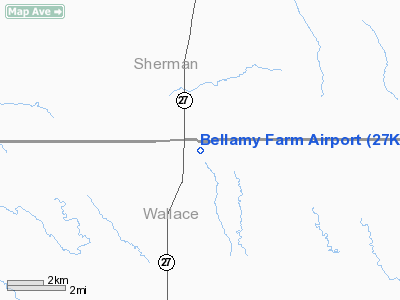
12 nautical miles S of Goodland, KS |
|
Location: |
Wallace County, KS |
|
Magnetic Variation: |
09E (1985) |
Owner & Manager
|
Ownership: |
Privately owned |
|
Owner: |
Brian Bellamy |
|
Address: |
Rr 1
Sharon Springs, KS 67758 |
|
Phone number: |
913-852-4524 |
|
Manager: |
Brian Bellamy |
|
Address: |
Rr 1
Sharon Springs, KS 67758 |
|
Phone number: |
913-899-5870 |
Airport
Operations and Facilities
|
Airport
Use: |
Private |
|
Wind
indicator: |
Yes |
|
Segmented Circle: |
No |
|
Control
Tower: |
No |
|
Landing
fee charge: |
No |
|
Sectional chart: |
Wichita |
|
Region: |
ACE - Central |
|
Boundary
ARTCC: |
ZDV - Denver |
|
Tie-in
FSS: |
ICT - Wichita |
|
FSS on Airport: |
No |
|
FSS Toll Free: |
1-800-WX-BRIEF |
Airport Services
|
Runway Information
Runway 13/31
|
Dimension: |
3000 x 150 ft / 914.4 x 45.7 m |
|
Surface: |
TURF, |
|
|
Runway 13
|
Runway 31
|
|
Traffic
Pattern: |
Left |
Left |
|
Radio Navigation Aids
|
ID |
Type |
Name |
Ch |
Freq |
Var |
Dist |
|
GL |
NDB |
Shugr |
|
414.00 |
09E |
11.3 nm |
|
ITR |
NDB |
Kit Carson |
|
209.00 |
10E |
27.4 nm |
|
SYF |
NDB |
St Francis |
|
386.00 |
10E |
36.0 nm |
|
JDM |
NDB |
Wheatfield |
|
408.00 |
08E |
38.6 nm |
|
OEL |
NDB |
Oakley |
|
380.00 |
08E |
42.0 nm |
|
GLD |
VORTAC |
Goodland |
098X |
115.10 |
12E |
15.6 nm |
Remarks
-
CONDL: PROVIDED
APPROACH TO EACH RWY IS MAINTAINED FOR A MIN. 20:1 GLIDE SLOPE & THE
TRANSITIONAL SURFACE BE MAINTAINED FOR A 7:1 SLOPE.
Based Aircraft
|
Aircraft based
on field: |
3 |
|
Single Engine
Airplanes: |
2 |
|
Multi Engine
Airplanes: |
1 |
Bellamy Farm Airport
Address:
Marion County, FL
Tel:
913-852-4524, 913-899-5870
Images
and information placed above are from
http://www.airport-data.com/airport/27KS/
We
thank them for the data!
|
General Info |
| Country |
United
States |
| State |
KANSAS
|
| FAA ID |
27KS
|
| Latitude |
39-07-44.015N |
|
Longitude |
101-42-59.616W |
|
Elevation |
3650
feet |
| Near
City |
GOODLAND
|
We don't guarantee the information is fresh and accurate. The data may
be wrong or outdated.
For more up-to-date information please refer to other sources.
|
|


