 |
|
|
Location &
QuickFacts
|
FAA
Information Effective: |
2008-06-05 |
|
Airport
Identifier: |
SN66 |
|
Airport
Status: |
Operational |
|
Longitude/Latitude: |
100-27-19.4890W/38-49-06.0430N
-100.455414/38.818345 (Estimated) |
|
Elevation: |
2635 ft / 803.15 m (Estimated) |
|
Land: |
0 acres |
|
From
nearest city: |
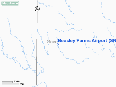
9 nautical miles SE of Gove, KS |
|
Location: |
Gove County, KS |
|
Magnetic Variation: |
09E (1985) |
Owner & Manager
|
Ownership: |
Privately owned |
|
Owner: |
Beesley Farms Inc |
|
Address: |
Hcr 1 Box 28
Gove, KS 67736 |
|
Manager: |
Roger Beesley |
|
Address: |
Gove, KS 67736 |
|
Phone number: |
316-297-5908
AFTER 2000 HRS PHONE 316-397-5908. |
Airport
Operations and Facilities
|
Airport
Use: |
Private |
|
Wind
indicator: |
No |
|
Segmented Circle: |
No |
|
Control
Tower: |
No |
|
Landing
fee charge: |
No |
|
Sectional chart: |
Wichita |
|
Region: |
ACE - Central |
|
Boundary
ARTCC: |
ZDV - Denver |
|
Tie-in
FSS: |
ICT - Wichita |
|
FSS on
Airport: |
No |
|
FSS Toll
Free: |
1-800-WX-BRIEF |
|
Runway Information
Runway 17/35
|
Dimension: |
2600 x 50 ft / 792.5 x 15.2 m |
|
Surface: |
TURF, |
|
|
Runway 17
|
Runway 35
|
|
Traffic
Pattern: |
Left |
Left |
|
Radio Navigation Aids
|
ID |
Type |
Name |
Ch |
Freq |
Var |
Dist |
|
OEL |
NDB |
Oakley |
|
380.00 |
08E |
24.4 nm |
|
TQK |
NDB |
Scott City |
|
256.00 |
08E |
28.7 nm |
|
JDM |
NDB |
Wheatfield |
|
408.00 |
08E |
49.9 nm |
|
HLC |
VORTAC |
Hill City |
084X |
113.70 |
08E |
28.6 nm |
Remarks
-
PRVDD THE APCH TO
EACH RWY IS MAINT FOR A MIN 20:1 GLIDE SLOPE, AND THE TRANSITIONAL SFC MAINT
FOR A 7:1 SLOPE.
Based Aircraft
|
Aircraft based
on field: |
1 |
|
Single Engine
Airplanes: |
1 |
Beesley Farms Airport
Address:
Gove County, KS
Tel:
316-297-5908
Images
and information placed above are from
http://www.airport-data.com/airport/SN66/
We
thank them for the data!
|
General Info |
| Country |
United
States |
| State |
KANSAS
|
| FAA ID |
SN66
|
| Latitude |
38-49-06.043N |
|
Longitude |
100-27-19.489W |
|
Elevation |
2635
feet |
| Near
City |
GOVE
|
We don't guarantee the information is fresh and accurate. The data may
be wrong or outdated.
For more up-to-date information please refer to other sources.
|
|


