 |
|
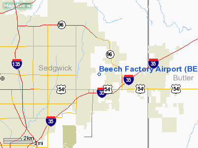
| Beech Factory Airport |
| IATA: BEC â ICAO: KBEC â FAA LID: BEC |
| Summary |
| Airport type |
Public |
| Owner |
Hawker Aircraft Company |
| Serves |
Wichita, Kansas |
| Elevation AMSL |
1,408 ft / 429 m |
| Coordinates |
37°41â²40â³N 097°12â²54â³W / 37.69444°N 97.215°W / 37.69444; -97.215 |
| Runways |
| Direction |
Length |
Surface |
| ft |
m |
| 18/36 |
8,000 |
2,438 |
Concrete |
| Statistics (2008) |
| Aircraft operations |
32,700 |
| Based aircraft |
77 |
| Source: Federal Aviation Administration |
Beech Factory Airport (IATA: BEC, ICAO: KBEC, FAA LID: BEC) is a public use airport located five nautical miles (9 km) east of the central business district of Wichita, a city in Sedgwick County, Kansas, United States. It is privately owned by the Hawker Beechcraft Corporation.
Facilities and aircraft
Beech Factory Airport covers an area of 1,280 acres (518 ha) at an elevation of 1,408 feet (429 m) above mean sea level. It has one runway designated 18/36 with a concrete surface measuring 8,000 by 100 feet (2,438 x 30 m).
For the 12-month period ending May 13, 2008, the airport had 32,700 aircraft operations, an average of 89 per day: 86% general aviation and 14% military. At that time there were 77 aircraft based at this airport: 27% single-engine, 38% multi-engine, 13% jet and 22% military.
The above content comes from Wikipedia and is published under free licenses – click here to read more.
|
Location &
QuickFacts
|
FAA
Information Effective: |
2008-06-05 |
|
Airport
Identifier: |
BEC |
|
Airport
Status: |
Operational |
|
Longitude/Latitude: |
097-12-53.9600W/37-41-40.1100N
-97.214989/37.694475 (Estimated) |
|
Elevation: |
1408 ft / 429.16 m (Surveyed) |
|
Land: |
1280 acres |
|
From
nearest city: |
5 nautical miles E of Wichita, KS |
|
Location: |
Sedgwick County, KS |
|
Magnetic Variation: |
06E (2000) |
Owner & Manager
|
Ownership: |
Privately owned |
|
Owner: |
Hawker Aircaft Company |
|
Address: |
9709 E. Central
Wichita, KS 67201 |
|
Phone number: |
316-676-5300 |
|
Manager: |
Larry Forister |
|
Address: |
9709 E. Central
Wichita, KS 67201 |
|
Phone number: |
316-676-8179 |
Airport
Operations and Facilities
|
Airport
Use: |
Open to public |
|
Wind
indicator: |
Yes |
|
Segmented Circle: |
Yes |
|
Control
Tower: |
Yes |
|
Lighting
Schedule: |
DUSK-DAWN
WHEN ATCT CLSD ACTVT MIRL RY 18/36; REIL RYS 18; 36 - 122.7. |
|
Beacon
Color: |
Clear-Green (lighted land airport) |
|
Landing
fee charge: |
No |
|
Sectional chart: |
Wichita |
|
Region: |
ACE - Central |
|
Boundary
ARTCC: |
ZKC - Kansas City |
|
Tie-in
FSS: |
ICT - Wichita |
|
FSS on
Airport: |
No |
|
FSS Toll
Free: |
1-800-WX-BRIEF |
|
NOTAMs
Facility: |
ICT (NOTAM-d service avaliable) |
Airport Communications
|
CTAF: |
122.700 |
|
Unicom: |
122.950 |
Airport Services
|
Fuel
available: |
100LLA
CALL 316-676-7140 FOR FUEL. |
|
Airframe
Repair: |
NONE |
|
Power
Plant Repair: |
NONE |
|
Bottled
Oxygen: |
NONE |
|
Runway Information
Runway 18/36
|
Dimension: |
8000 x 100 ft / 2438.4 x 30.5 m |
|
Surface: |
CONC, Good Condition |
|
Edge Lights: |
Medium |
|
|
Runway 18
|
Runway 36
|
|
Longitude: |
097-12-44.8700W |
097-13-03.0400W |
|
Latitude: |
37-42-18.9900N |
37-41-01.2300N |
|
Elevation: |
1408.00 ft |
1370.00 ft |
|
Alignment: |
127 |
11 |
|
Traffic
Pattern: |
Left |
Right |
|
Markings: |
Basic, Good Condition |
Basic, Good Condition |
|
Crossing
Height: |
45.00 ft |
45.00 ft |
|
VASI: |
4-light PAPI on left side |
4-light PAPI on left side |
|
Visual
Glide Angle: |
3.00° |
3.00° |
|
Runway End
Identifier: |
Yes |
Yes |
|
Radio Navigation Aids
|
ID |
Type |
Name |
Ch |
Freq |
Var |
Dist |
|
IC |
NDB |
Piche |
|
332.00 |
07E |
13.4 nm |
|
EQA |
NDB |
El Dorado |
|
383.00 |
05E |
19.6 nm |
|
EWK |
NDB |
Newton |
|
281.00 |
06E |
22.4 nm |
|
EGT |
NDB |
Wellington |
|
414.00 |
07E |
23.8 nm |
|
MPR |
NDB |
Mc Pherson |
|
227.00 |
06E |
45.2 nm |
|
IAB |
TACAN |
Mc Connell |
112X |
|
07E |
5.0 nm |
|
HUT |
VOR/DME |
Hutchinson |
115X |
116.80 |
09E |
38.7 nm |
|
ICT |
VORTAC |
Wichita |
085X |
113.80 |
07E |
17.8 nm |
|
ICT |
VOT |
Wichita |
|
114.00 |
|
11.0 nm |
Remarks
-
ARR & DEP ACFT
MAINTAIN 2200 FT MSL WITHIN 5 MILES OF FIELD DUE TO AFB TRAFFIC.
-
ARRIVALS FROM THE
WEST ENTER THE PATTERN EAST ALONG 13TH ST.
-
CTAF 122.7 USED
JOINTLY WITH JABARA ARPT WHEN BEECH ATCT CLSD.
-
DEER, COYOTE &
MIGRATORY WATER FOWL ON & INVOF ARPT.
-
PPR FOR PARKING
OR TAXIING WEST SIDE OF RY.
-
BE ALERT COL
JAMES JABARA ARPT 3 MILES NORTH 1/2 MILE WEST OF ARPT.
-
WHEN TWR CLSD CTC
SECURITY ON UNICOM FREQ WHEN CLEAR OF RY.
-
EXISTED PRIOR TO 1959.
Based Aircraft
|
Aircraft based
on field: |
77 |
|
Single Engine
Airplanes: |
21 |
|
Multi Engine
Airplanes: |
29 |
|
Jet Engine
Airplanes: |
10 |
|
Military: |
17 |
Operational Statistics
Time Period: 2005-06-01 - 2006-05-31
|
Aircraft
Operations: |
90/Day |
|
General
Aviation Local: |
81.0% |
|
General
Aviation Itinerant: |
5.2% |
|
Military: |
13.8% |
Beech Factory Airport
Address:
Sedgwick County, KS
Tel:
316-676-5300, 316-676-8179
Images
and information placed above are from
http://www.airport-data.com/airport/BEC/
We
thank them for the data!
|
General Info |
| Country |
United
States |
| State |
KANSAS
|
| FAA ID |
BEC
|
| Latitude |
37-41-40.110N |
|
Longitude |
097-12-53.960W |
|
Elevation |
1408
feet |
| Near
City |
WICHITA
|
We don't guarantee the information is fresh and accurate. The data may
be wrong or outdated.
For more up-to-date information please refer to other sources.
|
|


