 |
|
|
Location &
QuickFacts
|
FAA
Information Effective: |
2008-06-05 |
|
Airport
Identifier: |
37KS |
|
Airport
Status: |
Operational |
|
Longitude/Latitude: |
096-20-16.0010W/37-28-55.1110N
-96.337778/37.481975 (Estimated) |
|
Elevation: |
1060 ft / 323.09 m (Estimated) |
|
Land: |
0 acres |
|
From
nearest city: |
4 nautical miles NW of Howard, KS |
|
Location: |
Elk County, KS |
|
Magnetic Variation: |
06E (1985) |
Owner & Manager
|
Ownership: |
Privately owned |
|
Owner: |
Lynn L. Perkins |
|
Address: |
Box 626
Howard, KS 67349 |
|
Phone number: |
316-374-2142 |
|
Manager: |
Lynn L. Perkins |
|
Address: |
Box 626
Howard, KS 67349 |
|
Phone number: |
316-374-2090 |
Airport
Operations and Facilities
|
Airport
Use: |
Private |
|
Segmented Circle: |
No |
|
Control
Tower: |
No |
|
Landing
fee charge: |
No |
|
Sectional chart: |
Kansas City |
|
Region: |
ACE - Central |
|
Boundary
ARTCC: |
ZKC - Kansas City |
|
Tie-in
FSS: |
ICT - Wichita |
|
FSS on
Airport: |
No |
|
FSS Toll
Free: |
1-800-WX-BRIEF |
|
Runway Information
Runway 01/19
|
Dimension: |
2600 x 60 ft / 792.5 x 18.3 m |
|
Surface: |
TURF, |
|
|
Runway 01
|
Runway 19
|
|
Traffic
Pattern: |
Left |
Left |
|
Obstruction: |
15 ft pline, 500.0 ft from runway |
|
|
Radio Navigation Aids
|
ID |
Type |
Name |
Ch |
Freq |
Var |
Dist |
|
EQA |
NDB |
El Dorado |
|
383.00 |
05E |
29.0 nm |
|
PPF |
NDB |
Parsons |
|
258.00 |
06E |
40.5 nm |
|
CFV |
NDB |
Coffeyville |
|
212.00 |
05E |
43.5 nm |
|
MSB |
NDB |
Monarch |
|
410.00 |
04E |
47.7 nm |
|
IAB |
TACAN |
Mc Connell |
112X |
|
07E |
45.1 nm |
|
CNU |
VOR/DME |
Chanute |
029X |
109.20 |
05E |
36.5 nm |
|
BVO |
VOR/DME |
Bartlesville |
126X |
117.90 |
08E |
41.8 nm |
|
EMP |
VORTAC |
Emporia |
075X |
112.80 |
08E |
49.6 nm |
Remarks
-
400' STOPWAY ON
SOUTH END OF RWY.
-
PROVIDED RWY
APPROACHES ARE MAINTAINED FOR A 20:1 GLIDE SLOPE AND TRANSITIONAL SURFACES FOR
A 7:1 SLOPE.
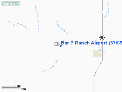
Bar P Ranch Airport
Address:
Elk County, KS
Tel:
316-374-2142, 316-374-2090
Images
and information placed above are from
http://www.airport-data.com/airport/37KS/
We
thank them for the data!
|
General Info |
| Country |
United
States |
| State |
KANSAS
|
| FAA ID |
37KS
|
| Latitude |
37-28-55.111N |
|
Longitude |
096-20-16.001W |
|
Elevation |
1060
feet |
| Near
City |
HOWARD
|
We don't guarantee the information is fresh and accurate. The data may
be wrong or outdated.
For more up-to-date information please refer to other sources.
|
|


