 |
|
|
Location &
QuickFacts
|
FAA
Information Effective: |
2008-06-05 |
|
Airport
Identifier: |
SN98 |
|
Airport
Status: |
Operational |
|
Longitude/Latitude: |
100-56-31.5900W/37-25-14.9900N
-100.942108/37.420831 (Estimated) |
|
Elevation: |
2954 ft / 900.38 m (Estimated) |
|
Land: |
8 acres |
|
From
nearest city: |
2 nautical miles SE of Satanta, KS |
|
Location: |
Haskell County, KS |
|
Magnetic Variation: |
08E (1965) |
Owner & Manager
|
Ownership: |
Privately owned |
|
Owner: |
Bill Anton |
|
Address: |
2268 Rd Ii
Satanta, KS 67870 |
|
Phone number: |
620-649-2797
DAYTIME PHONE 620-649-2220. |
|
Manager: |
Bill Anton |
|
Address: |
2268 Rd Ii
Satanta, KS 67870 |
|
Phone number: |
620-649-2797 |
Airport
Operations and Facilities
|
Airport
Use: |
Private |
|
Wind
indicator: |
Yes |
|
Segmented Circle: |
No |
|
Control
Tower: |
No |
|
Sectional chart: |
Wichita |
|
Region: |
ACE - Central |
|
Boundary
ARTCC: |
ZKC - Kansas City |
|
Tie-in
FSS: |
ICT - Wichita |
|
FSS Toll
Free: |
1-800-WX-BRIEF |
|
Runway Information
Runway 01/19
|
Dimension: |
2150 x 100 ft / 655.3 x 30.5 m |
|
Surface: |
TURF, |
|
|
Runway 01
|
Runway 19
|
|
Traffic
Pattern: |
Left |
Left |
|
Radio Navigation Aids
|
ID |
Type |
Name |
Ch |
Freq |
Var |
Dist |
|
ULS |
NDB |
Ulysses |
|
395.00 |
09E |
22.9 nm |
|
HQG |
NDB |
Hugoton |
|
365.00 |
09E |
25.8 nm |
|
GC |
NDB |
Pieve |
|
347.00 |
09E |
26.6 nm |
|
MEJ |
NDB |
Meade |
|
389.00 |
09E |
29.1 nm |
|
JHN |
NDB |
Bear Creek |
|
341.00 |
10E |
39.9 nm |
|
LBL |
VORTAC |
Liberal |
070X |
112.30 |
11E |
22.7 nm |
|
GCK |
VORTAC |
Garden City |
080X |
113.30 |
11E |
31.7 nm |
Remarks
-
PRVDD CLEAR 20:1
APCHS AND CLEAR 7:1 TRANSITIONAL SFCS.
Based Aircraft
|
Aircraft based
on field: |
1 |
|
Single Engine
Airplanes: |
1 |
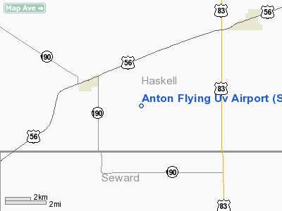
Anton Flying Uv Airport
Address:
Haskell County, KS
Tel:
620-649-2797
Images
and information placed above are from
http://www.airport-data.com/airport/SN98/
We
thank them for the data!
|
General Info |
| Country |
United
States |
| State |
KANSAS
|
| FAA ID |
SN98
|
| Latitude |
37-25-14.990N |
|
Longitude |
100-56-31.590W |
|
Elevation |
2954
feet |
| Near
City |
SATANTA
|
We don't guarantee the information is fresh and accurate. The data may
be wrong or outdated.
For more up-to-date information please refer to other sources.
|
|


