 |
|
Anthony Municipal Airport |
Coordinates: 37°09â²31â³N 098°04â²47â³W / 37.15861°N 98.07972°W / 37.15861; -98.07972
| Anthony Municipal Airport |
| IATA: ANY â ICAO: KANY â FAA LID: ANY |
| Summary |
| Airport type |
Public |
| Owner |
City of Anthony |
| Serves |
Anthony, Kansas |
| Elevation AMSL |
1,340 ft / 408 m |
| Runways |
| Direction |
Length |
Surface |
| ft |
m |
| 17/35 |
3,598 |
1,097 |
Asphalt |
| 10/28 |
2,200 |
671 |
Turf |
| Statistics (2007) |
| Aircraft operations |
6,200 |
| Based aircraft |
11 |
| Source: Federal Aviation Administration |
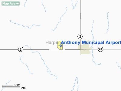
Anthony Municipal Airport (IATA: ANY, ICAO: KANY, FAA LID: ANY) is a city-owned public-use airport located three miles (5 km) northwest of the central business district of Anthony, a city in Harper County, Kansas, United States.
This Airport was originally built in the 1930's by a local aviator by the name of J. Howard Wilcox. The Airport got the addition of the Beacon in 1938 and is still in use today. In December of 1941 J. Howard Wilcox was asked to head the Kansas Wing of the Newly organized Civil Air Patrol. Wilcox flew to Washington D.C. and was briefed on the Organization and returned to Anthony. Upon returning he set up a town meeting and had attendees from several towns in the area. At this meeting he informed the locals of CAP and met with officials to use the Airport as the location of the Headquarters. This was approved and the Anthony Airport became the Kansas Wing Headquarters of the Civil Air Patrol on December 21, 1941. This airport was taken a further step by turning it into a CAP Training base for the State of Kansas. The Army took notice of this little airport and stationed several Boeing B-17s at the Airport. In the late 1950s the CAP Wing Headquarters moved from Anthony to a larger city, and Wilcox began to further his career in Law. CAP left Anthony and was only a story that Wilcox would tell the local children about. CAP returned to Anthony in 2008 as a Color Guard in the Anthony Balloon Fest Parade. Although CAP has not yet been re-established in Anthony, CAP has made several Appearances in the Harper County Fair Parade in Harper, KS and in the Anthony Christmas Parade. The Civil Air Patrol squadrons that have performed in the parades are Emerald City Composite Squadron out of Wichita, Kansas, and Cunningham Composite Squadron out of Cunningham, Kansas. These appearances were, and still are, arranged through a local Harper County youth, Cadet Second Lieutanent Trenton Seipel, that is an active member in the Civil Air Patrol.
Facilities and aircraft
Anthony Municipal Airport covers an area of 208 acres (84 ha) which contains two runways: 17/35 with a 3,598 x 70 ft (1,097 x 21 m) asphalt pavement and 10/28 with a 2,200 x 150 ft (671 x 46 m) turf surface.
For the 12-month period ending January 18, 2007, the airport had 6,200 general aviation aircraft operations, an average of 16 per day. At that time there were 11 aircraft based at this airport: 91% single-engine and 9% multi-engine.
The above content comes from Wikipedia and is published under free licenses – click here to read more.
|
Location &
QuickFacts
|
FAA
Information Effective: |
2008-06-05 |
|
Airport
Identifier: |
ANY |
|
Airport
Status: |
Operational |
|
Longitude/Latitude: |
098-04-46.7280W/37-09-30.6790N
-98.079647/37.158522 (Estimated) |
|
Elevation: |
1340 ft / 408.43 m (Surveyed) |
|
Land: |
208 acres |
|
From
nearest city: |
3 nautical miles NW of Anthony, KS |
|
Location: |
Harper County, KS |
|
Magnetic Variation: |
07E (1985) |
Owner & Manager
|
Ownership: |
Publicly owned |
|
Owner: |
City Of Anthony
CITY CLERK - 620-842-5434. |
|
Address: |
Box 504
Anthony, KS 67003 |
|
Phone
number: |
620-842-5982 |
|
Manager: |
Grant Sechler |
|
Address: |
Box 504
Anthony, KS 67003 |
|
Phone number: |
620-842-5960 |
Airport
Operations and Facilities
|
Airport
Use: |
Open to public |
|
Wind
indicator: |
Yes |
|
Segmented Circle: |
Yes |
|
Control
Tower: |
No |
|
Lighting
Schedule: |
DUSK-DAWN |
|
Beacon
Color: |
Clear-Green (lighted land airport) |
|
Landing
fee charge: |
No |
|
Sectional chart: |
Wichita |
|
Region: |
ACE - Central |
|
Boundary
ARTCC: |
ZKC - Kansas City |
|
Tie-in
FSS: |
ICT - Wichita |
|
FSS on
Airport: |
No |
|
FSS Toll
Free: |
1-800-WX-BRIEF |
|
NOTAMs
Facility: |
ICT (NOTAM-d service avaliable) |
|
Federal Agreements: |
NGY |
Airport Communications
|
CTAF: |
122.800 |
|
Unicom: |
122.800 |
Airport Services
|
Runway Information
Runway 10/28
|
Dimension: |
2200 x 150 ft / 670.6 x 45.7 m
RWY 10/28 MOWED 300 FT WIDE. |
|
Surface: |
TURF, Good Condition
RWY 10/28 SOFT AFTER RAIN. |
|
|
Runway 10
|
Runway 28
|
|
Longitude: |
098-05-03.3550W |
098-04-36.8420W |
|
Latitude: |
37-09-31.9640N |
37-09-26.6720N |
|
Elevation: |
1329.00 ft |
1336.00 ft |
|
Alignment: |
104 |
127 |
|
Traffic
Pattern: |
Left |
Left |
|
Obstruction: |
18 ft trees, 200.0 ft from runway, 11:1 slope to clear |
13 ft road, 300.0 ft from runway, 23:1 slope to clear |
|
Runway 17/35
|
Dimension: |
3598 x 70 ft / 1096.7 x 21.3 m
RWY 10/28 MOWED 300 FT WIDE. |
|
Surface: |
ASPH, Good Condition
RWY 10/28 SOFT AFTER RAIN. |
|
Edge Lights: |
Medium |
|
|
Runway 17
|
Runway 35
|
|
Longitude: |
098-04-44.5600W |
098-04-44.7080W |
|
Latitude: |
37-09-49.3070N |
37-09-13.7280N |
|
Elevation: |
1340.00 ft |
1334.00 ft |
|
Alignment: |
127 |
0 |
|
Traffic
Pattern: |
Left |
Left |
|
Markings: |
Non-precision instrument, Fair Condition |
Non-precision instrument, Fair Condition |
|
Crossing
Height: |
44.00 ft |
42.00 ft |
|
VASI: |
2-light PAPI on left side
PAPI OTS INDEFLY. |
2-light PAPI on left side |
|
Visual
Glide Angle: |
3.00° |
3.00° |
|
Obstruction: |
32 ft pline, 1050.0 ft from runway, 26:1 slope to clear |
34 ft ant, 1050.0 ft from runway, 40 ft left of
centerline, 25:1 slope to clear |
|
Radio Navigation Aids
|
ID |
Type |
Name |
Ch |
Freq |
Var |
Dist |
|
EGT |
NDB |
Wellington |
|
414.00 |
07E |
34.5 nm |
|
AVK |
NDB |
Alva |
|
203.00 |
08E |
36.4 nm |
|
IC |
NDB |
Piche |
|
332.00 |
07E |
39.0 nm |
|
PTT |
NDB |
Pratt |
|
356.00 |
07E |
46.6 nm |
|
IAB |
TACAN |
Mc Connell |
112X |
|
07E |
47.7 nm |
|
ODG |
VOR/DME |
Woodring |
027X |
109.00 |
08E |
49.2 nm |
|
ANY |
VORTAC |
Anthony |
076X |
112.90 |
07E |
4.4 nm |
|
ICT |
VORTAC |
Wichita |
085X |
113.80 |
07E |
42.5 nm |
|
END |
VORTAC |
Vance |
101X |
115.40 |
09E |
49.5 nm |
|
ICT |
VOT |
Wichita |
|
114.00 |
|
42.2 nm |
Remarks
-
FOR FUEL CALL 911.
-
EXISTED PRIOR TO 1959.
Based Aircraft
|
Aircraft based
on field: |
11 |
|
Single Engine
Airplanes: |
10 |
|
Multi Engine
Airplanes: |
1 |
Operational Statistics
Time Period: 2006-01-19 - 2007-01-18
|
Aircraft
Operations: |
120/Week |
|
General
Aviation Local: |
51.6% |
|
General
Aviation Itinerant: |
48.4% |
Anthony Municipal Airport
Address:
Harper County, KS
Tel:
620-842-5982,
620-842-5960
Images
and information placed above are from
http://www.airport-data.com/airport/ANY/
We
thank them for the data!
|
General Info |
| Country |
United
States |
| State |
KANSAS
|
| FAA ID |
ANY
|
| Latitude |
37-09-30.679N |
|
Longitude |
098-04-46.728W |
|
Elevation |
1340
feet |
| Near
City |
ANTHONY
|
We don't guarantee the information is fresh and accurate. The data may
be wrong or outdated.
For more up-to-date information please refer to other sources.
|
|


