 |
|
| Allen County Airport |
| IATA: none â ICAO: none â FAA LID: K88 |
| Summary |
| Airport type |
Public |
| Owner |
Allen County |
| Serves |
Iola, Kansas |
| Elevation AMSL |
1,015 ft / 309 m |
| Coordinates |
37°52â²06â³N 095°23â²13â³W / 37.86833°N 95.38694°W / 37.86833; -95.38694 |
| Website |
www.iola.com/k88.html |
| Runways |
| Direction |
Length |
Surface |
| ft |
m |
| 1/19 |
5,500 |
1,676 |
Concrete |
| Statistics (2008) |
| Aircraft operations |
16,502 |
| Based aircraft |
11 |
| Source: Federal Aviation Administration |
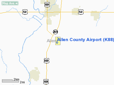
Allen County Airport (FAA LID: K88) is a county-owned public-use airport located three nautical miles (6 km) southeast of the central business district of Iola, in Allen County, Kansas, United States.
Facilities and aircraft
Allen County Airport covers an area of 340 acres (138 ha) at an elevation of 1,015 feet (309 m) above mean sea level. It has one runway designated 1/19 with a concrete surface measuring is 5,500 by 100 feet (1,676 x 30 m).
For the 12-month period ending July 25, 2008, the airport had 16,502 aircraft operations, an average of 45 per day: 97% general aviation, 3% air taxi, <1% scheduled commercial and <1% military. At that time there were 11 aircraft based at this airport: 82% single-engine and 18% multi-engine.
The above content comes from Wikipedia and is published under free licenses – click here to read more.
|
Location &
QuickFacts
|
FAA
Information Effective: |
2008-06-05 |
|
Airport
Identifier: |
K88 |
|
Airport
Status: |
Operational |
|
Longitude/Latitude: |
095-23-13.0000W/37-52-05.6000N
-95.386944/37.868222 (Estimated) |
|
Elevation: |
1015 ft / 309.37 m (Surveyed) |
|
Land: |
340 acres |
|
From
nearest city: |
3 nautical miles SE of Iola, KS |
|
Location: |
Allen County, KS |
|
Magnetic Variation: |
04E (2000) |
Owner & Manager
|
Ownership: |
Publicly owned |
|
Owner: |
Allen County |
|
Address: |
County Courthouse
Iola, KS 66749 |
|
Phone number: |
620-365-1422 |
|
Manager: |
Mitch Garner |
|
Address: |
1705 Minnesota Rd
Iola, KS 66749 |
|
Phone number: |
620-365-1465
HOME NUMBER (620) 365-7872 |
Airport
Operations and Facilities
|
Airport
Use: |
Open to public |
|
Wind
indicator: |
Yes |
|
Segmented Circle: |
No |
|
Control
Tower: |
No |
|
Lighting
Schedule: |
DUSK-DAWN
ACTVT HIRL RY 01/19 - CTAF. |
|
Beacon
Color: |
Clear-Green (lighted land airport) |
|
Landing
fee charge: |
No |
|
Sectional chart: |
Kansas City |
|
Region: |
ACE - Central |
|
Boundary
ARTCC: |
ZKC - Kansas City |
|
Tie-in
FSS: |
ICT - Wichita |
|
FSS on
Airport: |
No |
|
FSS Toll
Free: |
1-800-WX-BRIEF |
|
NOTAMs
Facility: |
ICT (NOTAM-d service avaliable) |
|
Federal Agreements: |
NGY |
Airport Communications
|
CTAF: |
122.800 |
|
Unicom: |
122.800 |
Airport Services
|
Fuel
available: |
100LLA MOGAS |
|
Airframe
Repair: |
NONE |
|
Power
Plant Repair: |
NONE |
|
Bottled
Oxygen: |
NONE |
|
Bulk
Oxygen: |
NONE |
|
Runway Information
Runway 01/19
|
Dimension: |
5500 x 100 ft / 1676.4 x 30.5 m |
|
Surface: |
CONC, Good Condition |
|
Edge Lights: |
High |
|
|
Runway 01
|
Runway 19
|
|
Longitude: |
095-23-21.0100W |
095-23-05.0900W |
|
Latitude: |
37-51-39.1400N |
37-52-32.0400N |
|
Elevation: |
1004.00 ft |
1015.00 ft |
|
Alignment: |
13 |
127 |
|
Traffic
Pattern: |
Left |
Left |
|
Markings: |
Non-precision instrument, Good Condition |
Non-precision instrument, Good Condition |
|
VASI: |
4-light PAPI on left side |
4-light PAPI on left side |
|
Obstruction: |
27 ft tree, 1293.0 ft from runway, 195 ft left of
centerline, 40:1 slope to clear |
38 ft tree, 1481.0 ft from runway, 33:1 slope to clear |
|
Radio Navigation Aids
|
ID |
Type |
Name |
Ch |
Freq |
Var |
Dist |
|
MSB |
NDB |
Monarch |
|
410.00 |
04E |
4.8 nm |
|
FSK |
NDB |
Fort Scott |
|
379.00 |
05E |
29.8 nm |
|
UKL |
NDB |
Boyd |
|
245.00 |
05E |
30.4 nm |
|
PPF |
NDB |
Parsons |
|
258.00 |
06E |
32.4 nm |
|
PTS |
NDB |
Pittsburg |
|
365.00 |
05E |
40.5 nm |
|
CFV |
NDB |
Coffeyville |
|
212.00 |
05E |
47.4 nm |
|
CNU |
VOR/DME |
Chanute |
029X |
109.20 |
05E |
17.6 nm |
|
OSW |
VORTAC |
Oswego |
123X |
117.60 |
08E |
43.6 nm |
|
EMP |
VORTAC |
Emporia |
075X |
112.80 |
08E |
43.7 nm |
|
BUM |
VORTAC |
Butler |
106X |
115.90 |
07E |
49.0 nm |
Remarks
-
POWERCHUTE
ACTIVITY ON & INVOF ARPT.
-
COURTESY CAR AVBL.
-
WILDLIFE ON & INVOF AIRPORT.
Based Aircraft
|
Aircraft based
on field: |
16 |
|
Single Engine
Airplanes: |
15 |
|
Multi Engine
Airplanes: |
1 |
Operational Statistics
Time Period: 2003-02-15 - 2004-02-14
|
Aircraft
Operations: |
46/Day |
|
Commerical: |
0.1% |
|
Air Taxi: |
2.8% |
|
General
Aviation Local: |
48.5% |
|
General
Aviation Itinerant: |
48.5% |
|
Military: |
0.2% |
Allen County Airport
Address:
Allen County, KS
Tel:
620-365-1422, 620-365-1465
Images
and information placed above are from
http://www.airport-data.com/airport/K88/
We
thank them for the data!
|
General Info |
| Country |
United
States |
| State |
KANSAS
|
| FAA ID |
K88
|
| Latitude |
37-52-12.300N |
|
Longitude |
095-23-11.000W |
|
Elevation |
1015
feet |
| Near
City |
IOLA
|
We don't guarantee the information is fresh and accurate. The data may
be wrong or outdated.
For more up-to-date information please refer to other sources.
|
|


