 |
|
|
Location &
QuickFacts
|
FAA
Information Effective: |
2008-06-05 |
|
Airport
Identifier: |
63KS |
|
Airport
Status: |
Operational |
|
Longitude/Latitude: |
097-03-39.0610W/39-19-41.9860N
-97.060850/39.328329 (Estimated) |
|
Elevation: |
1190 ft / 362.71 m (Estimated) |
|
Land: |
0 acres |
|
From
nearest city: |
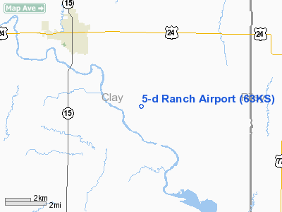
3 nautical miles SE of Clay Center, KS |
|
Location: |
Clay County, KS |
|
Magnetic Variation: |
07E (1985) |
Owner & Manager
|
Ownership: |
Privately owned |
|
Owner: |
Lyle Doberer |
|
Address: |
Rr No. 3
Clay Center, KS 67432 |
|
Phone number: |
913-632-3932 |
|
Address: |
|
Airport Operations and Facilities
|
Airport
Use: |
Private |
|
Segmented Circle: |
No |
|
Control
Tower: |
No |
|
Sectional chart: |
Wichita |
|
Region: |
ACE - Central |
|
Boundary
ARTCC: |
ZKC - Kansas City |
|
Tie-in
FSS: |
ICT - Wichita |
|
FSS Toll
Free: |
1-800-WX-BRIEF |
|
Runway Information
Runway 12/30
|
Dimension: |
1900 x 50 ft / 579.1 x 15.2 m |
|
Surface: |
TURF, |
|
|
Runway 12
|
Runway 30
|
|
Traffic
Pattern: |
Left |
Left |
|
Obstruction: |
|
4 ft fence |
|
Radio Navigation Aids
|
ID |
Type |
Name |
Ch |
Freq |
Var |
Dist |
|
CYW |
NDB |
Clay Center |
|
362.00 |
07E |
5.6 nm |
|
CVY |
NDB |
Cavalry |
|
314.00 |
06E |
22.0 nm |
|
MQD |
NDB |
Mc Dowell Creek |
|
391.00 |
06E |
23.8 nm |
|
DBX |
NDB |
Morrison |
|
212.00 |
06E |
26.1 nm |
|
CNK |
NDB |
Concordia |
|
335.00 |
06E |
30.6 nm |
|
MYZ |
NDB |
Marysville |
|
341.00 |
06E |
37.2 nm |
|
HRU |
NDB |
Herington |
|
407.00 |
06E |
39.9 nm |
|
RPB |
NDB |
Republican |
|
414.00 |
07E |
40.2 nm |
|
FRI |
VOR |
Fort Riley |
|
109.40 |
06E |
23.5 nm |
|
MHK |
VOR/DME |
Manhattan |
039X |
110.20 |
06E |
21.3 nm |
|
SLN |
VORTAC |
Salina |
118X |
117.10 |
07E |
35.6 nm |
Remarks
-
PROVIDED
APPROACHES MAINTAINED FOR 20:1 GLIDE SLOPE & TRANSITIONAL SFC FORA 7:1 SLOPE.
5-d Ranch Airport
Address:
Clay County, KS
Tel:
913-632-3932
Images
and information placed above are from
http://www.airport-data.com/airport/63KS/
We
thank them for the data!
|
General Info |
| Country |
United
States |
| State |
KANSAS
|
| FAA ID |
63KS
|
| Latitude |
39-19-41.986N |
|
Longitude |
097-03-39.061W |
|
Elevation |
1190
feet |
| Near
City |
CLAY
CENTER |
We don't guarantee the information is fresh and accurate. The data may
be wrong or outdated.
For more up-to-date information please refer to other sources.
|
|


