 |
|
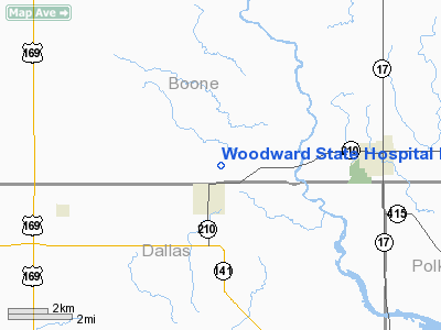
Woodward State Hospital Heliport |
Location &
QuickFacts
|
FAA
Information Effective: |
2007-07-05 |
|
Airport
Identifier: |
IA89 |
|
Airport
Status: |
Operational |
|
Longitude/Latitude: |
093-54-51.8230W/41-52-17.9470N
-93.914395/41.871652 (Estimated) |
|
Elevation: |
1060 ft / 323.09 m (Estimated) |
|
Land: |
0 acres |
|
From
nearest city: |
1 nautical miles N of Woodward, IA |
|
Location: |
Boone County, IA |
|
Magnetic Variation: |
04E (1985) |
Owner & Manager
|
Ownership: |
Publicly owned |
|
Owner: |
Woodward State Hosp-school |
|
Address: |
Woodward, IA 50276 |
|
Phone number: |
515-438-2600
EXT 121. |
|
Manager: |
Barry Wills, Business Mgr. |
|
Address: |
1251 334th Street
Woodward, IA 50276 |
|
Phone number: |
515-438-2600
EXT 210. |
Airport
Operations and Facilities
|
Airport
Use: |
Private
MEDICAL. |
|
Wind
indicator: |
Yes |
|
Segmented Circle: |
No |
|
Control
Tower: |
No |
|
Landing
fee charge: |
No |
|
Sectional chart: |
Omaha |
|
Region: |
ACE - Central |
|
Boundary
ARTCC: |
ZMP - Minneapolis |
|
Tie-in
FSS: |
FOD - Fort Dodge |
|
FSS on
Airport: |
No |
|
FSS
Phone: |
515-955-8114 |
|
FSS Toll
Free: |
1-800-WX-BRIEF |
|
Runway Information
Helipad H1
|
Dimension: |
30 x 30 ft / 9.1 x 9.1 m |
|
Surface: |
CONC, |
|
|
Runway H1
|
Runway
|
|
Traffic
Pattern: |
Left |
Left |
|
Radio Navigation Aids
|
ID |
Type |
Name |
Ch |
Freq |
Var |
Dist |
|
PRO |
NDB |
Perry |
|
251.00 |
06E |
11.3 nm |
|
BNW |
NDB |
Boone |
|
407.00 |
03E |
11.3 nm |
|
IKV |
NDB |
Ankeny |
|
275.00 |
03E |
18.9 nm |
|
EFW |
NDB |
Jefferson |
|
391.00 |
03E |
21.0 nm |
|
GCT |
NDB |
Guthrie Center |
|
518.00 |
05E |
25.9 nm |
|
EBS |
NDB |
Webster City |
|
323.00 |
03E |
34.3 nm |
|
CIN |
NDB |
Carroll |
|
397.00 |
04E |
40.3 nm |
|
GFZ |
NDB |
Greenfield |
|
338.00 |
04E |
40.6 nm |
|
ADU |
NDB |
Audubon |
|
266.00 |
04E |
45.9 nm |
|
IFA |
NDB |
Iowa Falls |
|
368.00 |
03E |
46.5 nm |
|
MIW |
NDB |
Marshalltown |
|
239.00 |
03E |
46.8 nm |
|
OXV |
NDB |
Knoxville |
|
284.00 |
03E |
49.9 nm |
|
TNU |
VOR/DME |
Newton |
072X |
112.50 |
03E |
36.5 nm |
|
JWJ |
VOR/DME |
Elmwood |
031X |
109.40 |
03E |
47.2 nm |
|
DSM |
VORTAC |
Des Moines |
122X |
117.50 |
07E |
28.7 nm |
|
FOD |
VORTAC |
Fort Dodge |
082X |
113.50 |
07E |
47.6 nm |
|
DSM |
VOT |
Des Moines |
|
109.20 |
|
22.7 nm |
Remarks
-
OWNER DESIRES
ARPT NOT TO BE CHARTED.
-
PRVDD THAT APCH/DEPARTURE
PATHS TO THE LANDING AREA ARE MAINTAINED FOR A MIN 8:1 GLIDE SLOPE. THAT THE
TRANSITIONAL SURFACE BE MAINTAINED FOR A MIN 2:1 SLOPE.
Woodward State Hospital Heliport
Address:
Boone County, IA
Tel:
515-438-2600
Images
and information placed above are from
http://www.airport-data.com/airport/IA89/
We
thank them for the data!
|
General Info |
| Country |
United
States |
| State |
IOWA
|
| FAA ID |
IA89
|
| Latitude |
41-52-17.947N |
|
Longitude |
093-54-51.823W |
|
Elevation |
1060
feet |
| Near
City |
WOODWARD
|
We don't guarantee the information is fresh and accurate. The data may
be wrong or outdated.
For more up-to-date information please refer to other sources.
|
|


