 |
|
Winnesheik County Memorial Hospital Heliport |
|
|
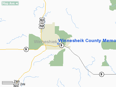
Location &
QuickFacts
|
FAA
Information Effective: |
2007-07-05 |
|
Airport
Identifier: |
IA04 |
|
Airport
Status: |
Operational |
|
Longitude/Latitude: |
091-46-28.3700W/43-17-38.8800N
-91.774547/43.294133 (Estimated) |
|
Elevation: |
892 ft / 271.88 m (Estimated) |
|
Land: |
0 acres |
|
From
nearest city: |
1 nautical miles SE of Decorah, IA |
|
Location: |
Winneshiek County, IA |
|
Magnetic Variation: |
01E (1995) |
Owner & Manager
|
Ownership: |
Privately owned |
|
Owner: |
Winneshiek Memorial Hospital |
|
Address: |
901 Montgomery Street
Decorah, IA 52101 |
|
Phone number: |
319-382-2911 |
|
Manager: |
Director Of Maintenance |
|
Address: |
901 Montgomery Street
Decorah, IA 52101 |
|
Phone number: |
319-382-2911 |
Airport
Operations and Facilities
|
Airport
Use: |
Private
MEDICAL USE. |
|
Wind
indicator: |
Yes |
|
Segmented Circle: |
No |
|
Control
Tower: |
No |
|
Lighting
Schedule: |
DUSK-DAWN
FOR PERIMETER LGTS CALL 319-382-2911. |
|
Beacon
Color: |
Clear-Green-Yellow (heliport) |
|
Sectional chart: |
Chicago |
|
Region: |
ACE - Central |
|
Boundary
ARTCC: |
ZMP - Minneapolis |
|
Tie-in
FSS: |
FOD - Fort Dodge |
|
FSS
Phone: |
515-955-8114 |
|
FSS Toll
Free: |
1-800-WX-BRIEF |
|
Runway Information
Helipad H1
|
Dimension: |
45 x 45 ft / 13.7 x 13.7 m |
|
Surface: |
CONC, |
|
|
Runway H1
|
Runway
|
|
Traffic
Pattern: |
Left |
Left |
|
Radio Navigation Aids
|
ID |
Type |
Name |
Ch |
Freq |
Var |
Dist |
|
DEH |
NDB |
Decorah |
|
236.00 |
01E |
2.0 nm |
|
CJJ |
NDB |
Cresco |
|
293.00 |
02E |
16.2 nm |
|
XWY |
NDB |
West Union |
|
278.00 |
02E |
21.1 nm |
|
CHU |
NDB |
Caledonia |
|
209.00 |
03E |
21.5 nm |
|
OLZ |
NDB |
Oelwein |
|
260.00 |
02E |
37.7 nm |
|
CCY |
NDB |
Charles City |
|
375.00 |
03E |
39.0 nm |
|
IY |
NDB |
Chukk |
|
417.00 |
03E |
42.9 nm |
|
LSE |
VOR/DME |
La Crosse |
021X |
108.40 |
02E |
41.6 nm |
|
RST |
VOR/DME |
Rochester |
057X |
112.00 |
05E |
46.3 nm |
|
ONA |
VOR/DME |
Winona |
051X |
111.40 |
01E |
47.1 nm |
|
UKN |
VORTAC |
Waukon |
113X |
116.60 |
05E |
10.4 nm |
|
ODI |
VORTAC |
Nodine |
126X |
117.90 |
01E |
39.5 nm |
Remarks
-
PRVDD THE FA70;
HELIPORT APCH SFC & HELIPORT TRANSITIONAL SFCS ARE CLEAR OF OBSTRUCTIONS.
Winnesheik County Memorial Hospital
Heliport
Address:
Winneshiek County, IA
Tel:
319-382-2911
Images
and information placed above are from
http://www.airport-data.com/airport/IA04/
We
thank them for the data!
|
General Info |
| Country |
United
States |
| State |
IOWA
|
| FAA ID |
IA04
|
| Latitude |
43-17-38.880N |
|
Longitude |
091-46-28.370W |
|
Elevation |
892 feet
|
| Near
City |
DECORAH
|
We don't guarantee the information is fresh and accurate. The data may
be wrong or outdated.
For more up-to-date information please refer to other sources.
|
|


