 |
|
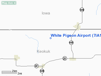
Location &
QuickFacts
|
FAA
Information Effective: |
2007-07-05 |
|
Airport
Identifier: |
7IA1 |
|
Airport
Status: |
Operational |
|
Longitude/Latitude: |
092-08-53.7000W/41-29-36.7000N
-92.148250/41.493528 (Estimated) |
|
Elevation: |
875 ft / 266.70 m (Estimated) |
|
Land: |
160 acres |
|
From
nearest city: |
4 nautical miles SW of North English, IA |
|
Location: |
Keokuk County, IA |
|
Magnetic Variation: |
01E (2000) |
Owner & Manager
|
Ownership: |
Privately owned |
|
Owner: |
Wayne G. Silver |
|
Address: |
230 Navajo Lane
North English, IA 52316 |
|
Phone
number: |
319-664-3330 |
|
Manager: |
Wayne G. Silver |
|
Address: |
230 Navajo Lane
North English, IA 52316 |
|
Phone number: |
319-664-3330 |
Airport Operations and Facilities
|
Airport Use: |
Private |
|
Wind indicator: |
Yes |
|
Segmented Circle: |
No |
|
Control Tower: |
No |
|
Sectional chart: |
Chicago |
|
Region: |
ACE - Central |
|
Boundary ARTCC: |
ZAU - Chicago |
|
Responsible ARTCC: |
ZAU - Chicago |
|
Tie-in FSS: |
FOD - Fort Dodge |
|
FSS Phone: |
515-955-8114 |
|
FSS Toll Free: |
1-800-WX-BRIEF |
Airport
Communications
Airport Services
|
Runway Information
Runway 09/27
|
Dimension: |
2400 x 70 ft / 731.5 x 21.3 m |
|
Surface: |
TURF, |
|
|
Runway 09
|
Runway 27
|
|
Traffic
Pattern: |
Left |
Left |
|
Obstruction: |
|
10 ft pline, 400.0 ft from runway |
|
Radio Navigation Aids
|
ID |
Type |
Name |
Ch |
Freq |
Var |
Dist |
|
OOA |
NDB |
Oskaloosa |
|
414.00 |
03E |
22.2 nm |
|
TZT |
NDB |
Belle Plaine |
|
371.00 |
02E |
24.3 nm |
|
AWG |
NDB |
Washington |
|
219.00 |
02E |
25.0 nm |
|
GGI |
NDB |
Grinnell |
|
248.00 |
02E |
29.2 nm |
|
FFL |
NDB |
Fairfield |
|
332.00 |
03E |
29.9 nm |
|
PEA |
NDB |
Pella |
|
257.00 |
02E |
36.2 nm |
|
MPZ |
NDB |
Mount Pleasant |
|
212.00 |
02E |
43.9 nm |
|
VTI |
NDB |
Garrison |
|
338.00 |
03E |
44.1 nm |
|
OXV |
NDB |
Knoxville |
|
284.00 |
03E |
45.1 nm |
|
BEX |
NDB |
Bloomfield |
|
269.00 |
02E |
46.8 nm |
|
CID |
VOR/DME |
Cedar Rapids |
088X |
114.10 |
05E |
28.7 nm |
|
OTM |
VOR/DME |
Ottumwa |
053X |
111.60 |
06E |
29.0 nm |
|
DDD |
VOR/DME |
Port City |
112X |
116.50 |
01E |
45.7 nm |
|
TNU |
VOR/DME |
Newton |
072X |
112.50 |
03E |
46.6 nm |
|
IOW |
VORTAC |
Iowa City |
109X |
116.20 |
05E |
24.1 nm |
Remarks
-
PRVDD A CLEAR
APCH EA RWY FOR A 20:1 GLIDE SLOPE AND A CLEAR TRANSITIONAL SFC FOR A 7:1
SLOPE.
Based
Aircraft
|
Aircraft based
on field: |
2 |
|
Single Engine
Airplanes: |
2 |
White Pigeon Airport
Address:
Keokuk County, IA
Tel:
319-664-3330
Images
and information placed above are from
http://www.airport-data.com/airport/7IA1/
We
thank them for the data!
|
General Info |
| Country |
United
States |
| State |
IOWA
|
| FAA ID |
7IA1
|
| Latitude |
41-29-36.700N |
|
Longitude |
092-08-53.700W |
|
Elevation |
875 feet
|
| Near
City |
NORTH
ENGLISH |
We don't guarantee the information is fresh and accurate. The data may
be wrong or outdated.
For more up-to-date information please refer to other sources.
|
|


