 |
|
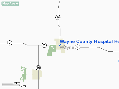
Wayne County Hospital Heliport |
Location &
QuickFacts
|
FAA
Information Effective: |
2007-07-05 |
|
Airport
Identifier: |
IA46 |
|
Airport
Status: |
Operational |
|
Longitude/Latitude: |
093-19-06.7620W/40-45-28.0190N
-93.318545/40.757783 (Estimated) |
|
Elevation: |
1093 ft / 333.15 m (Estimated) |
|
Land: |
0 acres |
|
From
nearest city: |
0 nautical miles NW of Corydon, IA |
|
Location: |
Wayne County, IA |
|
Magnetic Variation: |
04E (1990) |
Owner & Manager
|
Ownership: |
Publicly owned |
|
Owner: |
Wayne Co. Hospital |
|
Address: |
417 S. East Street
Corydon, IA 50060 |
|
Phone
number: |
515-872-2260 |
|
Manager: |
Bill Wilson/dan Killion |
|
Address: |
417 S. East Street
Corydon, IA 50060 |
|
Phone number: |
515-872-2260 |
Airport Operations and Facilities
|
Airport
Use: |
Private
MEDICAL USE. |
|
Wind
indicator: |
Yes |
|
Segmented Circle: |
Yes |
|
Control
Tower: |
No |
|
Sectional chart: |
Omaha |
|
Region: |
ACE - Central |
|
Boundary
ARTCC: |
ZAU - Chicago |
|
Tie-in
FSS: |
FOD - Fort Dodge |
|
FSS on
Airport: |
No |
|
FSS
Phone: |
515-955-8114 |
|
FSS Toll
Free: |
1-800-WX-BRIEF |
|
Runway Information
Helipad H1
|
Dimension: |
35 x 35 ft / 10.7 x 10.7 m |
|
Surface: |
CONC, |
|
|
Runway H1
|
Runway
|
|
Traffic
Pattern: |
Left |
Left |
|
Radio Navigation Aids
|
ID |
Type |
Name |
Ch |
Freq |
Var |
Dist |
|
CNC |
NDB |
Chariton |
|
335.00 |
05E |
15.7 nm |
|
TVK |
NDB |
Centerville |
|
290.00 |
04E |
19.5 nm |
|
OXV |
NDB |
Knoxville |
|
284.00 |
03E |
33.6 nm |
|
BEX |
NDB |
Bloomfield |
|
269.00 |
02E |
40.4 nm |
|
PEA |
NDB |
Pella |
|
257.00 |
02E |
42.5 nm |
|
TRX |
NDB |
Trenton |
|
400.00 |
03E |
42.6 nm |
|
OOA |
NDB |
Oskaloosa |
|
414.00 |
03E |
47.0 nm |
|
UNE |
NDB |
Union County |
|
379.00 |
04E |
48.3 nm |
|
OTM |
VOR/DME |
Ottumwa |
053X |
111.60 |
06E |
48.0 nm |
|
LMN |
VORTAC |
Lamoni |
114X |
116.70 |
07E |
31.1 nm |
|
DSM |
VORTAC |
Des Moines |
122X |
117.50 |
07E |
43.5 nm |
|
DSM |
VOT |
Des Moines |
|
109.20 |
|
49.6 nm |
Remarks
-
OWNER DESIRES
ARPT NOT BE CHARTED.
-
PRVDD APCH AND
DEP PATHS FOR A 8:1 GLIDE SLOPE AND TRANSITIONAL SURFACE FOR A 2:1 SLOPE ARE
MAINTAINED.
Wayne County Hospital Heliport
Address:
Wayne County, IA
Tel:
515-872-2260
Images
and information placed above are from
http://www.airport-data.com/airport/IA46/
We
thank them for the data!
|
General Info |
| Country |
United
States |
| State |
IOWA
|
| FAA ID |
IA46
|
| Latitude |
40-45-28.019N |
|
Longitude |
093-19-06.762W |
|
Elevation |
1093
feet |
| Near
City |
CORYDON
|
We don't guarantee the information is fresh and accurate. The data may
be wrong or outdated.
For more up-to-date information please refer to other sources.
|
|


