 |
|
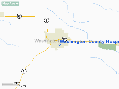
Washington County Hospital Heliport |
Location &
QuickFacts
|
FAA
Information Effective: |
2007-07-05 |
|
Airport
Identifier: |
3IA0 |
|
Airport
Status: |
Operational |
|
Longitude/Latitude: |
091-41-15.6000W/41-17-21.0610N
-91.687667/41.289184 (Estimated) |
|
Elevation: |
760 ft / 231.65 m (Estimated) |
|
Land: |
0 acres |
|
From
nearest city: |
0 nautical miles N of Washington, IA |
|
Location: |
Washington County, IA |
|
Magnetic Variation: |
02E (1985) |
Owner & Manager
|
Ownership: |
Publicly owned |
|
Owner: |
Washington County Hospital |
|
Address: |
400 East Polk
Washington, IA 52353 |
|
Phone number: |
319-653-5481 |
|
Manager: |
Ron Davis |
|
Address: |
400 East Polk
Washington, IA 52353 |
|
Phone number: |
319-653-5481 |
Airport
Operations and Facilities
|
Airport
Use: |
Private
MEDICAL. |
|
Wind
indicator: |
Yes |
|
Segmented Circle: |
No |
|
Control
Tower: |
No |
|
Landing
fee charge: |
No |
|
Sectional chart: |
Chicago |
|
Region: |
ACE - Central |
|
Boundary
ARTCC: |
ZAU - Chicago |
|
Tie-in
FSS: |
FOD - Fort Dodge |
|
FSS on
Airport: |
No |
|
FSS
Phone: |
515-955-8114 |
|
FSS Toll
Free: |
1-800-WX-BRIEF |
|
Runway Information
Helipad H1
|
Dimension: |
36 x 30 ft / 11.0 x 9.1 m |
|
Surface: |
CONC, |
|
|
Runway H1
|
Runway
|
|
Traffic
Pattern: |
Left |
Left |
|
Radio Navigation Aids
|
ID |
Type |
Name |
Ch |
Freq |
Var |
Dist |
|
AWG |
NDB |
Washington |
|
219.00 |
02E |
0.9 nm |
|
FFL |
NDB |
Fairfield |
|
332.00 |
03E |
21.6 nm |
|
MPZ |
NDB |
Mount Pleasant |
|
212.00 |
02E |
22.3 nm |
|
OOA |
NDB |
Oskaloosa |
|
414.00 |
03E |
36.3 nm |
|
TZT |
NDB |
Belle Plaine |
|
371.00 |
02E |
44.7 nm |
|
BEX |
NDB |
Bloomfield |
|
269.00 |
02E |
47.0 nm |
|
DDD |
VOR/DME |
Port City |
112X |
116.50 |
01E |
24.8 nm |
|
OTM |
VOR/DME |
Ottumwa |
053X |
111.60 |
06E |
32.8 nm |
|
CID |
VOR/DME |
Cedar Rapids |
088X |
114.10 |
05E |
36.2 nm |
|
IOW |
VORTAC |
Iowa City |
109X |
116.20 |
05E |
14.2 nm |
|
MZV |
VORTAC |
Moline |
091X |
114.40 |
05E |
47.4 nm |
|
BRL |
VORTAC |
Burlington |
051X |
111.40 |
05E |
48.5 nm |
Remarks
-
CONDL: PROVIDED
CLEAR APPROACH/DEPARTURE PATHS TO LANDING AREA ARE MAINTAINED FOR A MIN. 8:1
GLIDE SLOPE & THE TRANSITIONAL SURFACE IS MAINTAINED FOR A 2:1 SLOPE.
Washington County Hospital Heliport
Address:
Washington County, IA
Tel:
319-653-5481
Images
and information placed above are from
http://www.airport-data.com/airport/3IA0/
We
thank them for the data!
|
General Info |
| Country |
United
States |
| State |
IOWA
|
| FAA ID |
3IA0
|
| Latitude |
41-17-21.061N |
|
Longitude |
091-41-15.600W |
|
Elevation |
760 feet
|
| Near
City |
WASHINGTON |
We don't guarantee the information is fresh and accurate. The data may
be wrong or outdated.
For more up-to-date information please refer to other sources.
|
|


