 |
|
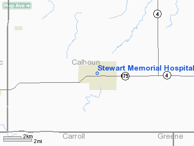
Stewart Memorial Hospital Heliport |
|
|
Location &
QuickFacts
|
FAA
Information Effective: |
2007-07-05 |
|
Airport
Identifier: |
2IA6 |
|
Airport
Status: |
Operational |
|
Longitude/Latitude: |
094-44-00.9330W/42-16-11.9370N
-94.733593/42.269983 (Estimated) |
|
Elevation: |
1243 ft / 378.87 m (Estimated) |
|
Land: |
0 acres |
|
From
nearest city: |
0 nautical miles N of Lake City, IA |
|
Location: |
Calhoun County, IA |
|
Magnetic Variation: |
05E (1985) |
Owner & Manager
|
Ownership: |
Privately owned |
|
Owner: |
Stewart Memorial Hospital |
|
Address: |
1301 W. Main
Lake City, IA 51449 |
|
Phone
number: |
712-464-3171 |
|
Manager: |
Kris Baumgart |
|
Address: |
1301 W. Main
Lake City, IA 51449 |
|
Phone number: |
712-464-3171 |
Airport Operations and Facilities
|
Airport
Use: |
Private
MEDICAL. |
|
Wind
indicator: |
No |
|
Segmented Circle: |
No |
|
Control
Tower: |
No |
|
Lighting
Schedule: |
PHONE REQ
FOR HELIPAD PERIMETER LGTS CALL 712-464-3171. |
|
Landing
fee charge: |
No |
|
Sectional chart: |
Omaha |
|
Region: |
ACE - Central |
|
Boundary
ARTCC: |
ZMP - Minneapolis |
|
Tie-in
FSS: |
FOD - Fort Dodge |
|
FSS on
Airport: |
No |
|
FSS
Phone: |
515-955-8114 |
|
FSS Toll
Free: |
1-800-WX-BRIEF |
|
Runway Information
Helipad H1
|
Dimension: |
72 x 60 ft / 21.9 x 18.3 m |
|
Surface: |
CONC,
HELIPAD LCTD ON ROOFTOP. |
|
|
Runway H1
|
Runway
|
|
Traffic
Pattern: |
Left |
Left |
|
Obstruction: |
25 ft twr
160' FROM HELIPAD NE. |
160' FROM HELIPAD NE. |
|
Radio Navigation Aids
|
ID |
Type |
Name |
Ch |
Freq |
Var |
Dist |
|
SKI |
NDB |
Sac City |
|
356.00 |
04E |
12.9 nm |
|
CIN |
NDB |
Carroll |
|
397.00 |
04E |
13.7 nm |
|
EFW |
NDB |
Jefferson |
|
391.00 |
03E |
23.3 nm |
|
POH |
NDB |
Pocahontas |
|
428.00 |
06E |
28.9 nm |
|
SLB |
NDB |
Storm Lake |
|
434.00 |
04E |
30.1 nm |
|
DNS |
NDB |
Denison |
|
350.00 |
04E |
33.5 nm |
|
ADU |
NDB |
Audubon |
|
266.00 |
04E |
35.7 nm |
|
PRO |
NDB |
Perry |
|
251.00 |
06E |
36.8 nm |
|
GCT |
NDB |
Guthrie Center |
|
518.00 |
05E |
37.8 nm |
|
EBS |
NDB |
Webster City |
|
323.00 |
03E |
39.7 nm |
|
BNW |
NDB |
Boone |
|
407.00 |
03E |
41.3 nm |
|
EAG |
NDB |
Eagle Grove |
|
302.00 |
03E |
45.0 nm |
|
CKP |
NDB |
Pilot Rock |
|
423.00 |
05E |
45.7 nm |
|
MEY |
NDB |
Mapleton |
|
335.00 |
05E |
47.5 nm |
|
HNR |
NDB |
Harlan |
|
272.00 |
05E |
49.6 nm |
|
EGQ |
NDB |
Emmetsburg |
|
410.00 |
04E |
50.0 nm |
|
FOD |
VORTAC |
Fort Dodge |
082X |
113.50 |
07E |
28.3 nm |
Remarks
-
CONDL- PROVIDED
APPROACH/DEPARTURE PATHS ARE MAINTAINED FOR A MINIMUM 8:1 GLIDE SLOPE AND THE
TRANSITIONAL SURFACE BE MAINTAINED FOR A MINIMUM 2:1 SLOPE; THE 25' RADIO
TOWER LOCATED 160' NE OF SITE IS LIGHTED.
Stewart Memorial Hospital Heliport
Address:
Calhoun County, IA
Tel:
712-464-3171
Images
and information placed above are from
http://www.airport-data.com/airport/2IA6/
We
thank them for the data!
|
General Info |
| Country |
United
States |
| State |
IOWA
|
| FAA ID |
2IA6
|
| Latitude |
42-16-11.937N |
|
Longitude |
094-44-00.933W |
|
Elevation |
1243
feet |
| Near
City |
LAKE
CITY |
We don't guarantee the information is fresh and accurate. The data may
be wrong or outdated.
For more up-to-date information please refer to other sources.
|
|


