 |
|
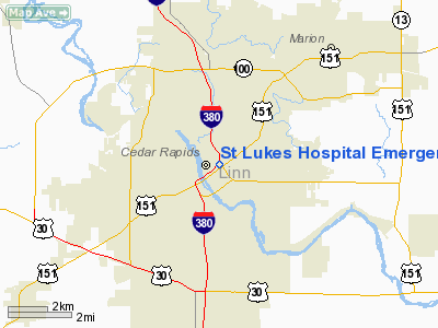
St Lukes Hospital Emergency Heliport |
|
|
Location &
QuickFacts
|
FAA
Information Effective: |
2007-07-05 |
|
Airport
Identifier: |
IA73 |
|
Airport
Status: |
Operational |
|
Longitude/Latitude: |
091-39-41.6470W/41-59-05.0010N
-91.661569/41.984722 (Estimated) |
|
Elevation: |
759 ft / 231.34 m (Estimated) |
|
Land: |
0 acres |
|
From
nearest city: |
0 nautical miles N of Cedar Rapids, IA |
|
Location: |
Linn County, IA |
|
Magnetic Variation: |
02E (1985) |
Owner & Manager
|
Ownership: |
Privately owned |
|
Owner: |
St Luke's Hospital |
|
Address: |
Po Box 3026
Cedar Rapids, IA 52402-3026 |
|
Phone
number: |
319-369-7043
ADDL PHONE 319-369-7218. |
|
Manager: |
Samuel T Wallace Adm |
|
Address: |
1026 A Ave N.e.
Cedar Rapids, IA 52402 |
|
Phone number: |
319-369-7161 |
Airport Operations and Facilities
|
Airport
Use: |
Private
MEDICAL. |
|
Wind
indicator: |
Yes |
|
Segmented Circle: |
No |
|
Control
Tower: |
No |
|
Lighting
Schedule: |
PHONE REQ
FOR PERIMETER LGTS CALL 319-369-7281. |
|
Landing
fee charge: |
No |
|
Sectional chart: |
Chicago |
|
Region: |
ACE - Central |
|
Boundary
ARTCC: |
ZAU - Chicago |
|
Tie-in
FSS: |
FOD - Fort Dodge |
|
FSS on
Airport: |
No |
|
FSS
Phone: |
515-955-8114 |
|
FSS Toll
Free: |
1-800-WX-BRIEF |
|
Runway Information
Helipad H1
|
Dimension: |
50 x 50 ft / 15.2 x 15.2 m |
|
Surface: |
ASPH, |
|
|
Runway H1
|
Runway
|
|
Traffic
Pattern: |
Left |
Left |
|
Radio Navigation Aids
|
ID |
Type |
Name |
Ch |
Freq |
Var |
Dist |
|
VTI |
NDB |
Garrison |
|
338.00 |
03E |
21.4 nm |
|
MXO |
NDB |
Monticello |
|
397.00 |
01E |
26.8 nm |
|
TZT |
NDB |
Belle Plaine |
|
371.00 |
02E |
28.4 nm |
|
IIB |
NDB |
Wapsie |
|
206.00 |
02E |
30.9 nm |
|
OQW |
NDB |
Maquoketa |
|
386.00 |
02E |
41.3 nm |
|
AWG |
NDB |
Washington |
|
219.00 |
02E |
42.4 nm |
|
OLZ |
NDB |
Oelwein |
|
260.00 |
02E |
44.3 nm |
|
CID |
VOR/DME |
Cedar Rapids |
088X |
114.10 |
05E |
8.1 nm |
|
DDD |
VOR/DME |
Port City |
112X |
116.50 |
01E |
43.7 nm |
|
IOW |
VORTAC |
Iowa City |
109X |
116.20 |
05E |
28.1 nm |
|
ALO |
VORTAC |
Waterloo |
059X |
112.20 |
06E |
47.5 nm |
|
DBQ |
VORTAC |
Dubuque |
105X |
115.80 |
04E |
49.3 nm |
Remarks
-
PROVIDED THAT THE
APCH/DEP PATHS TO THE LDG AREA ARE MAINTD FOR A MIN 8-1 GLIDE SLOPE & THAT THE
TRANSITIONAL SFC BE MAINTD FOR A MIN 2-1 SLOPE.
Based
Aircraft
|
Aircraft based
on field: |
1 |
|
Helicopters: |
1 |
St Lukes Hospital Emergency Heliport
Address:
Linn County, IA
Tel:
319-369-7043,
319-369-7161
Images
and information placed above are from
http://www.airport-data.com/airport/IA73/
We
thank them for the data!
|
General Info |
| Country |
United
States |
| State |
IOWA
|
| FAA ID |
IA73
|
| Latitude |
41-59-05.001N |
|
Longitude |
091-39-41.647W |
|
Elevation |
759 feet
|
| Near
City |
CEDAR
RAPIDS |
We don't guarantee the information is fresh and accurate. The data may
be wrong or outdated.
For more up-to-date information please refer to other sources.
|
|


