 |
|
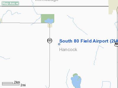
Location &
QuickFacts
|
FAA
Information Effective: |
2007-07-05 |
|
Airport
Identifier: |
2IA9 |
|
Airport
Status: |
Operational |
|
Longitude/Latitude: |
093-46-14.7910W/43-11-26.8520N
-93.770775/43.190792 (Estimated) |
|
Elevation: |
1210 ft / 368.81 m (Estimated) |
|
Land: |
4 acres |
|
From
nearest city: |
2 nautical miles SE of Crystal Lake, IA |
|
Location: |
Hancock County, IA |
|
Magnetic Variation: |
04E (1985) |
Owner & Manager
|
Ownership: |
Privately owned |
|
Owner: |
John E. Buck |
|
Address: |
2950 Kent Ave
Britt, IA 50423 |
|
Phone number: |
515-565-3678 |
|
Manager: |
John E. Buck |
|
Address: |
2950 Kent Ave
Britt, IA 50423 |
|
Phone number: |
515-565-3678 |
Airport
Operations and Facilities
|
Airport
Use: |
Private |
|
Wind
indicator: |
Yes |
|
Segmented Circle: |
No |
|
Control
Tower: |
No |
|
Landing
fee charge: |
No |
|
Sectional chart: |
Omaha |
|
Region: |
ACE - Central |
|
Boundary
ARTCC: |
ZMP - Minneapolis |
|
Tie-in
FSS: |
FOD - Fort Dodge |
|
FSS on
Airport: |
No |
|
FSS
Phone: |
515-955-8114 |
|
FSS Toll
Free: |
1-800-WX-BRIEF |
|
Runway Information
Runway 08/26
|
Dimension: |
1500 x 80 ft / 457.2 x 24.4 m |
|
Surface: |
TURF, |
|
|
Runway 08
|
Runway 26
|
|
Traffic
Pattern: |
Left |
Left |
|
Radio Navigation Aids
|
ID |
Type |
Name |
Ch |
Freq |
Var |
Dist |
|
FXY |
NDB |
Forest City |
|
359.00 |
05E |
7.1 nm |
|
AXA |
NDB |
Algona |
|
403.00 |
03E |
23.0 nm |
|
CAV |
NDB |
Clarion |
|
387.00 |
03E |
26.8 nm |
|
SBU |
NDB |
Blue Earth |
|
332.00 |
04E |
28.3 nm |
|
EAG |
NDB |
Eagle Grove |
|
302.00 |
03E |
29.6 nm |
|
HPT |
NDB |
Hampton |
|
230.00 |
03E |
36.9 nm |
|
EGQ |
NDB |
Emmetsburg |
|
410.00 |
04E |
41.4 nm |
|
PUF |
NDB |
Puff |
|
345.00 |
04E |
43.4 nm |
|
EBS |
NDB |
Webster City |
|
323.00 |
03E |
45.3 nm |
|
IY |
NDB |
Chukk |
|
417.00 |
03E |
45.8 nm |
|
POH |
NDB |
Pocahontas |
|
428.00 |
06E |
46.9 nm |
|
IFA |
NDB |
Iowa Falls |
|
368.00 |
03E |
48.4 nm |
|
EST |
VOR |
Estherville |
|
110.40 |
07E |
44.6 nm |
|
AEL |
VOR/DME |
Albert Lea |
035X |
109.80 |
05E |
34.3 nm |
|
FRM |
VOR/DME |
Fairmont |
039X |
110.20 |
07E |
39.5 nm |
|
JAY |
VOR/DME |
Austin |
019X |
108.20 |
03E |
43.8 nm |
|
MCW |
VORTAC |
Mason City |
096X |
114.90 |
06E |
20.2 nm |
|
FOD |
VORTAC |
Fort Dodge |
082X |
113.50 |
07E |
41.8 nm |
Remarks
-
OWNER DESIRES
ARPT NOT BE CHARTED.
-
CONDL: PROVIDED A
CLEAR APPROACH PATH TO EACH RWY IS MAINTAINED FOR A MIN. 20:1 GLIDE SLOPE &
THE TRANSITIONAL SURFACE BE MAINTAINED FOR A 7:1 SLOPE.
South 80 Field Airport
Address:
Hancock County, IA
Tel:
515-565-3678
Images
and information placed above are from
http://www.airport-data.com/airport/2IA9/
We
thank them for the data!
|
General Info |
| Country |
United
States |
| State |
IOWA
|
| FAA ID |
2IA9
|
| Latitude |
43-11-26.852N |
|
Longitude |
093-46-14.791W |
|
Elevation |
1210
feet |
| Near
City |
CRYSTAL
LAKE |
We don't guarantee the information is fresh and accurate. The data may
be wrong or outdated.
For more up-to-date information please refer to other sources.
|
|


