 |
|
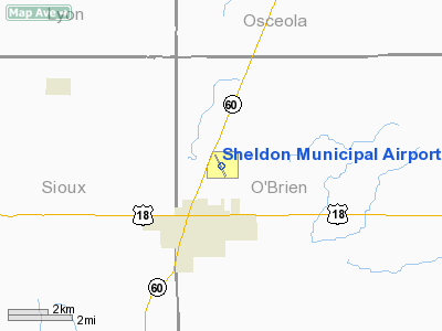
Sheldon Municipal Airport |
|
|
Location &
QuickFacts
|
FAA
Information Effective: |
2007-07-05 |
|
Airport
Identifier: |
SHL |
|
Airport
Status: |
Operational |
|
Longitude/Latitude: |
095-50-00.3590W/43-12-30.2170N
-95.833433/43.208394 (Estimated) |
|
Elevation: |
1419 ft / 432.51 m (Surveyed) |
|
Land: |
121 acres |
|
From
nearest city: |
2 nautical miles NE of Sheldon, IA |
|
Location: |
O Brien County, IA |
|
Magnetic Variation: |
05E (1995) |
Owner & Manager
|
Ownership: |
Publicly owned |
|
Owner: |
City Of Sheldon |
|
Address: |
416 9th St Box 276
Sheldon, IA 51201 |
|
Phone number: |
712-324-4651 |
|
Manager: |
Lyle Vust |
|
Address: |
3040 Highway 60 Boulevard
Sheldon, IA 51201-7508 |
|
Phone number: |
712-324-4005 |
Airport
Operations and Facilities
|
Airport
Use: |
Open to public |
|
Wind
indicator: |
Yes |
|
Segmented Circle: |
No |
|
Control
Tower: |
No |
|
Lighting
Schedule: |
DUSK-DAWN
ACTVT MIRL RY 15/33 AND VASI RYS 15 & 33 AND REIL RYS 15 & 33 - CTAF. |
|
Beacon
Color: |
Clear-Green (lighted land airport) |
|
Landing
fee charge: |
No |
|
Sectional chart: |
Omaha |
|
Region: |
ACE - Central |
|
Boundary
ARTCC: |
ZMP - Minneapolis |
|
Tie-in
FSS: |
FOD - Fort Dodge |
|
FSS on
Airport: |
No |
|
FSS
Phone: |
515-955-8114 |
|
FSS Toll
Free: |
1-800-WX-BRIEF |
|
NOTAMs
Facility: |
SHL (NOTAM-d service avaliable) |
|
Federal Agreements: |
NGY |
Airport Communications
|
CTAF: |
122.800 |
|
Unicom: |
122.800 |
Airport Services
|
Fuel
available: |
100LLA |
|
Airframe
Repair: |
MAJOR |
|
Power
Plant Repair: |
MAJOR |
|
Bottled
Oxygen: |
NONE |
|
Bulk
Oxygen: |
NONE |
|
Runway Information
Runway 15/33
|
Dimension: |
4199 x 75 ft / 1279.9 x 22.9 m |
|
Surface: |
CONC, Fair Condition |
|
Weight Limit: |
Single wheel: 28000 lbs. |
|
Edge Lights: |
Medium |
|
|
Runway 15
|
Runway 33
|
|
Longitude: |
095-50-12.1180W |
095-49-48.5460W |
|
Latitude: |
43-12-49.0500N |
43-12-11.3370N |
|
Elevation: |
1419.00 ft |
1412.00 ft |
|
Alignment: |
127 |
127 |
|
Traffic
Pattern: |
Left |
Left |
|
Markings: |
Non-precision instrument, Fair Condition |
Non-precision instrument, Fair Condition |
|
Crossing
Height: |
44.00 ft |
44.00 ft |
|
VASI: |
2-box on right side |
2-box on left side |
|
Visual
Glide Angle: |
3.00° |
3.00° |
|
Runway End
Identifier: |
Yes |
Yes |
|
Obstruction: |
16 ft road, 515.0 ft from runway, 175 ft left of
centerline, 19:1 slope to clear |
38 ft trees, 1490.0 ft from runway, 400 ft right of
centerline, 33:1 slope to clear |
|
Radio Navigation Aids
|
ID |
Type |
Name |
Ch |
Freq |
Var |
Dist |
|
SHL |
NDB |
Sheldon |
|
338.00 |
05E |
0.3 nm |
|
ISB |
NDB |
Sibley |
|
269.00 |
05E |
10.2 nm |
|
SOY |
NDB |
Sioux Center |
|
368.00 |
06E |
16.3 nm |
|
ORC |
NDB |
Orange City |
|
521.00 |
05E |
16.4 nm |
|
LTU |
NDB |
Little Sioux |
|
326.00 |
05E |
31.1 nm |
|
CKP |
NDB |
Pilot Rock |
|
423.00 |
05E |
31.2 nm |
|
SLB |
NDB |
Storm Lake |
|
434.00 |
04E |
44.8 nm |
|
MJQ |
NDB |
Jackson |
|
353.00 |
04E |
45.4 nm |
|
FS |
NDB |
Rokky |
|
245.00 |
06E |
46.8 nm |
|
PUF |
NDB |
Puff |
|
345.00 |
04E |
48.7 nm |
|
EGQ |
NDB |
Emmetsburg |
|
410.00 |
04E |
49.8 nm |
|
EST |
VOR |
Estherville |
|
110.40 |
07E |
49.1 nm |
|
DDL |
VOR/DME |
Sheldon |
023X |
108.60 |
05E |
0.2 nm |
|
SPW |
VOR/DME |
Spencer |
037X |
110.00 |
05E |
27.9 nm |
|
OTG |
VOR/DME |
Worthington |
043X |
110.60 |
08E |
28.6 nm |
|
FSD |
VORTAC |
Sioux Falls |
097X |
115.00 |
09E |
49.1 nm |
Remarks
Based
Aircraft
|
Aircraft based
on field: |
25 |
|
Single Engine
Airplanes: |
16 |
|
Multi Engine
Airplanes: |
5 |
|
Jet Engine
Airplanes: |
1 |
|
Helicopters: |
1 |
|
Ultralights: |
2 |
Operational Statistics
Time Period:
2004-11-23 -
2005-11-22
|
Aircraft
Operations: |
156/Week |
|
Air Taxi: |
15.0% |
|
General
Aviation Local: |
50.1% |
|
General
Aviation Itinerant: |
34.3% |
|
Military: |
0.6% |
Sheldon Municipal Airport
Address:
O Brien County, IA
Tel:
712-324-4651, 712-324-4005
Images
and information placed above are from
http://www.airport-data.com/airport/SHL/
We
thank them for the data!
|
General Info |
| Country |
United
States |
| State |
IOWA
|
| FAA ID |
SHL
|
| Latitude |
43-12-30.217N |
|
Longitude |
095-50-00.359W |
|
Elevation |
1419
feet |
| Near
City |
SHELDON
|
We don't guarantee the information is fresh and accurate. The data may
be wrong or outdated.
For more up-to-date information please refer to other sources.
|
|


