 |
|
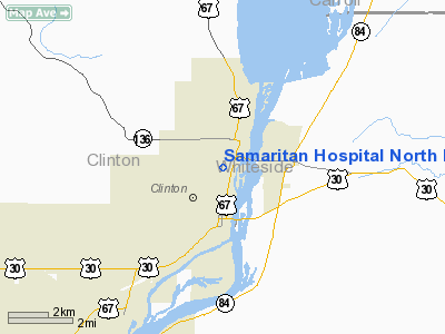
Samaritan Hospital North Heliport |
|
|
Location &
QuickFacts
|
FAA
Information Effective: |
2007-07-05 |
|
Airport
Identifier: |
7IA5 |
|
Airport
Status: |
Operational |
|
Longitude/Latitude: |
090-11-24.4570W/41-51-39.1030N
-90.190127/41.860862 (Estimated) |
|
Elevation: |
708 ft / 215.80 m (Estimated) |
|
Land: |
0 acres |
|
From
nearest city: |
0 nautical miles N of Clinton, IA |
|
Location: |
Clinton County, IA |
|
Magnetic Variation: |
01E (1990) |
Owner & Manager
|
Ownership: |
Privately owned |
|
Owner: |
Samaritan Health Systems Inc |
|
Address: |
1410 North Fourth Street
Clinton, IA 52732 |
|
Phone
number: |
319-244-5555 |
|
Manager: |
Michael Funk |
|
Address: |
1410 North Fourth Street
Clinton, IA 52732 |
|
Phone number: |
319-244-5521 |
Airport Operations and Facilities
|
Airport
Use: |
Private |
|
Wind
indicator: |
Yes |
|
Segmented Circle: |
No |
|
Control
Tower: |
No |
|
Lighting
Schedule: |
PHONE REQ
FOR PERIMETER & FLOOD LIGHTS CALL (319) 244-5698. |
|
Sectional chart: |
Chicago |
|
Region: |
ACE - Central |
|
Boundary
ARTCC: |
ZAU - Chicago |
|
Tie-in
FSS: |
FOD - Fort Dodge |
|
FSS on
Airport: |
No |
|
FSS
Phone: |
515-955-8114 |
|
FSS Toll
Free: |
1-800-WX-BRIEF |
|
Runway Information
Helipad H1
|
Dimension: |
40 x 40 ft / 12.2 x 12.2 m |
|
Surface: |
CONC, |
|
|
Runway H1
|
Runway
|
|
Traffic
Pattern: |
Left |
Left |
|
Radio Navigation Aids
|
ID |
Type |
Name |
Ch |
Freq |
Var |
Dist |
|
CWI |
NDB |
Clinton |
|
377.00 |
01E |
6.5 nm |
|
BOZ |
NDB |
Whiteside |
|
254.00 |
01E |
20.2 nm |
|
OQW |
NDB |
Maquoketa |
|
386.00 |
02E |
27.2 nm |
|
FEP |
NDB |
Freeport |
|
335.00 |
00E |
35.5 nm |
|
EZI |
NDB |
Kewanee |
|
245.00 |
01E |
41.0 nm |
|
MXO |
NDB |
Monticello |
|
397.00 |
01E |
47.0 nm |
|
PLL |
VOR/DME |
Polo |
049X |
111.20 |
03E |
30.4 nm |
|
RFD |
VOR/DME |
Rockford |
045X |
110.80 |
01E |
49.4 nm |
|
CVA |
VORTAC |
Davenport |
085X |
113.80 |
04E |
16.0 nm |
|
MZV |
VORTAC |
Moline |
091X |
114.40 |
05E |
38.2 nm |
|
DBQ |
VORTAC |
Dubuque |
105X |
115.80 |
04E |
39.9 nm |
|
DVN |
VOT |
Davenport Municipal |
|
111.80 |
|
23.2 nm |
Remarks
-
PROVIDED CLEAR
APCH/DEP PATHS FOR A MINIMUM 8:1 GLIDE SLOPE; A CLEAR TRANSITIONAL SFC FOR A
MINIMUM 2:1 SLOPE & TREES ON WEST SIDE OF HELIPAD TRIMMED/REMOVED TO MAXIMUM
4:1 SLOPE.
Samaritan Hospital North Heliport
Address:
Clinton County, IA
Tel:
319-244-5555,
319-244-5521
Images
and information placed above are from
http://www.airport-data.com/airport/7IA5/
We
thank them for the data!
|
General Info |
| Country |
United
States |
| State |
IOWA
|
| FAA ID |
7IA5
|
| Latitude |
41-51-39.103N |
|
Longitude |
090-11-24.457W |
|
Elevation |
708 feet
|
| Near
City |
CLINTON
|
We don't guarantee the information is fresh and accurate. The data may
be wrong or outdated.
For more up-to-date information please refer to other sources.
|
|


