 |
|
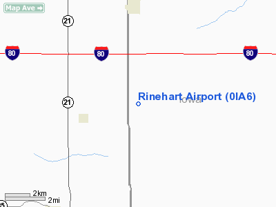
Location &
QuickFacts
|
FAA
Information Effective: |
2007-07-05 |
|
Airport
Identifier: |
0IA6 |
|
Airport
Status: |
Operational |
|
Longitude/Latitude: |
092-17-23.6590W/41-39-35.0090N
-92.289905/41.659725 (Estimated) |
|
Elevation: |
920 ft / 280.42 m (Estimated) |
|
Land: |
0 acres |
|
From
nearest city: |
3 nautical miles S of Victor, IA |
|
Location: |
Iowa County, IA |
|
Magnetic Variation: |
03E (1985) |
Owner & Manager
|
Ownership: |
Privately owned |
|
Owner: |
Rinehart Bros. |
|
Address: |
Rfd 1
Victor, IA 52347 |
|
Phone number: |
319-685-6191 |
|
Manager: |
Robert D Rinehart |
|
Address: |
Rfd 1
Victor, IA 52347 |
|
Phone number: |
319-685-6191 |
Airport
Operations and Facilities
|
Airport
Use: |
Private |
|
Wind
indicator: |
Yes |
|
Segmented Circle: |
No |
|
Control
Tower: |
No |
|
Landing
fee charge: |
No |
|
Sectional chart: |
Chicago |
|
Region: |
ACE - Central |
|
Boundary
ARTCC: |
ZAU - Chicago |
|
Tie-in
FSS: |
FOD - Fort Dodge |
|
FSS on
Airport: |
No |
|
FSS
Phone: |
515-955-8114 |
|
FSS Toll
Free: |
1-800-WX-BRIEF |
|
Runway Information
Runway 18/36
|
Dimension: |
2600 x 80 ft / 792.5 x 24.4 m |
|
Surface: |
TURF, |
|
|
Runway 18
|
Runway 36
|
|
Traffic
Pattern: |
Left |
Left |
|
Obstruction: |
4 ft fence |
4 ft fence, 0.0 ft from runway |
|
Radio Navigation Aids
|
ID |
Type |
Name |
Ch |
Freq |
Var |
Dist |
|
TZT |
NDB |
Belle Plaine |
|
371.00 |
02E |
13.6 nm |
|
GGI |
NDB |
Grinnell |
|
248.00 |
02E |
20.0 nm |
|
OOA |
NDB |
Oskaloosa |
|
414.00 |
03E |
27.6 nm |
|
PEA |
NDB |
Pella |
|
257.00 |
02E |
33.1 nm |
|
VTI |
NDB |
Garrison |
|
338.00 |
03E |
35.9 nm |
|
AWG |
NDB |
Washington |
|
219.00 |
02E |
36.0 nm |
|
MIW |
NDB |
Marshalltown |
|
239.00 |
03E |
39.0 nm |
|
FFL |
NDB |
Fairfield |
|
332.00 |
03E |
41.3 nm |
|
OXV |
NDB |
Knoxville |
|
284.00 |
03E |
43.1 nm |
|
IIB |
NDB |
Wapsie |
|
206.00 |
02E |
50.0 nm |
|
CID |
VOR/DME |
Cedar Rapids |
088X |
114.10 |
05E |
26.4 nm |
|
TNU |
VOR/DME |
Newton |
072X |
112.50 |
03E |
37.5 nm |
|
OTM |
VOR/DME |
Ottumwa |
053X |
111.60 |
06E |
37.9 nm |
|
JWJ |
VOR/DME |
Elmwood |
031X |
109.40 |
03E |
38.8 nm |
|
IOW |
VORTAC |
Iowa City |
109X |
116.20 |
05E |
31.6 nm |
Remarks
-
PROVIDED THE
APPROACH TO EACH RWY IS MAINTAINED FOR A MINIMUM 20:1 GLIDE SLOPE AND THE THE
TRANSITIONAL SURFACE BE MAINTAINED FOR A 7:1 SLOPE.
Based
Aircraft
|
Aircraft based
on field: |
1 |
|
Single Engine
Airplanes: |
1 |
Rinehart Airport
Address:
Iowa County, IA
Tel:
319-685-6191
Images
and information placed above are from
http://www.airport-data.com/airport/0IA6/
We
thank them for the data!
|
General Info |
| Country |
United
States |
| State |
IOWA
|
| FAA ID |
0IA6
|
| Latitude |
41-39-35.009N |
|
Longitude |
092-17-23.659W |
|
Elevation |
920 feet
|
| Near
City |
VICTOR
|
We don't guarantee the information is fresh and accurate. The data may
be wrong or outdated.
For more up-to-date information please refer to other sources.
|
|


