 |
|
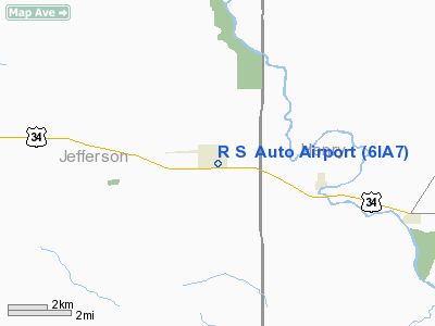
Richard Smithberg Auto Airport |
Location &
QuickFacts
|
FAA
Information Effective: |
2007-07-05 |
|
Airport
Identifier: |
6IA7 |
|
Airport
Status: |
Operational |
|
Longitude/Latitude: |
091-44-39.0200W/40-59-25.2800N
-91.744172/40.990356 (Estimated) |
|
Elevation: |
770 ft / 234.70 m (Estimated) |
|
Land: |
0 acres |
|
From
nearest city: |
1 nautical miles SE of Lockridge, IA |
|
Location: |
Jefferson County, IA |
|
Magnetic Variation: |
02E (1990) |
Owner & Manager
|
Ownership: |
Privately owned |
|
Owner: |
Richard A. Smithberg |
|
Address: |
Rr 1, Box 130
Lockridge, IA 52635 |
|
Phone number: |
319-696-2981 |
|
Manager: |
Richard A. Smithberg |
|
Address: |
Rr 1, Box 130
Lockridge, IA 52635 |
|
Phone number: |
319-696-2981 |
Airport
Operations and Facilities
|
Airport
Use: |
Private |
|
Segmented Circle: |
No |
|
Control
Tower: |
No |
|
Sectional chart: |
Chicago |
|
Region: |
ACE - Central |
|
Boundary
ARTCC: |
ZAU - Chicago |
|
Tie-in
FSS: |
FOD - Fort Dodge |
|
FSS on
Airport: |
No |
|
FSS
Phone: |
515-955-8114 |
|
FSS Toll
Free: |
1-800-WX-BRIEF |
|
Runway Information
Runway 16/34
|
Dimension: |
1500 x 100 ft / 457.2 x 30.5 m |
|
Surface: |
TURF, |
|
|
Runway 16
|
Runway 34
|
|
Traffic
Pattern: |
Left |
Left |
|
Radio Navigation Aids
|
ID |
Type |
Name |
Ch |
Freq |
Var |
Dist |
|
MPZ |
NDB |
Mount Pleasant |
|
212.00 |
02E |
11.0 nm |
|
FFL |
NDB |
Fairfield |
|
332.00 |
03E |
11.2 nm |
|
AWG |
NDB |
Washington |
|
219.00 |
02E |
17.7 nm |
|
BEX |
NDB |
Bloomfield |
|
269.00 |
02E |
34.5 nm |
|
EOK |
NDB |
Keokuk |
|
366.00 |
02E |
34.6 nm |
|
OOA |
NDB |
Oskaloosa |
|
414.00 |
03E |
36.5 nm |
|
OTM |
VOR/DME |
Ottumwa |
053X |
111.60 |
06E |
26.5 nm |
|
DDD |
VOR/DME |
Port City |
112X |
116.50 |
01E |
35.2 nm |
|
IOW |
VORTAC |
Iowa City |
109X |
116.20 |
05E |
32.3 nm |
|
BRL |
VORTAC |
Burlington |
051X |
111.40 |
05E |
40.5 nm |
Remarks
-
PROVIDED APCH TO
EACH RY MNTND FOR A MINIMUM 20:1 GLIDE SLOPE AND ARPT TRANSITIONAL SURFACE BE
MNTND FOR A 7:1 GLIDE SLOPE.
Richard Smithberg Auto Airport
Address:
Jefferson County, IA
Tel:
319-696-2981
Images
and information placed above are from
http://www.airport-data.com/airport/6IA7/
We
thank them for the data!
|
General Info |
| Country |
United
States |
| State |
IOWA
|
| FAA ID |
6IA7
|
| Latitude |
40-59-26.000N |
|
Longitude |
091-44-42.000W |
|
Elevation |
770 feet
|
| Near
City |
LOCKRIDGE |
We don't guarantee the information is fresh and accurate. The data may
be wrong or outdated.
For more up-to-date information please refer to other sources.
|
|


