 |
|
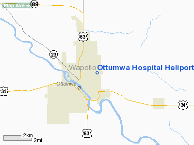
Ottumwa Hospital Heliport |
Location &
QuickFacts
|
FAA
Information Effective: |
2007-07-05 |
|
Airport
Identifier: |
3IA6 |
|
Airport
Status: |
Operational |
|
Longitude/Latitude: |
092-23-26.6650W/41-01-44.0520N
-92.390740/41.028903 (Estimated) |
|
Elevation: |
845 ft / 257.56 m (Estimated) |
|
Land: |
0 acres |
|
From
nearest city: |
0 nautical miles W of Ottumwa, IA |
|
Location: |
Wapello County, IA |
|
Magnetic Variation: |
03E (1985) |
Owner & Manager
|
Ownership: |
Privately owned |
|
Owner: |
Ottumwa Reg'l Health Center |
|
Address: |
1001 E Pennsylvania Ave.
Ottumwa, IA 52501 |
|
Phone
number: |
515-682-7511 |
|
Manager: |
Clarence Cory |
|
Address: |
1001 E Pennsylvania Ave.
Ottumwa, IA 52501 |
|
Phone number: |
515-682-7511 |
Airport Operations and Facilities
|
Airport
Use: |
Private
MEDICAL. |
|
Wind
indicator: |
Yes |
|
Segmented Circle: |
No |
|
Control
Tower: |
No |
|
Landing
fee charge: |
No |
|
Sectional chart: |
Chicago |
|
Region: |
ACE - Central |
|
Boundary
ARTCC: |
ZAU - Chicago |
|
Tie-in
FSS: |
FOD - Fort Dodge |
|
FSS on
Airport: |
No |
|
FSS
Phone: |
515-955-8114 |
|
FSS Toll
Free: |
1-800-WX-BRIEF |
|
Runway Information
Helipad H1
|
Dimension: |
30 x 30 ft / 9.1 x 9.1 m |
|
Surface: |
CONC, Good Condition |
|
|
Runway H1
|
Runway
|
|
Traffic
Pattern: |
Left |
Left |
|
Obstruction: |
25 ft tree, 75.0 ft from runway |
|
|
Radio Navigation Aids
|
ID |
Type |
Name |
Ch |
Freq |
Var |
Dist |
|
OOA |
NDB |
Oskaloosa |
|
414.00 |
03E |
12.6 nm |
|
BEX |
NDB |
Bloomfield |
|
269.00 |
02E |
17.2 nm |
|
FFL |
NDB |
Fairfield |
|
332.00 |
03E |
18.3 nm |
|
TVK |
NDB |
Centerville |
|
290.00 |
04E |
31.0 nm |
|
PEA |
NDB |
Pella |
|
257.00 |
02E |
33.7 nm |
|
AWG |
NDB |
Washington |
|
219.00 |
02E |
35.8 nm |
|
OXV |
NDB |
Knoxville |
|
284.00 |
03E |
36.5 nm |
|
MPZ |
NDB |
Mount Pleasant |
|
212.00 |
02E |
40.3 nm |
|
GGI |
NDB |
Grinnell |
|
248.00 |
02E |
43.7 nm |
|
CNC |
NDB |
Chariton |
|
335.00 |
05E |
44.0 nm |
|
OTM |
VOR/DME |
Ottumwa |
053X |
111.60 |
06E |
2.9 nm |
|
IOW |
VORTAC |
Iowa City |
109X |
116.20 |
05E |
45.8 nm |
Remarks
-
PROVIDED
APPROACHES ARE MAINTAINED FOR A 8:1 GLIDE SLOPE AND TRNSITIONAL SFCS FOR A 2:1
SLOPES.
Ottumwa Hospital Heliport
Address:
Wapello County, IA
Tel:
515-682-7511
Images
and information placed above are from
http://www.airport-data.com/airport/3IA6/
We
thank them for the data!
|
General Info |
| Country |
United
States |
| State |
IOWA
|
| FAA ID |
3IA6
|
| Latitude |
41-01-44.052N |
|
Longitude |
092-23-26.665W |
|
Elevation |
845 feet
|
| Near
City |
OTTUMWA
|
We don't guarantee the information is fresh and accurate. The data may
be wrong or outdated.
For more up-to-date information please refer to other sources.
|
|


