 |
|
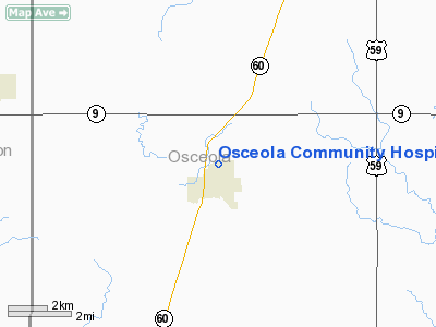
Osceola Community Hospital Heliport |
|
|
Location &
QuickFacts
|
FAA
Information Effective: |
2007-07-05 |
|
Airport
Identifier: |
IA40 |
|
Airport
Status: |
Operational |
|
Longitude/Latitude: |
095-44-33.0560W/43-24-35.8870N
-95.742516/43.409969 (Estimated) |
|
Elevation: |
1537 ft / 468.48 m (Estimated) |
|
Land: |
0 acres |
|
From
nearest city: |
0 nautical miles N of Sibley, IA |
|
Location: |
Osceola County, IA |
|
Magnetic Variation: |
06E (1985) |
Owner & Manager
|
Ownership: |
Privately owned |
|
Owner: |
Osceola Community Hospital |
|
Address: |
9th Avenue North
Sibley, IA 51249 |
|
Phone
number: |
712-754-2574 |
|
Manager: |
Janet Dykstra - Administrator |
|
Address: |
9th Avenue North
Sibley, IA 51249 |
|
Phone number: |
712-754-2574 |
Airport Operations and Facilities
|
Airport
Use: |
Private
MEDICAL USE. |
|
Wind
indicator: |
Yes |
|
Segmented Circle: |
No |
|
Control
Tower: |
No |
|
Lighting
Schedule: |
PHONE REQ
FOR LIGHTS CALL 712-754-2574. |
|
Sectional chart: |
Omaha |
|
Region: |
ACE - Central |
|
Boundary
ARTCC: |
ZMP - Minneapolis |
|
Tie-in
FSS: |
FOD - Fort Dodge |
|
FSS
Phone: |
515-955-8114 |
|
FSS Toll
Free: |
1-800-WX-BRIEF |
|
Runway Information
Helipad H1
|
Dimension: |
30 x 30 ft / 9.1 x 9.1 m |
|
Surface: |
CONC, |
|
|
Runway H1
|
Runway
|
|
Traffic
Pattern: |
Left |
Left |
|
Radio Navigation Aids
|
ID |
Type |
Name |
Ch |
Freq |
Var |
Dist |
|
ISB |
NDB |
Sibley |
|
269.00 |
05E |
2.6 nm |
|
SHL |
NDB |
Sheldon |
|
338.00 |
05E |
12.4 nm |
|
SOY |
NDB |
Sioux Center |
|
368.00 |
06E |
25.7 nm |
|
ORC |
NDB |
Orange City |
|
521.00 |
05E |
28.8 nm |
|
LTU |
NDB |
Little Sioux |
|
326.00 |
05E |
31.6 nm |
|
MJQ |
NDB |
Jackson |
|
353.00 |
04E |
35.9 nm |
|
MWM |
NDB |
Windom |
|
203.00 |
03E |
40.7 nm |
|
CKP |
NDB |
Pilot Rock |
|
423.00 |
05E |
41.6 nm |
|
PUF |
NDB |
Puff |
|
345.00 |
04E |
44.0 nm |
|
FS |
NDB |
Rokky |
|
245.00 |
06E |
47.7 nm |
|
EGQ |
NDB |
Emmetsburg |
|
410.00 |
04E |
49.0 nm |
|
PQN |
NDB/DME |
Pipestone |
028X |
284.00 |
06E |
42.2 nm |
|
EST |
VOR |
Estherville |
|
110.40 |
07E |
43.6 nm |
|
DDL |
VOR/DME |
Sheldon |
023X |
108.60 |
05E |
12.5 nm |
|
OTG |
VOR/DME |
Worthington |
043X |
110.60 |
08E |
15.9 nm |
|
SPW |
VOR/DME |
Spencer |
037X |
110.00 |
05E |
28.0 nm |
|
FSD |
VORTAC |
Sioux Falls |
097X |
115.00 |
09E |
47.5 nm |
Remarks
-
SEE AIRSPACE
LETTER DATED 19 MAY 97.
Osceola Community Hospital Heliport
Address:
Osceola County, IA
Tel:
712-754-2574
Images
and information placed above are from
http://www.airport-data.com/airport/IA40/
We
thank them for the data!
|
General Info |
| Country |
United
States |
| State |
IOWA
|
| FAA ID |
IA40
|
| Latitude |
43-24-35.887N |
|
Longitude |
095-44-33.056W |
|
Elevation |
1537
feet |
| Near
City |
SIBLEY
|
We don't guarantee the information is fresh and accurate. The data may
be wrong or outdated.
For more up-to-date information please refer to other sources.
|
|


