 |
|
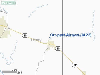
Location &
QuickFacts
|
FAA
Information Effective: |
2007-07-05 |
|
Airport
Identifier: |
IA22 |
|
Airport
Status: |
Operational |
|
Longitude/Latitude: |
091-24-12.5580W/40-56-18.1180N
-91.403488/40.938366 (Estimated) |
|
Elevation: |
790 ft / 240.79 m (Estimated) |
|
Land: |
0 acres |
|
From
nearest city: |
1 nautical miles N of New London, IA |
|
Location: |
Henry County, IA |
|
Magnetic Variation: |
02E (1985) |
Owner & Manager
|
Ownership: |
Privately owned |
|
Owner: |
Dale E Orr |
|
Address: |
2526 New London Road
New London, IA 52645 |
|
Phone
number: |
319-367-2782 |
|
Manager: |
Dale Orr |
|
Address: |
2526 New London Road
New London, IA 52645 |
|
Phone number: |
319-367-2782 |
Airport Operations and Facilities
|
Airport
Use: |
Private |
|
Wind
indicator: |
Yes |
|
Segmented Circle: |
No |
|
Control
Tower: |
No |
|
Landing
fee charge: |
No |
|
Sectional chart: |
Chicago |
|
Region: |
ACE - Central |
|
Boundary
ARTCC: |
ZAU - Chicago |
|
Tie-in
FSS: |
FOD - Fort Dodge |
|
FSS on
Airport: |
No |
|
FSS
Phone: |
515-955-8114 |
|
FSS Toll
Free: |
1-800-WX-BRIEF |
|
Runway Information
Runway 17/35
|
Dimension: |
1650 x 80 ft / 502.9 x 24.4 m |
|
Surface: |
TURF, |
|
|
Runway 17
|
Runway 35
|
|
Traffic
Pattern: |
Left |
Left |
|
Displaced
threshold: |
0.00 ft |
40.00 ft |
|
Radio Navigation Aids
|
ID |
Type |
Name |
Ch |
Freq |
Var |
Dist |
|
MPZ |
NDB |
Mount Pleasant |
|
212.00 |
02E |
4.8 nm |
|
AWG |
NDB |
Washington |
|
219.00 |
02E |
23.9 nm |
|
FFL |
NDB |
Fairfield |
|
332.00 |
03E |
26.9 nm |
|
EOK |
NDB |
Keokuk |
|
366.00 |
02E |
28.5 nm |
|
JZY |
NDB |
Macomb |
|
251.00 |
01E |
46.0 nm |
|
BEX |
NDB |
Bloomfield |
|
269.00 |
02E |
48.1 nm |
|
DDD |
VOR/DME |
Port City |
112X |
116.50 |
01E |
28.2 nm |
|
OTM |
VOR/DME |
Ottumwa |
053X |
111.60 |
06E |
42.2 nm |
|
GBG |
VOR/DME |
Galesburg |
035X |
109.80 |
03E |
44.0 nm |
|
BRL |
VORTAC |
Burlington |
051X |
111.40 |
05E |
25.3 nm |
|
IOW |
VORTAC |
Iowa City |
109X |
116.20 |
05E |
36.2 nm |
|
MZV |
VORTAC |
Moline |
091X |
114.40 |
05E |
41.6 nm |
Remarks
-
PROVIDED APCH SLOPES ARE 20:1.
Based Aircraft
|
Aircraft based
on field: |
1 |
|
Single Engine
Airplanes: |
1 |
Orr-port Airport
Address:
Henry County, IA
Tel:
319-367-2782
Images
and information placed above are from
http://www.airport-data.com/airport/IA22/
We
thank them for the data!
|
General Info |
| Country |
United
States |
| State |
IOWA
|
| FAA ID |
IA22
|
| Latitude |
40-56-18.118N |
|
Longitude |
091-24-12.558W |
|
Elevation |
790 feet
|
| Near
City |
NEW
LONDON |
We don't guarantee the information is fresh and accurate. The data may
be wrong or outdated.
For more up-to-date information please refer to other sources.
|
|


