 |
|
Muscatine Municipal Airport |
| Muscatine Municipal Airport |
| IATA: MUT â ICAO: KMUT â FAA LID: MUT |
| Summary |
| Airport type |
Public |
| Owner |
City of Muscatine |
| Serves |
Muscatine, Iowa |
| Elevation AMSL |
547 ft / 167 m |
| Coordinates |
41°22â²04â³N 091°08â²54â³W / 41.36778°N 91.14833°W / 41.36778; -91.14833 |
| Runways |
| Direction |
Length |
Surface |
| ft |
m |
| 6/24 |
5,500 |
1,676 |
Concrete |
| 12/30 |
4,000 |
1,219 |
Concrete |
| Statistics (2007) |
| Aircraft operations |
14,106 |
| Based aircraft |
36 |
| Source: Federal Aviation Administration |
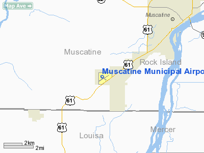
Muscatine Municipal Airport (IATA: MUT, ICAO: KMUT, FAA LID: MUT) is a city-owned, public-use airport located five miles (8 km) southwest of the central business district of Muscatine, a city in Muscatine County, Iowa, United States.
Facilities and aircraft
Muscatine Municipal Airport covers an area of 604 acres (244 ha) which contains two concrete paved runways: 6/24 measuring 5,500 x 100 ft (1,676 x 30 m) and 12/30 measuring 4,000 x 75 ft (1,219 x 23 m).
For the 12-month period ending May 24, 2007, the airport had 14,106 aircraft operations, an average of 38 per day: 94% general aviation and 6% air taxi. At that time there were 36 aircraft based at this airport: 75% single-engine, 8% multi-engine, 11% jet and 6% glider.
The above content comes from Wikipedia and is published under free licenses – click here to read more.
Location &
QuickFacts
|
FAA
Information Effective: |
2007-07-05 |
|
Airport
Identifier: |
MUT |
|
Airport
Status: |
Operational |
|
Longitude/Latitude: |
091-08-53.6000W/41-22-04.0000N
-91.148222/41.367778 (Estimated) |
|
Elevation: |
547 ft / 166.73 m (Surveyed) |
|
Land: |
604 acres |
|
From
nearest city: |
5 nautical miles SW of Muscatine, IA |
|
Location: |
Muscatine County, IA |
|
Magnetic Variation: |
01W (2000) |
Owner & Manager
|
Ownership: |
Publicly owned |
|
Owner: |
City Of Muscatine
JERRY PAGE, CHMN ARPT COMM. |
|
Address: |
215 Sycamore
Muscatine, IA 52761 |
|
Phone number: |
563-264-1550 |
|
Manager: |
Janet Lewis |
|
Address: |
5701 Grandview Avenue
Muscatine, IA 52761 |
|
Phone number: |
563-263-8672 |
Airport
Operations and Facilities
|
Airport
Use: |
Open to public |
|
Wind
indicator: |
Yes |
|
Segmented Circle: |
No |
|
Control
Tower: |
No |
|
Lighting
Schedule: |
DUSK-DAWN
MIRL RYS 06/24 & 12/30 PRESET ON LOW INTST; TO INCR INTST & ACTVT VASI
RY 06; MALSR RY 24; PAPI RYS 24, 12 & 30; REIL RYS 06; 12 & 30 - CTAF. |
|
Beacon
Color: |
Clear-Green (lighted land airport) |
|
Landing
fee charge: |
No |
|
Sectional chart: |
Chicago |
|
Region: |
ACE - Central |
|
Boundary
ARTCC: |
ZAU - Chicago |
|
Tie-in
FSS: |
FOD - Fort Dodge |
|
FSS on
Airport: |
No |
|
FSS
Phone: |
515-955-8114 |
|
FSS Toll
Free: |
1-800-WX-BRIEF |
|
NOTAMs
Facility: |
MUT (NOTAM-d service avaliable) |
|
Federal Agreements: |
NGY |
Airport Communications
|
CTAF: |
122.700 |
|
Unicom: |
122.700 |
Airport Services
|
Fuel
available: |
100LLA MOGAS |
|
Airframe
Repair: |
MINOR |
|
Power
Plant Repair: |
MINOR |
|
Bottled
Oxygen: |
NONE |
|
Bulk
Oxygen: |
NONE |
|
Runway Information
Runway 06/24
|
Dimension: |
5500 x 100 ft / 1676.4 x 30.5 m |
|
Surface: |
CONC, Good Condition |
|
Surface
Treatment: |
Saw-cut or plastic Grooved |
|
Weight Limit: |
Single wheel: 28000 lbs. |
|
Edge Lights: |
Medium |
|
|
Runway 06
|
Runway 24
|
|
Longitude: |
091-09-15.9817W |
091-08-14.4825W |
|
Latitude: |
41-21-44.2703N |
41-22-12.6628N |
|
Elevation: |
545.00 ft |
541.00 ft |
|
Alignment: |
58 |
127 |
|
ILS Type: |
|
ILS/DME |
|
Traffic
Pattern: |
Left |
Left |
|
Markings: |
Non-precision instrument, Fair Condition |
Precision instrument, Fair Condition |
|
Crossing
Height: |
34.00 ft |
52.00 ft |
|
VASI: |
4-box on left side |
4-light PAPI on left side |
|
Visual
Glide Angle: |
3.00° |
3.00° |
|
Approach
lights: |
|
MALSR |
|
Runway End
Identifier: |
Yes |
No |
|
Runway 12/30
|
Dimension: |
4000 x 75 ft / 1219.2 x 22.9 m |
|
Surface: |
CONC, Good Condition |
|
Surface
Treatment: |
Saw-cut or plastic Grooved |
|
Edge Lights: |
Medium |
|
|
Runway 12
|
Runway 30
|
|
Longitude: |
091-09-26.6381W |
091-08-43.7039W |
|
Latitude: |
41-22-23.8379N |
41-22-01.1252N |
|
Elevation: |
536.00 ft |
543.00 ft |
|
Alignment: |
125 |
127 |
|
Traffic
Pattern: |
Left |
Left |
|
Markings: |
Non-precision instrument, Fair Condition |
Non-precision instrument, Fair Condition |
|
Crossing
Height: |
44.00 ft |
40.00 ft |
|
VASI: |
4-light PAPI on left side |
4-light PAPI on left side |
|
Visual
Glide Angle: |
3.00° |
3.00° |
|
Runway End
Identifier: |
Yes |
Yes |
|
Radio Navigation Aids
|
ID |
Type |
Name |
Ch |
Freq |
Var |
Dist |
|
AWG |
NDB |
Washington |
|
219.00 |
02E |
24.3 nm |
|
MPZ |
NDB |
Mount Pleasant |
|
212.00 |
02E |
30.3 nm |
|
FFL |
NDB |
Fairfield |
|
332.00 |
03E |
43.6 nm |
|
OQW |
NDB |
Maquoketa |
|
386.00 |
02E |
45.0 nm |
|
CWI |
NDB |
Clinton |
|
377.00 |
01E |
46.1 nm |
|
GBG |
VOR/DME |
Galesburg |
035X |
109.80 |
03E |
41.4 nm |
|
CID |
VOR/DME |
Cedar Rapids |
088X |
114.10 |
05E |
42.4 nm |
|
IOW |
VORTAC |
Iowa City |
109X |
116.20 |
05E |
22.8 nm |
|
MZV |
VORTAC |
Moline |
091X |
114.40 |
05E |
23.2 nm |
|
CVA |
VORTAC |
Davenport |
085X |
113.80 |
04E |
36.3 nm |
|
BRL |
VORTAC |
Burlington |
051X |
111.40 |
05E |
40.0 nm |
|
DVN |
VOT |
Davenport Municipal |
|
111.80 |
|
29.2 nm |
Remarks
-
GLIDER OPN ON ARPT.
-
EXISTED PRIOR TO 1959.
Based Aircraft
|
Aircraft based
on field: |
36 |
|
Single Engine
Airplanes: |
27 |
|
Multi Engine
Airplanes: |
3 |
|
Jet Engine
Airplanes: |
4 |
|
Gliders: |
2 |
Operational Statistics
Time Period: 2006-05-25 - 2007-05-24
|
Aircraft
Operations: |
272/Week |
|
Air Taxi: |
6.4% |
|
General
Aviation Local: |
46.8% |
|
General
Aviation Itinerant: |
46.8% |
Muscatine Municipal Airport
Address:
Muscatine County, IA
Tel:
563-264-1550, 563-263-8672
Images
and information placed above are from
http://www.airport-data.com/airport/MUT/
We
thank them for the data!
|
General Info |
| Country |
United
States |
| State |
IOWA
|
| FAA ID |
MUT
|
| Latitude |
41-22-04.308N |
|
Longitude |
091-08-53.579W |
|
Elevation |
548 feet
|
| Near
City |
MUSCATINE |
We don't guarantee the information is fresh and accurate. The data may
be wrong or outdated.
For more up-to-date information please refer to other sources.
|
|


