 |
|
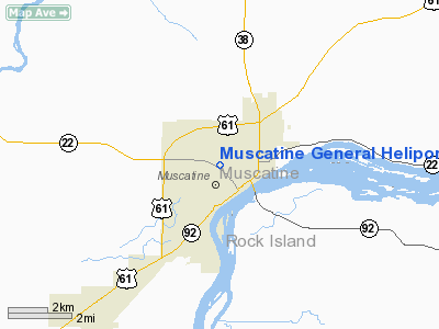
Muscatine General Heliport |
Location &
QuickFacts
|
FAA
Information Effective: |
2007-07-05 |
|
Airport
Identifier: |
8IA0 |
|
Airport
Status: |
Operational |
|
Longitude/Latitude: |
091-03-15.0000W/41-26-01.0000N
-91.054167/41.433611 (Estimated) |
|
Elevation: |
633 ft / 192.94 m (Estimated) |
|
Land: |
0 acres |
|
From
nearest city: |
0 nautical miles NW of Muscatine, IA |
|
Location: |
Muscatine County, IA |
|
Magnetic Variation: |
01E (1995) |
Owner & Manager
|
Ownership: |
Privately owned |
|
Owner: |
Muscatine General Hospital |
|
Address: |
1518 Mulberry St
Muscatina, IA 52761 |
|
Phone number: |
319-264-9100 |
|
Manager: |
Donald Harker |
|
Address: |
1518 Mulberry St
Muscatine, IA 52761 |
|
Phone number: |
319-264-9100 |
Airport
Operations and Facilities
|
Airport
Use: |
Private
MEDICAL |
|
Wind
indicator: |
Yes |
|
Segmented Circle: |
No |
|
Control
Tower: |
No |
|
Lighting
Schedule: |
DUSK-DAWN |
|
Sectional chart: |
Chicago |
|
Region: |
ACE - Central |
|
Boundary
ARTCC: |
ZAU - Chicago |
|
Tie-in
FSS: |
FOD - Fort Dodge |
|
FSS on
Airport: |
No |
|
FSS
Phone: |
515-955-8114 |
|
FSS Toll
Free: |
1-800-WX-BRIEF |
|
Runway Information
Helipad H1
|
Dimension: |
30 x 30 ft / 9.1 x 9.1 m |
|
Surface: |
ASPH,
ROOFTOP. |
|
|
Runway H1
|
Runway
|
|
Traffic
Pattern: |
Left |
Left |
|
Radio Navigation Aids
|
ID |
Type |
Name |
Ch |
Freq |
Var |
Dist |
|
AWG |
NDB |
Washington |
|
219.00 |
02E |
29.4 nm |
|
MPZ |
NDB |
Mount Pleasant |
|
212.00 |
02E |
36.0 nm |
|
OQW |
NDB |
Maquoketa |
|
386.00 |
02E |
39.7 nm |
|
CWI |
NDB |
Clinton |
|
377.00 |
01E |
40.4 nm |
|
MXO |
NDB |
Monticello |
|
397.00 |
01E |
46.2 nm |
|
FFL |
NDB |
Fairfield |
|
332.00 |
03E |
49.3 nm |
|
DDD |
VOR/DME |
Port City |
112X |
116.50 |
01E |
5.9 nm |
|
GBG |
VOR/DME |
Galesburg |
035X |
109.80 |
03E |
40.9 nm |
|
CID |
VOR/DME |
Cedar Rapids |
088X |
114.10 |
05E |
42.7 nm |
|
MZV |
VORTAC |
Moline |
091X |
114.40 |
05E |
19.9 nm |
|
IOW |
VORTAC |
Iowa City |
109X |
116.20 |
05E |
25.7 nm |
|
CVA |
VORTAC |
Davenport |
085X |
113.80 |
04E |
30.5 nm |
|
BRL |
VORTAC |
Burlington |
051X |
111.40 |
05E |
43.1 nm |
|
DVN |
VOT |
Davenport Municipal |
|
111.80 |
|
23.6 nm |
Remarks
-
PRVDD CLEAR APCH/DEP
PATHS FOR A 8:1 GS & CLEAR TRANSITIONAL SFC FOR A 2:1 SLOPE.
Muscatine General Heliport
Address:
Muscatine County, IA
Tel:
319-264-9100
Images
and information placed above are from
http://www.airport-data.com/airport/8IA0/
We
thank them for the data!
|
General Info |
| Country |
United
States |
| State |
IOWA
|
| FAA ID |
8IA0
|
| Latitude |
41-26-01.000N |
|
Longitude |
091-03-15.000W |
|
Elevation |
633 feet
|
| Near
City |
MUSCATINE |
We don't guarantee the information is fresh and accurate. The data may
be wrong or outdated.
For more up-to-date information please refer to other sources.
|
|


