 |
|
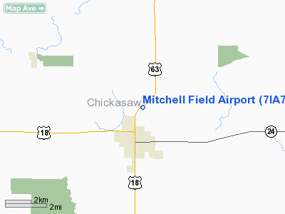
Location &
QuickFacts
|
FAA
Information Effective: |
2007-07-05 |
|
Airport
Identifier: |
7IA7 |
|
Airport
Status: |
Operational |
|
Longitude/Latitude: |
092-18-36.0000W/43-05-01.0000N
-92.310000/43.083611 (Estimated) |
|
Elevation: |
1160 ft / 353.57 m (Estimated) |
|
Land: |
8 acres |
|
From
nearest city: |
1 nautical miles N of New Hampton, IA |
|
Location: |
Chickasaw County, IA |
|
Magnetic Variation: |
02E (1990) |
Owner & Manager
|
Ownership: |
Privately owned |
|
Owner: |
Randall I Mitchell |
|
Address: |
1866 Mccloud
New Hampton, IA 50659 |
|
Phone number: |
515-394-3676 |
|
Manager: |
Randall I Mitchell |
|
Address: |
1866 Mccloud
New Hampton, IA 50659 |
|
Phone number: |
515-394-3676 |
Airport
Operations and Facilities
|
Airport
Use: |
Private |
|
Wind
indicator: |
Yes |
|
Segmented Circle: |
No |
|
Control
Tower: |
No |
|
Sectional chart: |
Chicago |
|
Region: |
ACE - Central |
|
Boundary
ARTCC: |
ZMP - Minneapolis |
|
Tie-in
FSS: |
FOD - Fort Dodge |
|
FSS on
Airport: |
No |
|
FSS
Phone: |
515-955-8114 |
|
FSS Toll
Free: |
1-800-WX-BRIEF |
|
Runway Information
Runway 06/24
|
Dimension: |
1500 x 16 ft / 457.2 x 4.9 m |
|
Surface: |
CONC, |
|
|
Runway 06
|
Runway 24
|
|
Traffic
Pattern: |
Left |
Left |
|
Radio Navigation Aids
|
ID |
Type |
Name |
Ch |
Freq |
Var |
Dist |
|
CCY |
NDB |
Charles City |
|
375.00 |
03E |
13.1 nm |
|
IY |
NDB |
Chukk |
|
417.00 |
03E |
18.6 nm |
|
CJJ |
NDB |
Cresco |
|
293.00 |
02E |
18.7 nm |
|
XWY |
NDB |
West Union |
|
278.00 |
02E |
24.7 nm |
|
DEH |
NDB |
Decorah |
|
236.00 |
01E |
27.7 nm |
|
OLZ |
NDB |
Oelwein |
|
260.00 |
02E |
28.2 nm |
|
IIB |
NDB |
Wapsie |
|
206.00 |
02E |
41.1 nm |
|
HPT |
NDB |
Hampton |
|
230.00 |
03E |
45.7 nm |
|
CHU |
NDB |
Caledonia |
|
209.00 |
03E |
46.9 nm |
|
JAY |
VOR/DME |
Austin |
019X |
108.20 |
03E |
39.8 nm |
|
RST |
VOR/DME |
Rochester |
057X |
112.00 |
05E |
43.9 nm |
|
ALO |
VORTAC |
Waterloo |
059X |
112.20 |
06E |
31.9 nm |
|
UKN |
VORTAC |
Waukon |
113X |
116.60 |
05E |
35.9 nm |
|
MCW |
VORTAC |
Mason City |
096X |
114.90 |
06E |
44.8 nm |
Remarks
-
APCHS MAINTAINED
FOR A 20:1 SLOPE & TRANSITIONAL SFC FOR A 7:1 SLOPE.
Based
Aircraft
|
Aircraft based
on field: |
1 |
|
Single Engine
Airplanes: |
1 |
Mitchell Field Airport
Address:
Chickasaw County, IA
Tel:
515-394-3676
Images
and information placed above are from
http://www.airport-data.com/airport/7IA7/
We
thank them for the data!
|
General Info |
| Country |
United
States |
| State |
IOWA
|
| FAA ID |
7IA7
|
| Latitude |
43-05-01.000N |
|
Longitude |
092-18-36.000W |
|
Elevation |
1160
feet |
| Near
City |
NEW
HAMPTON |
We don't guarantee the information is fresh and accurate. The data may
be wrong or outdated.
For more up-to-date information please refer to other sources.
|
|


