 |
|
|
|
Location &
QuickFacts
|
FAA
Information Effective: |
2007-07-05 |
|
Airport
Identifier: |
04IA |
|
Airport
Status: |
Operational |
|
Longitude/Latitude: |
092-03-16.6330W/41-05-18.0610N
-92.054620/41.088350 (Estimated) |
|
Elevation: |
801 ft / 244.14 m (Surveyed) |
|
Land: |
6 acres |
|
From
nearest city: |
3 nautical miles SE of Packwood, IA |
|
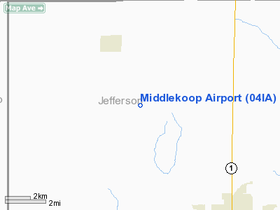
Location: |
Jefferson County, IA |
|
Magnetic Variation: |
03E (1985) |
Owner & Manager
|
Ownership: |
Privately owned |
|
Owner: |
Jack Middlekoop |
|
Address: |
1637 - 155th Street
Packwood, IA 52580 |
|
Phone number: |
319-695-3266 |
|
Manager: |
Jack Middlekoop |
|
Address: |
1637 - 155th Street
Packwood, IA 52580 |
|
Phone number: |
319-695-3266 |
Airport Operations and Facilities
|
Airport Use: |
Private |
|
Wind indicator: |
No |
|
Segmented Circle: |
No |
|
Control Tower: |
No |
|
Landing fee charge: |
No |
|
Sectional chart: |
Chicago |
|
Region: |
ACE - Central |
|
Boundary ARTCC: |
ZAU - Chicago |
|
Tie-in FSS: |
FOD - Fort Dodge |
|
FSS on Airport: |
No |
|
FSS Phone: |
515-955-8114 |
|
FSS Toll Free: |
1-800-WX-BRIEF |
Airport Services
|
Airframe
Repair: |
NONE |
|
Power
Plant Repair: |
NONE |
|
Runway Information
Runway 18/36
|
Dimension: |
2310 x 84 ft / 704.1 x 25.6 m |
|
Surface: |
TURF, Good Condition |
|
|
Runway 18
|
Runway 36
|
|
Traffic
Pattern: |
Left |
Left |
|
Obstruction: |
5 ft fence, 12.0 ft from runway, 2:1 slope to clear |
15 ft road, 0.0 ft from runway |
|
Radio Navigation Aids
|
ID |
Type |
Name |
Ch |
Freq |
Var |
Dist |
|
FFL |
NDB |
Fairfield |
|
332.00 |
03E |
5.5 nm |
|
AWG |
NDB |
Washington |
|
219.00 |
02E |
20.8 nm |
|
OOA |
NDB |
Oskaloosa |
|
414.00 |
03E |
21.3 nm |
|
MPZ |
NDB |
Mount Pleasant |
|
212.00 |
02E |
26.2 nm |
|
BEX |
NDB |
Bloomfield |
|
269.00 |
02E |
26.8 nm |
|
PEA |
NDB |
Pella |
|
257.00 |
02E |
44.4 nm |
|
TVK |
NDB |
Centerville |
|
290.00 |
04E |
45.4 nm |
|
EOK |
NDB |
Keokuk |
|
366.00 |
02E |
47.0 nm |
|
GGI |
NDB |
Grinnell |
|
248.00 |
02E |
48.2 nm |
|
TZT |
NDB |
Belle Plaine |
|
371.00 |
02E |
49.0 nm |
|
OXV |
NDB |
Knoxville |
|
284.00 |
03E |
49.5 nm |
|
OTM |
VOR/DME |
Ottumwa |
053X |
111.60 |
06E |
12.8 nm |
|
DDD |
VOR/DME |
Port City |
112X |
116.50 |
01E |
44.2 nm |
|
CID |
VOR/DME |
Cedar Rapids |
088X |
114.10 |
05E |
49.5 nm |
|
IOW |
VORTAC |
Iowa City |
109X |
116.20 |
05E |
32.7 nm |
Remarks
-
MKD AND LGTD 343
FT TOWER 1 MILE NORTH OF ARPT.
-
ARPT CLSD DEC 1 - APR 1.
Based Aircraft
|
Aircraft based
on field: |
1 |
|
Single Engine
Airplanes: |
1 |
Operational Statistics
Time Period:
1991-06-18 -
1992-06-16
|
Aircraft
Operations: |
38/Month |
|
General
Aviation Local: |
33.3% |
|
General
Aviation Itinerant: |
66.7% |
Middlekoop Airport
Address:
Jefferson County, IA
Tel:
319-695-3266
Images
and information placed above are from
http://www.airport-data.com/airport/04IA/
We
thank them for the data!
|
General Info |
| Country |
United
States |
| State |
IOWA
|
| FAA ID |
04IA
|
| Latitude |
41-05-18.061N |
|
Longitude |
092-03-16.633W |
|
Elevation |
801 feet
|
| Near
City |
PACKWOOD
|
We don't guarantee the information is fresh and accurate. The data may
be wrong or outdated.
For more up-to-date information please refer to other sources.
|
|


