 |
|
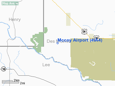
Location &
QuickFacts
|
FAA
Information Effective: |
2007-07-05 |
|
Airport
Identifier: |
4IA4 |
|
Airport
Status: |
Operational |
|
Longitude/Latitude: |
091-20-20.0000W/40-49-07.0000N
-91.338889/40.818611 (Estimated) |
|
Elevation: |
715 ft / 217.93 m (Estimated) |
|
Land: |
6 acres |
|
From
nearest city: |
3 nautical miles SW of Danville, IA |
|
Location: |
Des Moines County, IA |
|
Magnetic Variation: |
01E (2000) |
Owner & Manager
|
Ownership: |
Privately owned |
|
Owner: |
John A. Mccoy |
|
Address: |
21361 Agency Rd
Danville, IA 52623 |
|
Phone number: |
319-392-4115 |
|
Manager: |
John A. Mccoy |
|
Address: |
21361 Agency Rd
Danville, IA 52623 |
|
Phone number: |
319-392-4115 |
Airport
Operations and Facilities
|
Airport
Use: |
Private |
|
Wind
indicator: |
Yes |
|
Segmented Circle: |
No |
|
Control
Tower: |
No |
|
Sectional chart: |
Chicago |
|
Region: |
ACE - Central |
|
Boundary
ARTCC: |
ZAU - Chicago |
|
Responsible ARTCC: |
ZAU - Chicago |
|
Tie-in
FSS: |
FOD - Fort Dodge |
|
FSS
Phone: |
515-955-8114 |
|
FSS Toll
Free: |
1-800-WX-BRIEF |
|
Runway Information
Runway 18/36
|
Dimension: |
3000 x 90 ft / 914.4 x 27.4 m |
|
Surface: |
TURF, |
|
|
Runway 18
|
Runway 36
|
|
Traffic
Pattern: |
Left |
Left |
|
Obstruction: |
25 ft trees, 2000.0 ft from runway |
25 ft pline, 0.0 ft from runway |
|
Radio Navigation Aids
|
ID |
Type |
Name |
Ch |
Freq |
Var |
Dist |
|
MPZ |
NDB |
Mount Pleasant |
|
212.00 |
02E |
10.8 nm |
|
EOK |
NDB |
Keokuk |
|
366.00 |
02E |
21.7 nm |
|
AWG |
NDB |
Washington |
|
219.00 |
02E |
31.6 nm |
|
FFL |
NDB |
Fairfield |
|
332.00 |
03E |
31.7 nm |
|
JZY |
NDB |
Macomb |
|
251.00 |
01E |
39.8 nm |
|
BEX |
NDB |
Bloomfield |
|
269.00 |
02E |
49.9 nm |
|
DDD |
VOR/DME |
Port City |
112X |
116.50 |
01E |
34.0 nm |
|
GBG |
VOR/DME |
Galesburg |
035X |
109.80 |
03E |
41.7 nm |
|
OTM |
VOR/DME |
Ottumwa |
053X |
111.60 |
06E |
46.6 nm |
|
BRL |
VORTAC |
Burlington |
051X |
111.40 |
05E |
19.7 nm |
|
MZV |
VORTAC |
Moline |
091X |
114.40 |
05E |
43.8 nm |
|
IOW |
VORTAC |
Iowa City |
109X |
116.20 |
05E |
43.9 nm |
Remarks
-
PRVDD A CLEAR
20:1 GLIDE SLOPE; A CLEAR TRANSITIONAL SFC FOR A 7:1 SLOPE; & PLINES AT SOUTH
END MKD.
Based Aircraft
|
Aircraft based
on field: |
1 |
|
Single Engine
Airplanes: |
1 |
Mccoy Airport
Address:
Des Moines County, IA
Tel:
319-392-4115
Images
and information placed above are from
http://www.airport-data.com/airport/4IA4/
We
thank them for the data!
|
General Info |
| Country |
United
States |
| State |
IOWA
|
| FAA ID |
4IA4
|
| Latitude |
40-49-07.000N |
|
Longitude |
091-20-20.000W |
|
Elevation |
715 feet
|
| Near
City |
DANVILLE
|
We don't guarantee the information is fresh and accurate. The data may
be wrong or outdated.
For more up-to-date information please refer to other sources.
|
|


