 |
|
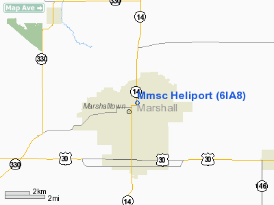
Marshalltown Medical Surgical Centre Heliport |
Location &
QuickFacts
|
FAA
Information Effective: |
2007-07-05 |
|
Airport
Identifier: |
6IA8 |
|
Airport
Status: |
Operational |
|
Longitude/Latitude: |
092-54-26.0000W/42-02-55.0000N
-92.907222/42.048611 (Estimated) |
|
Elevation: |
920 ft / 280.42 m (Estimated) |
|
Land: |
0 acres |
|
From
nearest city: |
0 nautical miles N of Marshalltown, IA |
|
Location: |
Marshall County, IA |
|
Magnetic Variation: |
03E (1990) |
Owner & Manager
|
Ownership: |
Privately owned |
|
Owner: |
Marshalltown Med/surgical Ctr |
|
Address: |
Three South 4th Avenue
Marshalltown, IA 50158 |
|
Phone
number: |
515-754-5060 |
|
Manager: |
Harold L. Brown |
|
Address: |
Three South 4th Avenue
Marshalltown, IA 50158 |
|
Phone number: |
515-754-5060 |
Airport Operations and Facilities
|
Airport
Use: |
Private
MEDICAL USE. |
|
Segmented Circle: |
No |
|
Control
Tower: |
No |
|
Sectional chart: |
Chicago |
|
Region: |
ACE - Central |
|
Boundary
ARTCC: |
ZAU - Chicago |
|
Tie-in
FSS: |
FOD - Fort Dodge |
|
FSS on
Airport: |
No |
|
FSS
Phone: |
515-955-8114 |
|
FSS Toll
Free: |
1-800-WX-BRIEF |
|
Runway Information
Helipad H1
|
Dimension: |
30 x 30 ft / 9.1 x 9.1 m |
|
Surface: |
ASPH, |
|
|
Runway H1
|
Runway
|
|
Traffic
Pattern: |
Left |
Left |
|
Radio Navigation Aids
|
ID |
Type |
Name |
Ch |
Freq |
Var |
Dist |
|
MIW |
NDB |
Marshalltown |
|
239.00 |
03E |
3.7 nm |
|
GGI |
NDB |
Grinnell |
|
248.00 |
02E |
21.9 nm |
|
TZT |
NDB |
Belle Plaine |
|
371.00 |
02E |
29.6 nm |
|
IFA |
NDB |
Iowa Falls |
|
368.00 |
03E |
30.3 nm |
|
IKV |
NDB |
Ankeny |
|
275.00 |
03E |
36.1 nm |
|
PEA |
NDB |
Pella |
|
257.00 |
02E |
38.7 nm |
|
VTI |
NDB |
Garrison |
|
338.00 |
03E |
40.9 nm |
|
BNW |
NDB |
Boone |
|
407.00 |
03E |
42.2 nm |
|
HPT |
NDB |
Hampton |
|
230.00 |
03E |
43.1 nm |
|
OXV |
NDB |
Knoxville |
|
284.00 |
03E |
46.2 nm |
|
EBS |
NDB |
Webster City |
|
323.00 |
03E |
48.9 nm |
|
IIB |
NDB |
Wapsie |
|
206.00 |
02E |
49.0 nm |
|
JWJ |
VOR/DME |
Elmwood |
031X |
109.40 |
03E |
3.8 nm |
|
TNU |
VOR/DME |
Newton |
072X |
112.50 |
03E |
18.3 nm |
|
ALO |
VORTAC |
Waterloo |
059X |
112.20 |
06E |
38.0 nm |
|
DSM |
VORTAC |
Des Moines |
122X |
117.50 |
07E |
49.6 nm |
|
DSM |
VOT |
Des Moines |
|
109.20 |
|
46.0 nm |
Remarks
-
PROVIDED CLEAR
APCH/DEP PATHS FOR A MINIMUM 8:1 GLIDE SLOPE AND A CLEAR TRANSITIONAL SURFACE
FOR A MINIMUM 2:1 SLOPE.
Marshalltown Medical Surgical Centre
Heliport
Address:
Marshall County, IA
Tel:
515-754-5060
Images
and information placed above are from
http://www.airport-data.com/airport/6IA8/
We
thank them for the data!
|
General Info |
| Country |
United
States |
| State |
IOWA
|
| FAA ID |
6IA8
|
| Latitude |
42-02-55.000N |
|
Longitude |
092-54-26.000W |
|
Elevation |
920 feet
|
| Near
City |
MARSHALLTOWN |
We don't guarantee the information is fresh and accurate. The data may
be wrong or outdated.
For more up-to-date information please refer to other sources.
|
|


