 |
|
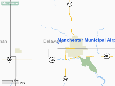
Manchester Municipal Airport |
|
|
Location &
QuickFacts
|
FAA
Information Effective: |
2007-07-05 |
|
Airport
Identifier: |
C27 |
|
Airport
Status: |
Operational |
|
Longitude/Latitude: |
091-29-54.5340W/42-29-35.9490N
-91.498482/42.493319 (Estimated) |
|
Elevation: |
987 ft / 300.84 m (Surveyed) |
|
Land: |
56 acres |
|
From
nearest city: |
2 nautical miles W of Manchester, IA |
|
Location: |
Delaware County, IA |
|
Magnetic Variation: |
02E (1985) |
Owner & Manager
|
Ownership: |
Publicly owned |
|
Owner: |
City Of Manchester |
|
Address: |
208 E Main Street
Manchester, IA 52057 |
|
Phone
number: |
563-927-4326 |
|
Manager: |
Marty Kelzer
ARPT MANAGER, CITY MANAGER NOT AT FIELD. |
|
Address: |
208 E Main Street
Manchester, IA 52057 |
|
Phone number: |
563-927-3636
563-927-4326 ARPT. PHONE |
Airport Operations and Facilities
|
Airport
Use: |
Open to public |
|
Wind
indicator: |
Yes |
|
Segmented Circle: |
No |
|
Control
Tower: |
No |
|
Lighting
Schedule: |
DUSK-DAWN |
|
Beacon
Color: |
Clear-Green (lighted land airport) |
|
Landing
fee charge: |
No |
|
Sectional chart: |
Chicago |
|
Region: |
ACE - Central |
|
Boundary
ARTCC: |
ZAU - Chicago |
|
Tie-in
FSS: |
FOD - Fort Dodge |
|
FSS on
Airport: |
No |
|
FSS
Phone: |
515-955-8114 |
|
FSS Toll
Free: |
1-800-WX-BRIEF |
|
NOTAMs
Facility: |
FOD (NOTAM-d service avaliable) |
Airport Communications
Airport Services
|
Fuel
available: |
100LL |
|
Airframe
Repair: |
NONE |
|
Power
Plant Repair: |
NONE |
|
Runway Information
Runway 18/36
|
Dimension: |
3465 x 50 ft / 1056.1 x 15.2 m
EXTENDED 190' RWY 18 END |
|
Surface: |
ASPH, Good Condition |
|
Edge Lights: |
Low |
|
|
Runway 18
|
Runway 36
|
|
Traffic
Pattern: |
Left |
Left |
|
Markings: |
Basic, Good Condition |
Basic, Good Condition |
|
Displaced
threshold: |
0.00 ft |
305.00 ft |
|
Obstruction: |
20 ft tree, 815.0 ft from runway, 200 ft right of
centerline, 30:1 slope to clear |
33 ft pole, 355.0 ft from runway, 80 ft right of
centerline, 4:1 slope to clear
APCH SLOPE 20:1 TO DSPLCD THLD. |
|
Radio Navigation Aids
|
ID |
Type |
Name |
Ch |
Freq |
Var |
Dist |
|
IIB |
NDB |
Wapsie |
|
206.00 |
02E |
20.2 nm |
|
MXO |
NDB |
Monticello |
|
397.00 |
01E |
23.8 nm |
|
OLZ |
NDB |
Oelwein |
|
260.00 |
02E |
24.1 nm |
|
VTI |
NDB |
Garrison |
|
338.00 |
03E |
28.3 nm |
|
XWY |
NDB |
West Union |
|
278.00 |
02E |
29.8 nm |
|
OQW |
NDB |
Maquoketa |
|
386.00 |
02E |
42.9 nm |
|
DEH |
NDB |
Decorah |
|
236.00 |
01E |
48.2 nm |
|
PVB |
NDB |
Platteville |
|
203.00 |
01E |
48.4 nm |
|
CID |
VOR/DME |
Cedar Rapids |
088X |
114.10 |
05E |
38.6 nm |
|
DBQ |
VORTAC |
Dubuque |
105X |
115.80 |
04E |
35.4 nm |
|
ALO |
VORTAC |
Waterloo |
059X |
112.20 |
06E |
40.1 nm |
|
UKN |
VORTAC |
Waukon |
113X |
116.60 |
05E |
47.3 nm |
Based Aircraft
|
Aircraft based
on field: |
4 |
|
Single Engine
Airplanes: |
4 |
Operational Statistics
Time Period:
2005-06-27 -
2006-06-26
|
Aircraft
Operations: |
38/Week |
|
General
Aviation Local: |
43.2% |
|
General
Aviation Itinerant: |
56.8% |
Manchester Municipal Airport
Address:
Delaware County, IA
Tel:
563-927-4326,
563-927-3636
Images
and information placed above are from
http://www.airport-data.com/airport/C27/
We
thank them for the data!
|
General Info |
| Country |
United
States |
| State |
IOWA
|
| FAA ID |
C27
|
| Latitude |
42-29-35.949N |
|
Longitude |
091-29-54.534W |
|
Elevation |
987 feet
|
| Near
City |
MANCHESTER |
We don't guarantee the information is fresh and accurate. The data may
be wrong or outdated.
For more up-to-date information please refer to other sources.
|
|


