 |
|
Location &
QuickFacts
|
FAA
Information Effective: |
2007-07-05 |
|
Airport
Identifier: |
93IA |
|
Airport
Status: |
Operational |
|
Longitude/Latitude: |
093-38-59.0000W/42-15-37.0000N
-93.649722/42.260278 (Estimated) |
|
Elevation: |
1063 ft / 324.00 m (Estimated) |
|
Land: |
0 acres |
|
From
nearest city: |
3 nautical miles S of Jewell, IA |
|
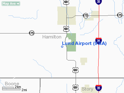
Location: |
Hamilton County, IA |
|
Magnetic Variation: |
() |
Owner & Manager
|
Ownership: |
Privately owned |
|
Owner: |
Mark A. Lund |
|
Address: |
, 2681 365th
Jewell, IA 50130 |
|
Phone number: |
515-291-1117 |
|
Manager: |
Mark A. Lund |
|
Address: |
2681 365th
Jewell, IA 50130 |
|
Phone number: |
515-291-1117 |
Airport
Operations and Facilities
|
Airport
Use: |
Private |
|
Control
Tower: |
No |
|
Sectional chart: |
Omaha |
|
Region: |
ACE - Central |
|
Boundary
ARTCC: |
ZMP - Minneapolis |
|
Tie-in
FSS: |
FOD - Fort Dodge |
|
FSS
Phone: |
515-955-8114 |
|
FSS Toll
Free: |
1-800-WX-BRIEF |
|
Runway Information
Runway 09/27
|
Dimension: |
2600 x 60 ft / 792.5 x 18.3 m |
|
Surface: |
TURF, |
|
|
Runway 09
|
Runway 27
|
|
Traffic
Pattern: |
Left |
Left |
|
Radio Navigation Aids
|
ID |
Type |
Name |
Ch |
Freq |
Var |
Dist |
|
EBS |
NDB |
Webster City |
|
323.00 |
03E |
14.6 nm |
|
BNW |
NDB |
Boone |
|
407.00 |
03E |
15.3 nm |
|
IFA |
NDB |
Iowa Falls |
|
368.00 |
03E |
21.5 nm |
|
EAG |
NDB |
Eagle Grove |
|
302.00 |
03E |
29.3 nm |
|
CAV |
NDB |
Clarion |
|
387.00 |
03E |
29.6 nm |
|
HPT |
NDB |
Hampton |
|
230.00 |
03E |
33.7 nm |
|
MIW |
NDB |
Marshalltown |
|
239.00 |
03E |
33.9 nm |
|
IKV |
NDB |
Ankeny |
|
275.00 |
03E |
34.0 nm |
|
EFW |
NDB |
Jefferson |
|
391.00 |
03E |
34.3 nm |
|
PRO |
NDB |
Perry |
|
251.00 |
06E |
34.5 nm |
|
GCT |
NDB |
Guthrie Center |
|
518.00 |
05E |
49.3 nm |
|
JWJ |
VOR/DME |
Elmwood |
031X |
109.40 |
03E |
34.2 nm |
|
TNU |
VOR/DME |
Newton |
072X |
112.50 |
03E |
37.5 nm |
|
FOD |
VORTAC |
Fort Dodge |
082X |
113.50 |
07E |
35.6 nm |
|
DSM |
VORTAC |
Des Moines |
122X |
117.50 |
07E |
49.5 nm |
|
DSM |
VOT |
Des Moines |
|
109.20 |
|
43.4 nm |
Remarks
-
OWNER DESIRES
ARPT NOT BE CHARTED.
-
PRVDD RY HEADINGS
OF 090 DEG AND 270 DEG; CLEAR 20:1 APCHS; CLEAR 7:1 TRANSITIONAL SURFACE.
Lund Airport
Address:
Hamilton County, IA
Tel:
515-291-1117
Images
and information placed above are from
http://www.airport-data.com/airport/93IA/
We
thank them for the data!
We don't guarantee the information is fresh and accurate. The data may
be wrong or outdated.
For more up-to-date information please refer to other sources.
|
|


