 |
|
Location &
QuickFacts
|
FAA
Information Effective: |
2007-07-05 |
|
Airport
Identifier: |
6IA1 |
|
Airport
Status: |
Operational |
|
Longitude/Latitude: |
094-58-45.0000W/42-25-10.0000N
-94.979167/42.419444 (Estimated) |
|
Elevation: |
1219 ft / 371.55 m (Estimated) |
|
Land: |
0 acres |
|
From
nearest city: |
0 nautical miles N of Sac City, IA |
|
Location: |
Sac County, IA |
|
Magnetic Variation: |
05E (1990) |
Owner & Manager
|
Ownership: |
Privately owned |
|
Owner: |
Loring Hospital |
|
Address: |
211 Highland Avenue
Sac City, IA 50583 |
|
Phone
number: |
712-662-7105 |
|
Manager: |
Greg Miner, Admin |
|
Address: |
211 Highland Avenue
Sac City, IA 50583 |
|
Phone number: |
712-662-7105 |
Airport Operations and Facilities
|
Airport
Use: |
Private
MEDICAL USE. |
|
Segmented Circle: |
No |
|
Control
Tower: |
No |
|
Sectional chart: |
Omaha |
|
Region: |
ACE - Central |
|
Boundary
ARTCC: |
ZMP - Minneapolis |
|
Tie-in
FSS: |
FOD - Fort Dodge |
|
FSS on
Airport: |
No |
|
FSS
Phone: |
515-955-8114 |
|
FSS Toll
Free: |
1-800-WX-BRIEF |
|
Runway Information
Helipad H1
|
Dimension: |
100 x 100 ft / 30.5 x 30.5 m |
|
Surface: |
ASPH, |
|
|
Runway H1
|
Runway
|
|
Traffic
Pattern: |
Left |
Left |
|
Radio Navigation Aids
|
ID |
Type |
Name |
Ch |
Freq |
Var |
Dist |
|
SKI |
NDB |
Sac City |
|
356.00 |
04E |
2.3 nm |
|
SLB |
NDB |
Storm Lake |
|
434.00 |
04E |
16.0 nm |
|
CIN |
NDB |
Carroll |
|
397.00 |
04E |
24.1 nm |
|
POH |
NDB |
Pocahontas |
|
428.00 |
06E |
24.5 nm |
|
CKP |
NDB |
Pilot Rock |
|
423.00 |
05E |
31.6 nm |
|
DNS |
NDB |
Denison |
|
350.00 |
04E |
31.7 nm |
|
EFW |
NDB |
Jefferson |
|
391.00 |
03E |
37.4 nm |
|
MEY |
NDB |
Mapleton |
|
335.00 |
05E |
39.0 nm |
|
EGQ |
NDB |
Emmetsburg |
|
410.00 |
04E |
42.7 nm |
|
LTU |
NDB |
Little Sioux |
|
326.00 |
05E |
43.1 nm |
|
ADU |
NDB |
Audubon |
|
266.00 |
04E |
43.9 nm |
|
EBS |
NDB |
Webster City |
|
323.00 |
03E |
49.3 nm |
|
SPW |
VOR/DME |
Spencer |
037X |
110.00 |
05E |
45.7 nm |
|
FOD |
VORTAC |
Fort Dodge |
082X |
113.50 |
07E |
32.4 nm |
Remarks
-
PROVIDED CLEAR
APCH/DEP PATHS FOR A MINIMUM 8:1 GLIDE SLOPE AND A CLEAR TRANSITIONAL SFC FOR
A MINIMUM 2:1 GLIDE SLOPE.
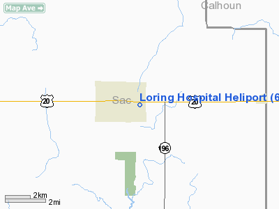
Loring Hospital Heliport
Address:
Sac County, IA
Tel:
712-662-7105
Images
and information placed above are from
http://www.airport-data.com/airport/6IA1/
We
thank them for the data!
|
General Info |
| Country |
United
States |
| State |
IOWA
|
| FAA ID |
6IA1
|
| Latitude |
42-25-10.000N |
|
Longitude |
094-58-45.000W |
|
Elevation |
1219
feet |
| Near
City |
SAC CITY
|
We don't guarantee the information is fresh and accurate. The data may
be wrong or outdated.
For more up-to-date information please refer to other sources.
|
|


