 |
|
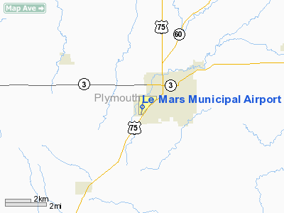
Le Mars Municipal Airport |
|
|
Location &
QuickFacts
|
FAA
Information Effective: |
2007-07-05 |
|
Airport
Identifier: |
LRJ |
|
Airport
Status: |
Operational |
|
Longitude/Latitude: |
096-11-37.3250W/42-46-40.6460N
-96.193701/42.777957 (Estimated) |
|
Elevation: |
1196 ft / 364.54 m (Surveyed) |
|
Land: |
108 acres |
|
From
nearest city: |
2 nautical miles SW of Le Mars, IA |
|
Location: |
Plymouth County, IA |
|
Magnetic Variation: |
05E (1995) |
Owner & Manager
|
Ownership: |
Publicly owned |
|
Owner: |
City Of Le Mars |
|
Address: |
22 2nd St Se
Le Mars, IA 51031 |
|
Phone
number: |
712-546-7018 |
|
Manager: |
Earl Draayer |
|
Address: |
1327 Hawkeye Ave Sw
Le Mars, IA 51031 |
|
Phone number: |
712-546-4724 |
Airport Operations and Facilities
|
Airport
Use: |
Open to public |
|
Wind
indicator: |
Yes |
|
Segmented Circle: |
No |
|
Control
Tower: |
No |
|
Lighting
Schedule: |
DUSK-DAWN
ACTVT MIRL RY 18/36 AND REIL RYS 18 & 36 PAPI RWY 18 AND SAVASI RWY 36
- CTAF. |
|
Beacon
Color: |
Clear-Green (lighted land airport) |
|
Landing
fee charge: |
No |
|
Sectional chart: |
Omaha |
|
Region: |
ACE - Central |
|
Traffic
Pattern Alt: |
1000 ft |
|
Boundary
ARTCC: |
ZMP - Minneapolis |
|
Tie-in
FSS: |
FOD - Fort Dodge |
|
FSS on
Airport: |
No |
|
FSS
Phone: |
515-955-8114 |
|
FSS Toll
Free: |
1-800-WX-BRIEF |
|
NOTAMs
Facility: |
LRJ (NOTAM-d service avaliable) |
|
Federal Agreements: |
NGY |
Airport Communications
|
CTAF: |
122.800 |
|
Unicom: |
122.800 |
Airport Services
|
Fuel
available: |
100LLA |
|
Airframe
Repair: |
MINOR |
|
Power
Plant Repair: |
MINOR |
|
Bottled
Oxygen: |
NONE |
|
Bulk
Oxygen: |
NONE |
|
Runway Information
Runway 18/36
|
Dimension: |
4001 x 75 ft / 1219.5 x 22.9 m |
|
Surface: |
CONC, Good Condition |
|
Weight Limit: |
Single wheel: 28000 lbs.
Dual wheel: 48000 lbs. |
|
Edge Lights: |
Medium |
|
|
Runway 18
|
Runway 36
|
|
Longitude: |
096-11-33.5590W |
096-11-41.0900W |
|
Latitude: |
42-47-00.2150N |
42-46-21.0810N |
|
Elevation: |
1193.00 ft |
1194.00 ft |
|
Alignment: |
127 |
8 |
|
Traffic
Pattern: |
Left |
Left |
|
Markings: |
Non-precision instrument, Good Condition |
Non-precision instrument, Good Condition |
|
Displaced
threshold: |
0.00 ft |
290.00 ft |
|
VASI: |
2-light PAPI on left side |
2-box SAVASI on right side |
|
Visual
Glide Angle: |
3.00° |
3.00° |
|
Runway End
Identifier: |
Yes |
Yes |
|
Obstruction: |
48 ft trees, 955.0 ft from runway, 200 ft right of
centerline, 15:1 slope to clear
36 FT TREE AT 100-210 FT L. |
20 ft road, 374.0 ft from runway, 8:1 slope to clear
APCH SLOPE 33:1 TO DSPLCD THLD. |
|
Radio Navigation Aids
|
ID |
Type |
Name |
Ch |
Freq |
Var |
Dist |
|
ORC |
NDB |
Orange City |
|
521.00 |
05E |
14.1 nm |
|
SOY |
NDB |
Sioux Center |
|
368.00 |
06E |
21.3 nm |
|
OI |
NDB |
Tommi |
|
305.00 |
07E |
22.5 nm |
|
GAK |
NDB |
Sioux Gateway |
|
233.00 |
06E |
23.8 nm |
|
SU |
NDB |
Salix |
|
414.00 |
07E |
27.4 nm |
|
CKP |
NDB |
Pilot Rock |
|
423.00 |
05E |
28.4 nm |
|
SHL |
NDB |
Sheldon |
|
338.00 |
05E |
30.6 nm |
|
VMR |
NDB |
Vermillion |
|
375.00 |
06E |
32.7 nm |
|
MEY |
NDB |
Mapleton |
|
335.00 |
05E |
40.0 nm |
|
ISB |
NDB |
Sibley |
|
269.00 |
05E |
40.4 nm |
|
SLB |
NDB |
Storm Lake |
|
434.00 |
04E |
43.3 nm |
|
LCG |
NDB |
Wayne |
|
389.00 |
06E |
47.5 nm |
|
DDL |
VOR/DME |
Sheldon |
023X |
108.60 |
05E |
30.5 nm |
|
SPW |
VOR/DME |
Spencer |
037X |
110.00 |
05E |
49.4 nm |
|
SUX |
VORTAC |
Sioux City |
112X |
116.50 |
09E |
26.7 nm |
Remarks
-
AFT HRS SVC FEE $25.
-
RY 36 IS CALM
WIND RY.
-
PRVDD APCH TO
EACH RWY IS MAINTD FOR A MIN 20:1 GLIDE SLOPE AND THE TRSNL SFC BE MAINTD FOR
A 7:1 SLOPE.
Based
Aircraft
|
Aircraft based
on field: |
20 |
|
Single Engine
Airplanes: |
13 |
|
Multi Engine
Airplanes: |
1 |
|
Jet Engine
Airplanes: |
1 |
|
Ultralights: |
5 |
Operational Statistics
Time Period:
2004-09-20 -
2005-09-19
|
Aircraft
Operations: |
156/Week |
|
General
Aviation Local: |
78.0% |
|
General
Aviation Itinerant: |
21.4% |
|
Military: |
0.6% |
Le Mars Municipal Airport
Address:
Plymouth County, IA
Tel:
712-546-7018,
712-546-4724
Images
and information placed above are from
http://www.airport-data.com/airport/LRJ/
We
thank them for the data!
|
General Info |
| Country |
United
States |
| State |
IOWA
|
| FAA ID |
LRJ
|
| Latitude |
42-46-40.646N |
|
Longitude |
096-11-37.325W |
|
Elevation |
1196
feet |
| Near
City |
LE MARS
|
We don't guarantee the information is fresh and accurate. The data may
be wrong or outdated.
For more up-to-date information please refer to other sources.
|
|


