 |
|
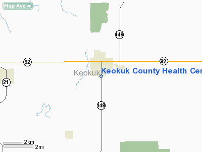
Keokuk County Health Center Heliport |
Location &
QuickFacts
|
FAA
Information Effective: |
2007-07-05 |
|
Airport
Identifier: |
83IA |
|
Airport
Status: |
Operational |
|
Longitude/Latitude: |
092-12-19.6500W/41-19-21.0400N
-92.205458/41.322511 (Estimated) |
|
Elevation: |
753 ft / 229.51 m (Estimated) |
|
Land: |
0 acres |
|
From
nearest city: |
0 nautical miles S of Sigourney, IA |
|
Location: |
Keokuk County, IA |
|
Magnetic Variation: |
() |
Owner & Manager
|
Ownership: |
Privately owned |
|
Owner: |
Keokuk County Health Center |
|
Address: |
1312 S. Stuart Street
Sigourney, IA 52591 |
|
Phone
number: |
641-622-2720 |
|
Manager: |
Bill Halleran
DIRECTOR OF FACILITY SERVICES. |
|
Address: |
1312 S. Stuart St.
Sigourney, IA 52591 |
|
Phone number: |
641-622-2720 |
Airport Operations and Facilities
|
Airport
Use: |
Private
MEDICAL USE. |
|
Control
Tower: |
No |
|
Lighting
Schedule: |
PHONE REQ
FOR PERIMETER LGTS CALL 641-622-2720. |
|
Region: |
ACE - Central |
|
Boundary
ARTCC: |
ZAU - Chicago |
|
Tie-in
FSS: |
FOD - Fort Dodge |
|
FSS
Phone: |
515-955-8114 |
|
FSS Toll
Free: |
1-800-WX-BRIEF |
|
Runway Information
Helipad H1
|
Dimension: |
40 x 40 ft / 12.2 x 12.2 m |
|
Surface: |
CONC, |
|
|
Runway H1
|
Runway
|
|
Traffic
Pattern: |
Left |
Left |
|
Radio Navigation Aids
|
ID |
Type |
Name |
Ch |
Freq |
Var |
Dist |
|
OOA |
NDB |
Oskaloosa |
|
414.00 |
03E |
14.0 nm |
|
FFL |
NDB |
Fairfield |
|
332.00 |
03E |
21.1 nm |
|
AWG |
NDB |
Washington |
|
219.00 |
02E |
24.2 nm |
|
GGI |
NDB |
Grinnell |
|
248.00 |
02E |
33.1 nm |
|
PEA |
NDB |
Pella |
|
257.00 |
02E |
33.7 nm |
|
TZT |
NDB |
Belle Plaine |
|
371.00 |
02E |
34.0 nm |
|
BEX |
NDB |
Bloomfield |
|
269.00 |
02E |
36.2 nm |
|
MPZ |
NDB |
Mount Pleasant |
|
212.00 |
02E |
38.9 nm |
|
OXV |
NDB |
Knoxville |
|
284.00 |
03E |
41.1 nm |
|
TVK |
NDB |
Centerville |
|
290.00 |
04E |
49.5 nm |
|
OTM |
VOR/DME |
Ottumwa |
053X |
111.60 |
06E |
18.5 nm |
|
CID |
VOR/DME |
Cedar Rapids |
088X |
114.10 |
05E |
38.9 nm |
|
DDD |
VOR/DME |
Port City |
112X |
116.50 |
01E |
47.7 nm |
|
TNU |
VOR/DME |
Newton |
072X |
112.50 |
03E |
49.2 nm |
|
IOW |
VORTAC |
Iowa City |
109X |
116.20 |
05E |
29.2 nm |
Remarks
-
OWNER DESIRES
HELIPORT NOT BE CHARTED.
-
SEE AIRSPACE LTR
DTD 2/28/02 FOR CONDITIONS.
Keokuk County Health Center Heliport
Address:
Keokuk County, IA
Tel:
641-622-2720
Images
and information placed above are from
http://www.airport-data.com/airport/83IA/
We
thank them for the data!
We don't guarantee the information is fresh and accurate. The data may
be wrong or outdated.
For more up-to-date information please refer to other sources.
|
|


