 |
|
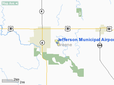
Jefferson Municipal Airport |
|
|
Location &
QuickFacts
|
FAA
Information Effective: |
2007-07-05 |
|
Airport
Identifier: |
EFW |
|
Airport
Status: |
Operational |
|
Longitude/Latitude: |
094-20-33.3000W/42-00-36.6000N
-94.342583/42.010167 (Estimated) |
|
Elevation: |
1048 ft / 319.43 m (Surveyed) |
|
Land: |
200 acres |
|
From
nearest city: |
2 nautical miles E of Jefferson, IA |
|
Location: |
Greene County, IA |
|
Magnetic Variation: |
03E (2000) |
Owner & Manager
|
Ownership: |
Publicly owned |
|
Owner: |
City Of Jefferson |
|
Address: |
City Hall
Jefferson, IA 50129 |
|
Phone number: |
515-386-3111 |
|
Manager: |
Kirk Wright |
|
Address: |
1581 235 St
Jefferson, IA 50129 |
|
Phone number: |
515-386-4429 |
Airport
Operations and Facilities
|
Airport
Use: |
Open to public |
|
Wind
indicator: |
Yes |
|
Segmented Circle: |
No |
|
Control
Tower: |
No |
|
Lighting
Schedule: |
DUSK-DAWN
ACTVT MIRL RY 14/32 & REIL RYS 14 & 32 - CTAF. |
|
Beacon
Color: |
Clear-Green (lighted land airport) |
|
Landing
fee charge: |
No |
|
Sectional chart: |
Omaha |
|
Region: |
ACE - Central |
|
Boundary
ARTCC: |
ZMP - Minneapolis |
|
Tie-in
FSS: |
FOD - Fort Dodge |
|
FSS on
Airport: |
No |
|
FSS
Phone: |
515-955-8114 |
|
FSS Toll
Free: |
1-800-WX-BRIEF |
|
NOTAMs
Facility: |
FOD (NOTAM-d service avaliable) |
|
Federal Agreements: |
NGY |
Airport Communications
|
CTAF: |
122.800 |
|
Unicom: |
122.800 |
Airport Services
|
Fuel
available: |
100LLMOGAS |
|
Airframe
Repair: |
MINOR |
|
Power
Plant Repair: |
MINOR |
|
Bottled
Oxygen: |
NONE |
|
Bulk
Oxygen: |
NONE |
|
Runway Information
Runway 14/32
|
Dimension: |
3200 x 75 ft / 975.4 x 22.9 m |
|
Surface: |
CONC, Good Condition |
|
Weight Limit: |
Single wheel: 11000 lbs. |
|
Edge Lights: |
Medium |
|
|
Runway 14
|
Runway 32
|
|
Longitude: |
094-20-48.9990W |
094-20-23.3940W |
|
Latitude: |
42-00-49.6530N |
42-00-24.4600N |
|
Elevation: |
1042.00 ft |
1042.00 ft |
|
Alignment: |
127 |
127 |
|
Traffic
Pattern: |
Left |
Left |
|
Markings: |
Non-precision instrument, Good Condition |
Non-precision instrument, Good Condition |
|
Crossing
Height: |
28.00 ft |
27.00 ft |
|
VASI: |
2-light PAPI on left side |
2-light PAPI on left side |
|
Visual
Glide Angle: |
3.00° |
3.00° |
|
Runway End
Identifier: |
Yes |
Yes |
|
Obstruction: |
20 ft road, 640.0 ft from runway, 22:1 slope to clear |
4 ft fence, 280.0 ft from runway, 20:1 slope to clear |
|
Runway 18/36
|
Dimension: |
1715 x 150 ft / 522.7 x 45.7 m |
|
Surface: |
TURF, Fair Condition |
|
|
Runway 18
|
Runway 36
|
|
Longitude: |
094-20-23.2600W |
094-20-27.4300W |
|
Latitude: |
42-00-47.3800N |
42-00-30.7200N |
|
Elevation: |
1035.00 ft |
1043.00 ft |
|
Alignment: |
127 |
11 |
|
Traffic
Pattern: |
Left |
Left |
|
Obstruction: |
19 ft road, 590.0 ft from runway, 31:1 slope to clear |
40 ft pline, 1365.0 ft from runway, 34:1 slope to clear |
|
Radio Navigation Aids
|
ID |
Type |
Name |
Ch |
Freq |
Var |
Dist |
|
EFW |
NDB |
Jefferson |
|
391.00 |
03E |
0.2 nm |
|
PRO |
NDB |
Perry |
|
251.00 |
06E |
13.5 nm |
|
CIN |
NDB |
Carroll |
|
397.00 |
04E |
19.9 nm |
|
GCT |
NDB |
Guthrie Center |
|
518.00 |
05E |
20.1 nm |
|
BNW |
NDB |
Boone |
|
407.00 |
03E |
22.0 nm |
|
ADU |
NDB |
Audubon |
|
266.00 |
04E |
31.9 nm |
|
EBS |
NDB |
Webster City |
|
323.00 |
03E |
33.4 nm |
|
SKI |
NDB |
Sac City |
|
356.00 |
04E |
36.2 nm |
|
IKV |
NDB |
Ankeny |
|
275.00 |
03E |
39.6 nm |
|
GFZ |
NDB |
Greenfield |
|
338.00 |
04E |
41.4 nm |
|
EAG |
NDB |
Eagle Grove |
|
302.00 |
03E |
46.2 nm |
|
POH |
NDB |
Pocahontas |
|
428.00 |
06E |
46.3 nm |
|
DNS |
NDB |
Denison |
|
350.00 |
04E |
46.3 nm |
|
AIO |
NDB |
Atlantic |
|
365.00 |
04E |
48.2 nm |
|
FOD |
VORTAC |
Fort Dodge |
082X |
113.50 |
07E |
36.2 nm |
|
DSM |
VORTAC |
Des Moines |
122X |
117.50 |
07E |
46.4 nm |
|
DSM |
VOT |
Des Moines |
|
109.20 |
|
41.3 nm |
Remarks
-
CTN: ULTRALIGHT
ACTVTY ON & INVOF ARPT.
-
RY 32 IS CALM
WIND RY.
Based Aircraft
|
Aircraft based
on field: |
27 |
|
Single Engine
Airplanes: |
23 |
|
Multi Engine
Airplanes: |
1 |
|
Ultralights: |
3 |
Operational Statistics
Time Period:
2004-11-11 -
2005-11-10
|
Aircraft
Operations: |
113/Week |
|
General
Aviation Local: |
49.1% |
|
General
Aviation Itinerant: |
49.1% |
|
Military: |
1.7% |
Jefferson Municipal Airport
Address:
Greene County, IA
Tel:
515-386-3111, 515-386-4429
Images
and information placed above are from
http://www.airport-data.com/airport/EFW/
We
thank them for the data!
|
General Info |
| Country |
United
States |
| State |
IOWA
|
| FAA ID |
EFW
|
| Latitude |
42-00-36.600N |
|
Longitude |
094-20-33.300W |
|
Elevation |
1048
feet |
| Near
City |
JEFFERSON |
We don't guarantee the information is fresh and accurate. The data may
be wrong or outdated.
For more up-to-date information please refer to other sources.
|
|


