 |
|
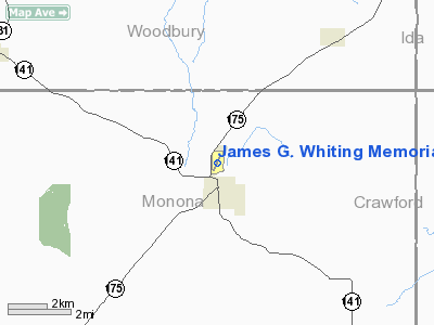
James G. Whiting Memorial Field Airport |
|
|
Location &
QuickFacts
|
FAA
Information Effective: |
2007-07-05 |
|
Airport
Identifier: |
MEY |
|
Airport
Status: |
Operational |
|
Longitude/Latitude: |
095-47-37.1230W/42-10-41.8620N
-95.793645/42.178295 (Estimated) |
|
Elevation: |
1116 ft / 340.16 m (Surveyed) |
|
Land: |
164 acres |
|
From
nearest city: |
1 nautical miles N of Mapleton, IA |
|
Location: |
Monona County, IA |
|
Magnetic Variation: |
05E (1995) |
Owner & Manager
|
Ownership: |
Publicly owned |
|
Owner: |
City Of Mapleton |
|
Address: |
513 Main
Mapleton, IA 51034 |
|
Phone number: |
712-882-1351 |
|
Manager: |
Bill Ashley |
|
Address: |
106 Chamberlin
Mapleton, IA 51034 |
|
Phone number: |
712-882-1836 |
Airport
Operations and Facilities
|
Airport
Use: |
Open to public |
|
Wind
indicator: |
Yes |
|
Segmented Circle: |
No |
|
Control
Tower: |
No |
|
Lighting
Schedule: |
DUSK-DAWN
ACTVT REIL RY 20 - CTAF. |
|
Beacon
Color: |
Clear-Green (lighted land airport) |
|
Landing
fee charge: |
No |
|
Sectional chart: |
Omaha |
|
Region: |
ACE - Central |
|
Boundary
ARTCC: |
ZMP - Minneapolis |
|
Tie-in
FSS: |
FOD - Fort Dodge |
|
FSS on
Airport: |
No |
|
FSS
Phone: |
515-955-8114 |
|
FSS Toll
Free: |
1-800-WX-BRIEF |
|
NOTAMs
Facility: |
FOD (NOTAM-d service avaliable) |
|
Federal Agreements: |
NY1 |
Airport Communications
|
CTAF: |
122.800 |
|
Unicom: |
122.800 |
Airport Services
|
Fuel
available: |
100 |
|
Airframe
Repair: |
MAJOR |
|
Power
Plant Repair: |
MAJOR |
|
Bottled
Oxygen: |
NONE |
|
Bulk
Oxygen: |
NONE |
|
Runway Information
Runway 02/20
|
Dimension: |
2801 x 60 ft / 853.7 x 18.3 m |
|
Surface: |
CONC, Good Condition |
|
Weight Limit: |
Single wheel: 28000 lbs.
Dual wheel: 48000 lbs. |
|
Edge Lights: |
Low |
|
|
Runway 02
|
Runway 20
|
|
Longitude: |
095-47-44.7050W |
095-47-29.4980W |
|
Latitude: |
42-10-29.2800N |
42-10-54.5310N |
|
Elevation: |
1116.00 ft |
1116.00 ft |
|
Alignment: |
24 |
127 |
|
Traffic
Pattern: |
Left |
Left |
|
Markings: |
Non-precision instrument, Good Condition |
Non-precision instrument, Good Condition |
|
Runway End
Identifier: |
No |
Yes |
|
Obstruction: |
62 ft tree, 1448.0 ft from runway, 139 ft right of
centerline, 20:1 slope to clear |
65 ft trees, 879.0 ft from runway, 390 ft left of
centerline, 10:1 slope to clear |
|
Radio Navigation Aids
|
ID |
Type |
Name |
Ch |
Freq |
Var |
Dist |
|
MEY |
NDB |
Mapleton |
|
335.00 |
05E |
0.1 nm |
|
DNS |
NDB |
Denison |
|
350.00 |
04E |
21.9 nm |
|
SU |
NDB |
Salix |
|
414.00 |
07E |
23.9 nm |
|
GAK |
NDB |
Sioux Gateway |
|
233.00 |
06E |
29.7 nm |
|
OI |
NDB |
Tommi |
|
305.00 |
07E |
34.2 nm |
|
CKP |
NDB |
Pilot Rock |
|
423.00 |
05E |
35.0 nm |
|
SLB |
NDB |
Storm Lake |
|
434.00 |
04E |
35.2 nm |
|
SKI |
NDB |
Sac City |
|
356.00 |
04E |
38.1 nm |
|
HNR |
NDB |
Harlan |
|
272.00 |
05E |
41.3 nm |
|
CIN |
NDB |
Carroll |
|
397.00 |
04E |
45.7 nm |
|
ADU |
NDB |
Audubon |
|
266.00 |
04E |
49.2 nm |
|
OM |
NDB |
Gerfi |
|
320.00 |
05E |
49.3 nm |
|
TQE |
VOR |
Tekamah |
|
108.40 |
07E |
30.5 nm |
|
SUX |
VORTAC |
Sioux City |
112X |
116.50 |
09E |
25.6 nm |
Remarks
Based
Aircraft
|
Aircraft based
on field: |
12 |
|
Single Engine
Airplanes: |
10 |
|
Ultralights: |
2 |
Operational Statistics
Time Period:
2005-06-28 -
2006-06-27
|
Aircraft
Operations: |
57/Week |
|
General
Aviation Local: |
43.2% |
|
General
Aviation Itinerant: |
56.8% |
James G. Whiting Memorial Field Airport
Address:
Monona County, IA
Tel:
712-882-1351, 712-882-1836
Images
and information placed above are from
http://www.airport-data.com/airport/MEY/
We
thank them for the data!
|
General Info |
| Country |
United
States |
| State |
IOWA
|
| FAA ID |
MEY
|
| Latitude |
42-10-41.862N |
|
Longitude |
095-47-37.123W |
|
Elevation |
1116
feet |
| Near
City |
MAPLETON
|
We don't guarantee the information is fresh and accurate. The data may
be wrong or outdated.
For more up-to-date information please refer to other sources.
|
|


