 |
|
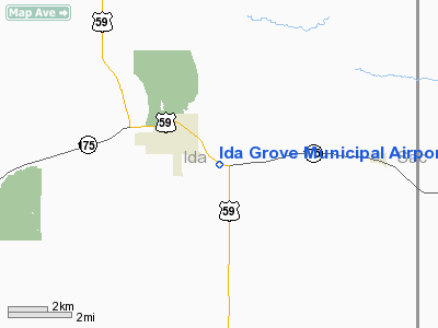
Ida Grove Municipal Airport |
|
|
Location &
QuickFacts
|
FAA
Information Effective: |
2007-07-05 |
|
Airport
Identifier: |
IDG |
|
Airport
Status: |
Operational |
|
Longitude/Latitude: |
095-26-41.5960W/42-19-57.3520N
-95.444888/42.332598 (Estimated) |
|
Elevation: |
1245 ft / 379.48 m (Surveyed) |
|
Land: |
39 acres |
|
From
nearest city: |
2 nautical miles SE of Ida Grove, IA |
|
Location: |
Ida County, IA |
|
Magnetic Variation: |
06E (1980) |
Owner & Manager
|
Ownership: |
Publicly owned |
|
Owner: |
City Of Ida Grove |
|
Address: |
301 Main Street
Ida Grove, IA 51445 |
|
Phone
number: |
712-364-2428 |
|
Manager: |
Diane Alborn
CITY CLERK. |
|
Address: |
301 Main Street
Ida Grove, IA 51445 |
|
Phone number: |
712-364-2428 |
Airport Operations and Facilities
|
Airport
Use: |
Open to public |
|
Wind
indicator: |
Yes |
|
Segmented Circle: |
No |
|
Control
Tower: |
No |
|
Lighting
Schedule: |
DUSK-DAWN
FOR LIRL RY 12/30 KEY CTAF 7 TIMES FOR MED INTST ONLY. |
|
Beacon
Color: |
Clear-Green (lighted land airport) |
|
Landing
fee charge: |
No |
|
Sectional chart: |
Omaha |
|
Region: |
ACE - Central |
|
Boundary
ARTCC: |
ZMP - Minneapolis |
|
Tie-in
FSS: |
FOD - Fort Dodge |
|
FSS on
Airport: |
No |
|
FSS
Phone: |
515-955-8114 |
|
FSS Toll
Free: |
1-800-WX-BRIEF |
|
NOTAMs
Facility: |
FOD (NOTAM-d service avaliable) |
Airport Communications
|
CTAF: |
122.800 |
|
Unicom: |
122.800 |
Airport Services
|
Fuel
available: |
100LL
FOR FUEL BTN 0800-1700 CALL (712) 364-2428 (CITY HALL) AFT 1700 CALL
(712) 364-3146 (SHERIFF'S OFFICE). |
|
Bottled
Oxygen: |
NONE |
|
Bulk
Oxygen: |
NONE |
|
Runway Information
Runway 12/30
|
Dimension: |
3172 x 50 ft / 966.8 x 15.2 m |
|
Surface: |
ASPH, Good Condition |
|
Edge Lights: |
Low |
|
|
Runway 12
|
Runway 30
|
|
Longitude: |
095-26-59.5300W |
095-26-23.6200W |
|
Latitude: |
42-20-05.6100N |
42-19-49.1300N |
|
Elevation: |
1236.00 ft |
1245.00 ft |
|
Alignment: |
122 |
127 |
|
Traffic
Pattern: |
Left |
Left |
|
Markings: |
Non-precision instrument, Good Condition |
Non-precision instrument, Good Condition |
|
Displaced
threshold: |
350.00 ft |
290.00 ft |
|
Obstruction: |
37 ft trees, 200.0 ft from runway, 110 ft left of
centerline
RWY 12 APCH SLOPE 14:1 TO DSPLCD THLD. |
22 ft road, 200.0 ft from runway
APCH SLOPE 22:1 TO DSPLCD THLD. |
|
Radio Navigation Aids
|
ID |
Type |
Name |
Ch |
Freq |
Var |
Dist |
|
MEY |
NDB |
Mapleton |
|
335.00 |
05E |
18.0 nm |
|
SLB |
NDB |
Storm Lake |
|
434.00 |
04E |
18.4 nm |
|
SKI |
NDB |
Sac City |
|
356.00 |
04E |
20.7 nm |
|
DNS |
NDB |
Denison |
|
350.00 |
04E |
21.2 nm |
|
CKP |
NDB |
Pilot Rock |
|
423.00 |
05E |
24.5 nm |
|
CIN |
NDB |
Carroll |
|
397.00 |
04E |
34.1 nm |
|
SU |
NDB |
Salix |
|
414.00 |
07E |
37.6 nm |
|
GAK |
NDB |
Sioux Gateway |
|
233.00 |
06E |
42.0 nm |
|
POH |
NDB |
Pocahontas |
|
428.00 |
06E |
43.2 nm |
|
ADU |
NDB |
Audubon |
|
266.00 |
04E |
45.4 nm |
|
HNR |
NDB |
Harlan |
|
272.00 |
05E |
45.5 nm |
|
OI |
NDB |
Tommi |
|
305.00 |
07E |
45.8 nm |
|
ORC |
NDB |
Orange City |
|
521.00 |
05E |
48.0 nm |
|
LTU |
NDB |
Little Sioux |
|
326.00 |
05E |
49.7 nm |
|
TQE |
VOR |
Tekamah |
|
108.40 |
07E |
47.5 nm |
|
SUX |
VORTAC |
Sioux City |
112X |
116.50 |
09E |
39.0 nm |
Remarks
-
600 FT MODEL
AIRPLANE RY LCTD 1/2 MI NORTH OF ARPT; DO NOT MISTAKE FOR ARPT RY.
-
EXISTED PRIOR TO 1959.
Based Aircraft
|
Aircraft based
on field: |
5 |
|
Single Engine
Airplanes: |
1 |
|
Multi Engine
Airplanes: |
2 |
|
Ultralights: |
2 |
Operational Statistics
Time Period:
2004-09-19 -
2005-09-18
|
Aircraft
Operations: |
33/Week |
|
Air Taxi: |
11.8% |
|
General
Aviation Local: |
58.8% |
|
General
Aviation Itinerant: |
29.4% |
Ida Grove Municipal Airport
Address:
Ida County, IA
Tel:
712-364-2428
Images
and information placed above are from
http://www.airport-data.com/airport/IDG/
We
thank them for the data!
|
General Info |
| Country |
United
States |
| State |
IOWA
|
| FAA ID |
IDG
|
| Latitude |
42-19-57.352N |
|
Longitude |
095-26-41.596W |
|
Elevation |
1245
feet |
| Near
City |
IDA
GROVE |
We don't guarantee the information is fresh and accurate. The data may
be wrong or outdated.
For more up-to-date information please refer to other sources.
|
|


